Property Record
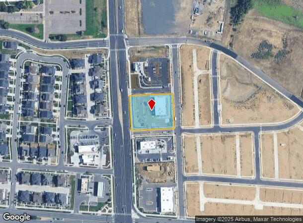
440 S Airport Blvd, Aurora, CO 80017
NEARBY LISTINGS FOR SALE OR LEASE
Property Detail
440 S Airport Blvd
Denver
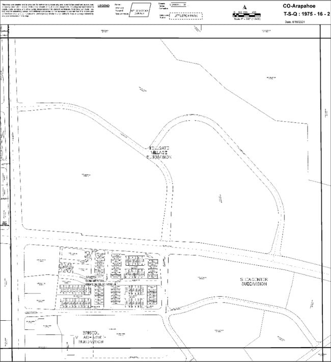
Buckley Yard Subdivision Flg No 1
Denver-Aurora-Lakewood, CO
TOWNSHIP T4S MAPPLATB 592 MAPPLATP 18 SUBDIVISIONCD 007780 SUBDIVISIONNAME BUCKLEY YARD SUBDIVISION FLG NO 1 BLOCK 002 LOT 001 LOT 1 BLK 2 BUCKLEY YARD SUB FLG NO 1 EX MRS
1975-16-2-20-001
Arapahoe
Commercialacreage
Colorado
2023
1
2024
1.26 AC
082600
Aurora
DEMOGRAPHICS near 440 S Airport Blvd
1 Mile
3 Mile
5 Mile
2024 Total Population
15,280
125,638
327,215
2029 Population
15,359
126,291
329,906
Pop Growth 2024-2029
+ 0.52%
+ 0.52%
+ 0.82%
Average Age
34
36
38
2024 Total Households
5,649
45,657
121,495
HH Growth 2024-2029
+ 0.57%
+ 0.59%
+ 0.85%
Median Household Inc
$59,042
$63,801
$66,938
Avg Household Size
2.60
2.60
2.60
2024 Avg HH Vehicles
2.00
2.00
2.00
Median Home Value
$370,833
$346,974
$371,496
Median Year Built
1986
1983
1982
Nearby Places
- Restaurants
- Banks
- Shops
- Fitness
- Groceries
PUBLIC TRANSPORTATION
COMMUTER RAIL
DRIVE
WALK
Distance
11 min
5.2 mi
DRIVE
WALK
Distance
13 min
7.7 mi
AIRPORT
Denver International
DRIVE
WALK
Distance
Denver International
22 min
15.7 mi
Nearby Properties
Address
Land Use
TOTAL SIZE
Lot Size
Zoning
Address
Land Use
TOTAL SIZE
Lot Size
Zoning
496,493 SF
33.45 AC
Address
Land Use
TOTAL SIZE
Lot Size
Zoning
876,549 SF
46.65 AC
Address
Land Use
TOTAL SIZE
Lot Size
Zoning
868,780 SF
105.02 AC
Address
Land Use
TOTAL SIZE
Lot Size
Zoning
277,940 SF
31.61 AC
Address
Land Use
TOTAL SIZE
Lot Size
Zoning
140.42 AC
Address
Land Use
TOTAL SIZE
Lot Size
Zoning
315,058 SF
36.85 AC
RPCZD
Address
Land Use
TOTAL SIZE
Lot Size
Zoning
672,521 SF
0.61 AC
RB3
Address
Land Use
TOTAL SIZE
Lot Size
Zoning
277,985 SF
19.07 AC
Address
Land Use
TOTAL SIZE
Lot Size
Zoning
201,600 SF
44.67 AC
R1
Address
Land Use
TOTAL SIZE
Lot Size
Zoning
300,759 SF
54.34 AC
Address
Land Use
TOTAL SIZE
Lot Size
Zoning
364,024 SF
23.23 AC
PUD
Address
Land Use
TOTAL SIZE
Lot Size
Zoning
220,395 SF
7.93 AC
Address
Land Use
TOTAL SIZE
Lot Size
Zoning
366,800 SF
20.21 AC
Address
Land Use
TOTAL SIZE
Lot Size
Zoning
186,088 SF
10.15 AC
RZIND
Address
Land Use
TOTAL SIZE
Lot Size
Zoning
176,751 SF
28.75 AC
Address
Land Use
TOTAL SIZE
Lot Size
Zoning
521,364 SF
14.88 AC
PUD
Address
Land Use
TOTAL SIZE
Lot Size
Zoning
328,315 SF
8.15 AC
Address
Land Use
TOTAL SIZE
Lot Size
Zoning
127,530 SF
20.76 AC
Address
Land Use
TOTAL SIZE
Lot Size
Zoning
215,175 SF
28.07 AC
Address
Land Use
TOTAL SIZE
Lot Size
Zoning
114,539 SF
5.35 AC
Address
Land Use
TOTAL SIZE
Lot Size
Zoning
345,688 SF
15.15 AC
PUD
Address
Land Use
TOTAL SIZE
Lot Size
Zoning
145,510 SF
9.61 AC
Address
Land Use
TOTAL SIZE
Lot Size
Zoning
135,050 SF
19.38 AC
Address
Land Use
TOTAL SIZE
Lot Size
Zoning
398,436 SF
28.13 AC
Address
Land Use
TOTAL SIZE
Lot Size
Zoning
146,784 SF
10.58 AC
Address
Land Use
TOTAL SIZE
Lot Size
Zoning
92,228 SF
12.39 AC
PUD
Address
Land Use
TOTAL SIZE
Lot Size
Zoning
265,326 SF
12.31 AC
RAOD
Address
Land Use
TOTAL SIZE
Lot Size
Zoning
325,111 SF
18.13 AC
PUD
Address
Land Use
TOTAL SIZE
Lot Size
Zoning
193,200 SF
15.09 AC
The World's #1 Commercial Real Estate Marketplace
Connect with us
© 2025 CoStar Group
The information above has been obtained from sources believed reliable. While we do not doubt its accuracy we have not verified it and make no guarantee, warranty or representation about it. It is your responsibility to independently confirm its accuracy and completeness. Any projections, opinions, assumptions, or estimates used are for example only and do not represent the current or future performance of the property. The value of this transaction to you depends on tax and other factors which should be evaluated by your tax, financial, and legal advisors. You and your advisors should conduct a careful, independent investigation of the property to determine to your satisfaction the suitability of the property for your needs.