Property Record
440 S Caroline St, Daytona Beach, FL 32114
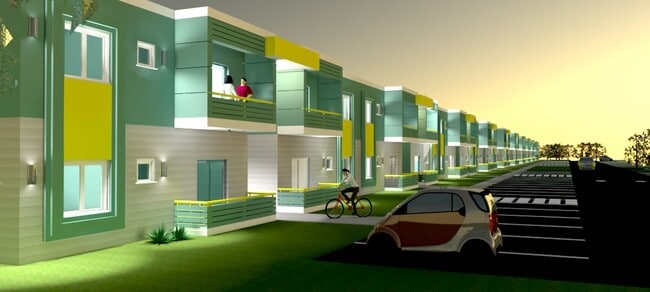

This Property Is For Sale
NEARBY LISTINGS FOR SALE OR LEASE
Property Detail
440 S Caroline St
Deltona-Daytona Beach-Ormond Beach, FL
Daytona Gardens
5239-07-42-0120
39-15-33 LOTS 12 TO 15 INC BLK 42 DAYTONA GARDENS PLAT 6 MB 10 PG 76 OF HODGMANS DAYTONA MB 2 PG 82 MB 12 PG 13-15 PER OR 2286 PG 0432 PER OR 6699 PG 0361 PER OR 7035 PGS 1266-1267 PER OR 7117 PG 3940 PER OR 7985 PG 3297 PER OR 8274 PG 0545
Residentialacreage
Volusia
AE
Florida
12127C0358H
12-15
2025
0.75 AC
2026
Downtown Daytona Beach
082100
Deltona/Daytona Beach
DEMOGRAPHICS near 440 S Caroline St
1 Mile
3 Mile
5 Mile
2024 Total Population
9,778
74,598
141,312
2029 Population
10,875
82,871
157,912
Pop Growth 2024-2029
+ 11.22%
+ 11.09%
+ 11.75%
Average Age
36
41
44
2024 Total Households
3,711
31,839
63,606
HH Growth 2024-2029
+ 11.67%
+ 11.62%
+ 12.29%
Median Household Inc
$31,541
$41,147
$45,396
Avg Household Size
2.30
2.10
2.10
2024 Avg HH Vehicles
1.00
1.00
1.00
Median Home Value
$141,116
$165,641
$193,902
Median Year Built
1972
1975
1979
Nearby Places
Map Layers
Map Styles
 Street
 Aerial
- Restaurants
- Banks
- Shops
- Fitness
- Groceries
PUBLIC TRANSPORTATION
AIRPORT
Daytona Beach International
DRIVE
WALK
Distance
Daytona Beach International
9 min
3.5 mi
Orlando Sanford International
DRIVE
WALK
Distance
Orlando Sanford International
58 min
42.2 mi
Nearby Properties
Address
Land Use
TOTAL SIZE
Lot Size
Zoning
Address
Land Use
TOTAL SIZE
Lot Size
Zoning
863,820 SF
374 AC
AP
Address
Land Use
TOTAL SIZE
Lot Size
Zoning
1,365,998 SF
13 AC
Address
Land Use
TOTAL SIZE
Lot Size
Zoning
1,842,969 SF
25.56 AC
Address
Land Use
TOTAL SIZE
Lot Size
Zoning
1,058,116 SF
54.22 AC
Address
Land Use
TOTAL SIZE
Lot Size
Zoning
664,082 SF
38.16 AC
02BA
Address
Land Use
TOTAL SIZE
Lot Size
Zoning
880,289 SF
4.98 AC
02T3
Address
Land Use
TOTAL SIZE
Lot Size
Zoning
663,508 SF
73.48 AC
Address
Land Use
TOTAL SIZE
Lot Size
Zoning
Address
Land Use
TOTAL SIZE
Lot Size
Zoning
542,849 SF
1.56 AC
02T1
Address
Land Use
TOTAL SIZE
Lot Size
Zoning
472,750 SF
16.76 AC
Address
Land Use
TOTAL SIZE
Lot Size
Zoning
223,127 SF
14.47 AC
Address
Land Use
TOTAL SIZE
Lot Size
Zoning
353,548 SF
50.65 AC
Address
Land Use
TOTAL SIZE
Lot Size
Zoning
275,814 SF
13 AC
Address
Land Use
TOTAL SIZE
Lot Size
Zoning
Address
Land Use
TOTAL SIZE
Lot Size
Zoning
318,230 SF
21.28 AC
Address
Land Use
TOTAL SIZE
Lot Size
Zoning
13,965 SF
0.70 AC
MH1
Address
Land Use
TOTAL SIZE
Lot Size
Zoning
286,461 SF
945.48 AC
B62
Address
Land Use
TOTAL SIZE
Lot Size
Zoning
300,038 SF
0.22 AC
Address
Land Use
TOTAL SIZE
Lot Size
Zoning
303,151 SF
13.58 AC
Address
Land Use
TOTAL SIZE
Lot Size
Zoning
226,459 SF
0.57 AC
Address
Land Use
TOTAL SIZE
Lot Size
Zoning
560,165 SF
37.79 AC
02BR2
Address
Land Use
TOTAL SIZE
Lot Size
Zoning
208,825 SF
30.30 AC
02BA
Address
Land Use
TOTAL SIZE
Lot Size
Zoning
12,871 SF
0.20 AC
R4
Address
Land Use
TOTAL SIZE
Lot Size
Zoning
5,774 SF
0.94 AC
B4
Address
Land Use
TOTAL SIZE
Lot Size
Zoning
153,293 SF
10.95 AC
Address
Land Use
TOTAL SIZE
Lot Size
Zoning
207,607 SF
9.83 AC
Address
Land Use
TOTAL SIZE
Lot Size
Zoning
198,182 SF
7.43 AC
Address
Land Use
TOTAL SIZE
Lot Size
Zoning
146,732 SF
2.12 AC
02T1
Address
Land Use
TOTAL SIZE
Lot Size
Zoning
105,866 SF
5.14 AC
Address
Land Use
TOTAL SIZE
Lot Size
Zoning
460,245 SF
2.92 AC
The World's #1 Commercial Real Estate Marketplace
Connect with us
© 2026 CoStar Group
The information above has been obtained from sources believed reliable. While we do not doubt its accuracy we have not verified it and make no guarantee, warranty or representation about it. It is your responsibility to independently confirm its accuracy and completeness. Any projections, opinions, assumptions, or estimates used are for example only and do not represent the current or future performance of the property. The value of this transaction to you depends on tax and other factors which should be evaluated by your tax, financial, and legal advisors. You and your advisors should conduct a careful, independent investigation of the property to determine to your satisfaction the suitability of the property for your needs.