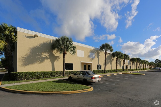
Property Record
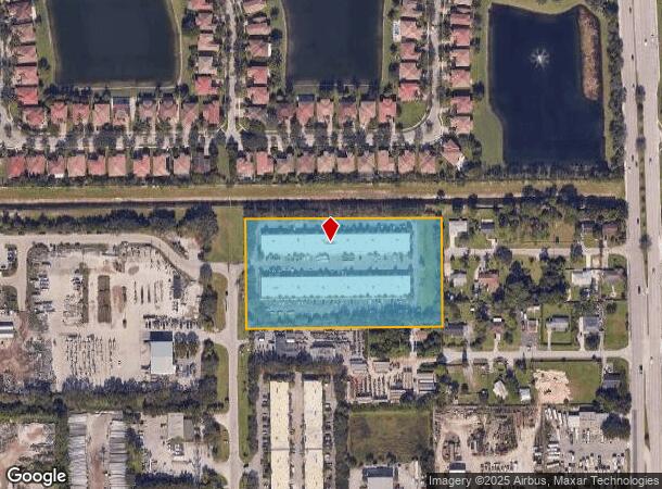
440 Tall Pines Rd, West Palm Beach, FL 33413

Current Lease Availabilities
NEARBY LISTINGS FOR SALE OR LEASE
Property Detail
440 Tall Pines Rd
West Palm Beach-Boca Raton-Delray Beach, FL
Palm Beach Farms Co Pl 3
00-42-43-27-05-005-1090
PALM BEACH FARMS CO PL 3 N 396 FT OF TR 46 (LESS W 25 FT TALL PINES RD & N 46 FT L-4 CNL R/WS) BLK 5
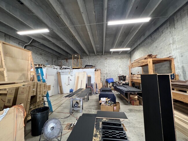
Warehouse
Palm Beach
AE
Florida
12099C0567F
4
2024
5.10 AC
2025
Southern Blvd
003201
South Florida
57,168 SF
DEMOGRAPHICS near 440 Tall Pines Rd
1 Mile
3 Mile
5 Mile
2024 Total Population
7,420
105,213
270,395
2029 Population
7,739
108,442
278,740
Pop Growth 2024-2029
+ 4.30%
+ 3.07%
+ 3.09%
Average Age
36
40
40
2024 Total Households
2,160
39,094
101,348
HH Growth 2024-2029
+ 3.66%
+ 2.92%
+ 2.79%
Median Household Inc
$93,990
$52,435
$55,344
Avg Household Size
3.20
2.50
2.50
2024 Avg HH Vehicles
2.00
2.00
2.00
Median Home Value
$342,818
$232,057
$241,705
Median Year Built
2001
1984
1985
Nearby Places
Map Layers
Map Styles
 Street
 Aerial
- Restaurants
- Banks
- Shops
- Fitness
- Groceries
PUBLIC TRANSPORTATION
COMMUTER RAIL
West Palm Beach (Tri-County Commuter - South Florida Regional Transportation Authority (Tri-Rail))
DRIVE
WALK
Distance
West Palm Beach (Tri-County Commuter - South Florida Regional Transportation Authority (Tri-Rail))
16 min
7.8 mi
DRIVE
WALK
Distance
17 min
8.6 mi
AIRPORT
Palm Beach International
DRIVE
WALK
Distance
Palm Beach International
10 min
4.1 mi
Nearby Properties
Address
Land Use
TOTAL SIZE
Lot Size
Zoning
Address
Land Use
TOTAL SIZE
Lot Size
Zoning
644,690 SF
44.88 AC
MUPD
Address
Land Use
TOTAL SIZE
Lot Size
Zoning
490,757 SF
12.11 AC
PIPD
Address
Land Use
TOTAL SIZE
Lot Size
Zoning
199,032 SF
769.86 AC
PO
Address
Land Use
TOTAL SIZE
Lot Size
Zoning
428,659 SF
26.16 AC
MUPD
Address
Land Use
TOTAL SIZE
Lot Size
Zoning
404,222 SF
36.71 AC
RH
Address
Land Use
TOTAL SIZE
Lot Size
Zoning
561,484 SF
21.86 AC
PO
Address
Land Use
TOTAL SIZE
Lot Size
Zoning
314,116 SF
10.25 AC
MF20
Address
Land Use
TOTAL SIZE
Lot Size
Zoning
347,853 SF
46.24 AC
PIPD
Address
Land Use
TOTAL SIZE
Lot Size
Zoning
150,344 SF
203.77 AC
PO
Address
Land Use
TOTAL SIZE
Lot Size
Zoning
379,598 SF
17.06 AC
RM-2
Address
Land Use
TOTAL SIZE
Lot Size
Zoning
379,598 SF
17.02 AC
RM-2
Address
Land Use
TOTAL SIZE
Lot Size
Zoning
371,177 SF
17.38 AC
RPD
Address
Land Use
TOTAL SIZE
Lot Size
Zoning
52,656 SF
849.42 AC
PO
Address
Land Use
TOTAL SIZE
Lot Size
Zoning
328,512 SF
15.27 AC
PUD
Address
Land Use
TOTAL SIZE
Lot Size
Zoning
210,445 SF
11.18 AC
MUPD
Address
Land Use
TOTAL SIZE
Lot Size
Zoning
334,396 SF
19.54 AC
PO
Address
Land Use
TOTAL SIZE
Lot Size
Zoning
294,321 SF
109.37 AC
PO
Address
Land Use
TOTAL SIZE
Lot Size
Zoning
324,453 SF
25.47 AC
IL
Address
Land Use
TOTAL SIZE
Lot Size
Zoning
178,614 SF
10.42 AC
PUD
Address
Land Use
TOTAL SIZE
Lot Size
Zoning
338,248 SF
54.21 AC
CF
Address
Land Use
TOTAL SIZE
Lot Size
Zoning
261,118 SF
58.77 AC
IPF
Address
Land Use
TOTAL SIZE
Lot Size
Zoning
196,683 SF
8.97 AC
RPD
Address
Land Use
TOTAL SIZE
Lot Size
Zoning
226,094 SF
27.47 AC
CI
Address
Land Use
TOTAL SIZE
Lot Size
Zoning
209,824 SF
73.38 AC
PO
Address
Land Use
TOTAL SIZE
Lot Size
Zoning
225,393 SF
22.54 AC
MUPD
Address
Land Use
TOTAL SIZE
Lot Size
Zoning
262,228 SF
21.44 AC
CG
Address
Land Use
TOTAL SIZE
Lot Size
Zoning
192,622 SF
17.97 AC
MUPD
Address
Land Use
TOTAL SIZE
Lot Size
Zoning
147,763 SF
9.78 AC
PIPD
Address
Land Use
TOTAL SIZE
Lot Size
Zoning
122,316 SF
29.96 AC
MUPD
Address
Land Use
TOTAL SIZE
Lot Size
Zoning
232,602 SF
21.98 AC
CG
The World's #1 Commercial Real Estate Marketplace
Connect with us
© 2025 CoStar Group
The information above has been obtained from sources believed reliable. While we do not doubt its accuracy we have not verified it and make no guarantee, warranty or representation about it. It is your responsibility to independently confirm its accuracy and completeness. Any projections, opinions, assumptions, or estimates used are for example only and do not represent the current or future performance of the property. The value of this transaction to you depends on tax and other factors which should be evaluated by your tax, financial, and legal advisors. You and your advisors should conduct a careful, independent investigation of the property to determine to your satisfaction the suitability of the property for your needs.