Property Record
4400 Bells Ln, Louisville, KY 40211

NEARBY LISTINGS FOR SALE OR LEASE
Property Detail
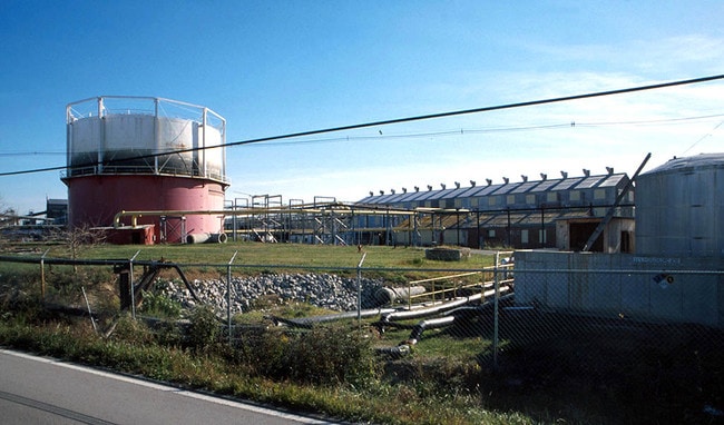
4400 Bells Ln
100300520052
109.25 AC+-
Industrialacreage
Jefferson
AH
Kentucky
21111C0039F
50.05 AC
2025
W Outlying Jefferson Cnty
2025
Louisville
012701
Louisville-Jefferson County, KY-IN
DEMOGRAPHICS near 4400 Bells Ln
1 Mile
3 Mile
5 Mile
2024 Total Population
929
64,989
188,785
2029 Population
927
65,091
188,829
Pop Growth 2024-2029
(0.22%)
+ 0.16%
+ 0.02%
Average Age
37
39
38
2024 Total Households
368
26,271
79,011
HH Growth 2024-2029
(0.54%)
+ 0.05%
+ 0.07%
Median Household Inc
$38,610
$36,234
$36,842
Avg Household Size
2.40
2.40
2.20
2024 Avg HH Vehicles
1.00
1.00
1.00
Median Home Value
$125,610
$108,745
$129,545
Median Year Built
1995
1953
1953
Nearby Places
Map Layers
Map Styles
 Street
 Aerial
- Restaurants
- Banks
- Shops
- Fitness
- Groceries
PUBLIC TRANSPORTATION
AIRPORT
Louisville Muhammad Ali International
DRIVE
WALK
Distance
Louisville Muhammad Ali International
16 min
9.4 mi
Freight Ports
Port of Toledo
DRIVE
WALK
Distance
Port of Toledo
364 min
312.5 mi
Nearby Properties
Address
Land Use
TOTAL SIZE
Lot Size
Zoning
Address
Land Use
TOTAL SIZE
Lot Size
Zoning
194,084 SF
24.87 AC
EZ1-ENTERP
Address
Land Use
TOTAL SIZE
Lot Size
Zoning
3,162 SF
23.76 AC
EZ1-ENTERP
Address
Land Use
TOTAL SIZE
Lot Size
Zoning
95,508 SF
3.67 AC
EZ1-ENTERP
Address
Land Use
TOTAL SIZE
Lot Size
Zoning
38.34 AC
Address
Land Use
TOTAL SIZE
Lot Size
Zoning
308 SF
57.16 AC
EZ1-ENTERP
Address
Land Use
TOTAL SIZE
Lot Size
Zoning
270 SF
121 AC
M3-INDUSTR
Address
Land Use
TOTAL SIZE
Lot Size
Zoning
164,677 SF
13.54 AC
EZ1-ENTERP
Address
Land Use
TOTAL SIZE
Lot Size
Zoning
139,200 SF
29.50 AC
EZ1-ENTERP
Address
Land Use
TOTAL SIZE
Lot Size
Zoning
21.36 AC
Address
Land Use
TOTAL SIZE
Lot Size
Zoning
Address
Land Use
TOTAL SIZE
Lot Size
Zoning
19,000 SF
12.86 AC
EZ1-ENTERP
Address
Land Use
TOTAL SIZE
Lot Size
Zoning
5,720 SF
93.67 AC
EZ1-ENTERP
Address
Land Use
TOTAL SIZE
Lot Size
Zoning
20,258 SF
60.94 AC
M3-INDUSTR
Address
Land Use
TOTAL SIZE
Lot Size
Zoning
91,913 SF
2.46 AC
C2-COMMERC
Address
Land Use
TOTAL SIZE
Lot Size
Zoning
1,440 SF
141.94 AC
M3-INDUSTR
Address
Land Use
TOTAL SIZE
Lot Size
Zoning
1,620 SF
16.84 AC
R6-RESIDEN
Address
Land Use
TOTAL SIZE
Lot Size
Zoning
88,320 SF
46.23 AC
EZ1-ENTERP
Address
Land Use
TOTAL SIZE
Lot Size
Zoning
24,839 SF
25.37 AC
M3-INDUSTR
Address
Land Use
TOTAL SIZE
Lot Size
Zoning
266,400 SF
16.40 AC
EZ1-ENTERP
Address
Land Use
TOTAL SIZE
Lot Size
Zoning
133,829 SF
10.03 AC
EZ1-ENTERP
Address
Land Use
TOTAL SIZE
Lot Size
Zoning
2,571 SF
87 SF
M3-INDUSTR
Address
Land Use
TOTAL SIZE
Lot Size
Zoning
34,940 SF
20.49 AC
C1-COMMERC
Address
Land Use
TOTAL SIZE
Lot Size
Zoning
14,192 SF
5.26 AC
R6-RESIDEN
Address
Land Use
TOTAL SIZE
Lot Size
Zoning
14,355 SF
1.50 AC
C2-COMMERC
Address
Land Use
TOTAL SIZE
Lot Size
Zoning
3,350 SF
8.28 AC
M3-INDUSTR
Address
Land Use
TOTAL SIZE
Lot Size
Zoning
304,575 SF
13.10 AC
M3-INDUSTR
Address
Land Use
TOTAL SIZE
Lot Size
Zoning
Address
Land Use
TOTAL SIZE
Lot Size
Zoning
5 AC
EZ1-ENTERP
Address
Land Use
TOTAL SIZE
Lot Size
Zoning
32,344 SF
7.16 AC
C1-COMMERC
Address
Land Use
TOTAL SIZE
Lot Size
Zoning
170,301 SF
9.64 AC
CM-COMMERC
The World's #1 Commercial Real Estate Marketplace
Connect with us
© 2025 CoStar Group
The information above has been obtained from sources believed reliable. While we do not doubt its accuracy we have not verified it and make no guarantee, warranty or representation about it. It is your responsibility to independently confirm its accuracy and completeness. Any projections, opinions, assumptions, or estimates used are for example only and do not represent the current or future performance of the property. The value of this transaction to you depends on tax and other factors which should be evaluated by your tax, financial, and legal advisors. You and your advisors should conduct a careful, independent investigation of the property to determine to your satisfaction the suitability of the property for your needs.