Property Record
4400 Nagel Rd, Avon, OH 44011


NEARBY LISTINGS FOR SALE OR LEASE
Property Detail
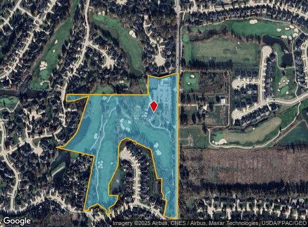
4400 Nagel Rd
Cleveland-Elyria, OH
Red Tail Development Sub
04-00-024-128-345
RED TAIL DEVELOPMENT SUB #14
Golfcourse
Lorain
AE
Ohio
39035C0136E
remai
2024
25.92 AC
2024
Lorain County
013102
Cleveland
19,670 SF
DEMOGRAPHICS near 4400 Nagel Rd
1 Mile
3 Mile
5 Mile
2024 Total Population
5,002
47,516
136,362
2029 Population
5,169
48,445
137,491
Pop Growth 2024-2029
+ 3.34%
+ 1.96%
+ 0.83%
Average Age
44
43
43
2024 Total Households
1,907
18,544
54,572
HH Growth 2024-2029
+ 3.20%
+ 1.87%
+ 0.63%
Median Household Inc
$117,408
$95,409
$91,616
Avg Household Size
2.60
2.50
2.40
2024 Avg HH Vehicles
2.00
2.00
2.00
Median Home Value
$297,612
$253,983
$254,236
Median Year Built
1991
1989
1985
Nearby Places
Map Layers
Map Styles
 Street
 Aerial
- Restaurants
- Banks
- Shops
- Fitness
- Groceries
PUBLIC TRANSPORTATION
COMMUTER RAIL
Elyria Amtrak (Capitol Limited - Amtrak, Lake Shore Limited - Amtrak)
DRIVE
WALK
Distance
Elyria Amtrak (Capitol Limited - Amtrak, Lake Shore Limited - Amtrak)
16 min
7.7 mi
AIRPORT
Cleveland-Hopkins International
DRIVE
WALK
Distance
Cleveland-Hopkins International
20 min
9.4 mi
Freight Ports
Port of Toledo
DRIVE
WALK
Distance
Port of Toledo
118 min
97.4 mi
SALE & LEASE HISTORY
LISTING DATE
SALE/LEASE

Apr 21, 2021
For Lease
Nearby Properties
Address
Land Use
TOTAL SIZE
Lot Size
Zoning
Address
Land Use
TOTAL SIZE
Lot Size
Zoning
634,322 SF
82.83 AC
Address
Land Use
TOTAL SIZE
Lot Size
Zoning
602,400 SF
5.04 AC
PUD
Address
Land Use
TOTAL SIZE
Lot Size
Zoning
221,566 SF
26.09 AC
Address
Land Use
TOTAL SIZE
Lot Size
Zoning
321,868 SF
71.81 AC
Address
Land Use
TOTAL SIZE
Lot Size
Zoning
156,541 SF
31.07 AC
Address
Land Use
TOTAL SIZE
Lot Size
Zoning
163,892 SF
46.81 AC
Address
Land Use
TOTAL SIZE
Lot Size
Zoning
193,858 SF
19.65 AC
R-MF24
Address
Land Use
TOTAL SIZE
Lot Size
Zoning
176,857 SF
8.62 AC
B-2
Address
Land Use
TOTAL SIZE
Lot Size
Zoning
163,038 SF
21.16 AC
Address
Land Use
TOTAL SIZE
Lot Size
Zoning
194,868 SF
23.21 AC
Address
Land Use
TOTAL SIZE
Lot Size
Zoning
50,668 SF
9.04 AC
Address
Land Use
TOTAL SIZE
Lot Size
Zoning
67,590 SF
23.66 AC
Address
Land Use
TOTAL SIZE
Lot Size
Zoning
111,856 SF
0.99 AC
Address
Land Use
TOTAL SIZE
Lot Size
Zoning
146,094 SF
15.29 AC
Address
Land Use
TOTAL SIZE
Lot Size
Zoning
37,464 SF
11.14 AC
Address
Land Use
TOTAL SIZE
Lot Size
Zoning
71,304 SF
8.63 AC
Address
Land Use
TOTAL SIZE
Lot Size
Zoning
128,416 SF
13.42 AC
R-40
Address
Land Use
TOTAL SIZE
Lot Size
Zoning
10,978 SF
40.75 AC
Address
Land Use
TOTAL SIZE
Lot Size
Zoning
39,418 SF
6.05 AC
Address
Land Use
TOTAL SIZE
Lot Size
Zoning
33.05 AC
Address
Land Use
TOTAL SIZE
Lot Size
Zoning
31,880 SF
159.03 AC
F-1F80
Address
Land Use
TOTAL SIZE
Lot Size
Zoning
18,697 SF
4.47 AC
Address
Land Use
TOTAL SIZE
Lot Size
Zoning
59,498 SF
0.71 AC
Address
Land Use
TOTAL SIZE
Lot Size
Zoning
75,636 SF
4.57 AC
Address
Land Use
TOTAL SIZE
Lot Size
Zoning
73,673 SF
6.80 AC
SR
Address
Land Use
TOTAL SIZE
Lot Size
Zoning
27,445 SF
2 AC
Address
Land Use
TOTAL SIZE
Lot Size
Zoning
88,501 SF
8.12 AC
F-1F80
Address
Land Use
TOTAL SIZE
Lot Size
Zoning
50,064 SF
15.73 AC
Address
Land Use
TOTAL SIZE
Lot Size
Zoning
54,847 SF
6.99 AC
CRG
Address
Land Use
TOTAL SIZE
Lot Size
Zoning
83,515 SF
3.20 AC
The World's #1 Commercial Real Estate Marketplace
Connect with us
© 2025 CoStar Group
The information above has been obtained from sources believed reliable. While we do not doubt its accuracy we have not verified it and make no guarantee, warranty or representation about it. It is your responsibility to independently confirm its accuracy and completeness. Any projections, opinions, assumptions, or estimates used are for example only and do not represent the current or future performance of the property. The value of this transaction to you depends on tax and other factors which should be evaluated by your tax, financial, and legal advisors. You and your advisors should conduct a careful, independent investigation of the property to determine to your satisfaction the suitability of the property for your needs.