Property Record
4400 S State Highway 349 Hwy, Midland, TX 79706
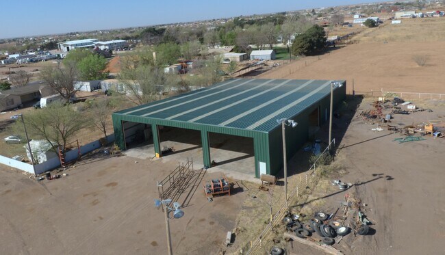

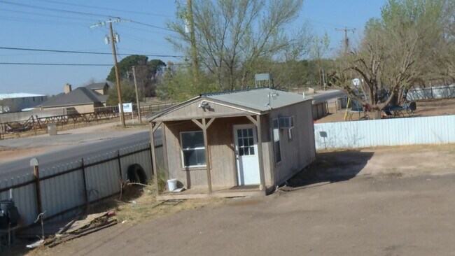
Property Detail
4400 S State Highway 349 Hwy
Midland, TX
ACRES: 1.610 SE/4 SEC: 15 BLK: 39-T2S
R000005-727
MIDLAND
Commercialbuilding
Texas
2025
1.61 AC
2025
Midland & Odessa
010117
Other Market Areas
10,530 SF
NEARBY LISTINGS FOR SALE OR LEASE
DEMOGRAPHICS near 4400 S State Highway 349 Hwy
1 mile
3 mile
5 mile
2025 Total Population
2,647
17,963
57,042
2030 Population
2,911
19,795
62,577
Pop Growth 2025-2030
+ 9.97%
+ 10.20%
+ 9.70%
Average Age
35
34
35
2025 Total Households
886
5,873
19,171
HH Growth 2025-2030
+ 11.17%
+ 11.41%
+ 10.90%
Median Household Inc
$109,429
$81,116
$72,445
Avg Household Size
2.90
2.90
2.90
2025 Avg HH Vehicles
3.00
2.00
2.00
Median Home Value
$241,401
$222,317
$221,759
Median Year Built
1991
1992
1974
Nearby Places
Map Layers
Map Styles
 Street
 Aerial
Layers
 Traffic
 Biking
Places
Listings with unknown addresses are not visible on the map
- Restaurants
- Banks
- Shops
- Fitness
- Groceries
PUBLIC TRANSPORTATION
AIRPORT
Midland International Air And Space Port
Drive
Walk
Distance
Midland International Air And Space Port
19 min
13.9 mi
Freight Ports
Calhoun Port
Drive
Walk
Distance
Calhoun Port
525 min
472.9 mi
SALE & LEASE HISTORY
LISTING DATE
SALE/LEASE

Jun 21, 2022
For Lease
Nearby Properties
Address
Land Use
TOTAL SIZE
Lot Size
Zoning
Address
Land Use
TOTAL SIZE
Lot Size
Zoning
245,203 SF
18.40 AC
Address
Land Use
TOTAL SIZE
Lot Size
Zoning
10,228 SF
15.98 AC
Address
Land Use
TOTAL SIZE
Lot Size
Zoning
12.91 AC
Address
Land Use
TOTAL SIZE
Lot Size
Zoning
800 SF
75.53 AC
Address
Land Use
TOTAL SIZE
Lot Size
Zoning
97,700 SF
10.79 AC
Address
Land Use
TOTAL SIZE
Lot Size
Zoning
9,650 SF
13 AC
MF1
Address
Land Use
TOTAL SIZE
Lot Size
Zoning
215,322 SF
19.80 AC
PDSC
Address
Land Use
TOTAL SIZE
Lot Size
Zoning
3,399 SF
648 AC
Address
Land Use
TOTAL SIZE
Lot Size
Zoning
15,068 SF
2.77 AC
LR2
Address
Land Use
TOTAL SIZE
Lot Size
Zoning
720 SF
1.86 AC
Address
Land Use
TOTAL SIZE
Lot Size
Zoning
4,263 SF
8.01 AC
Address
Land Use
TOTAL SIZE
Lot Size
Zoning
17,022 SF
1.60 AC
Address
Land Use
TOTAL SIZE
Lot Size
Zoning
13,440 SF
53.69 AC
Address
Land Use
TOTAL SIZE
Lot Size
Zoning
3,300 SF
18.80 AC
LR2
Address
Land Use
TOTAL SIZE
Lot Size
Zoning
15,000 SF
19.27 AC
Address
Land Use
TOTAL SIZE
Lot Size
Zoning
15,132 SF
2.54 AC
1F3
Address
Land Use
TOTAL SIZE
Lot Size
Zoning
58,900 SF
34.20 AC
IP3
Address
Land Use
TOTAL SIZE
Lot Size
Zoning
12,942 SF
1.68 AC
BP
Address
Land Use
TOTAL SIZE
Lot Size
Zoning
11,058 SF
1.85 AC
PDSC
Address
Land Use
TOTAL SIZE
Lot Size
Zoning
12,994 SF
1.44 AC
Address
Land Use
TOTAL SIZE
Lot Size
Zoning
2,300 SF
3.33 AC
Address
Land Use
TOTAL SIZE
Lot Size
Zoning
14,025 SF
17.47 AC
Address
Land Use
TOTAL SIZE
Lot Size
Zoning
Address
Land Use
TOTAL SIZE
Lot Size
Zoning
11,656 SF
1.55 AC
BP
Address
Land Use
TOTAL SIZE
Lot Size
Zoning
32,250 SF
Address
Land Use
TOTAL SIZE
Lot Size
Zoning
5,000 SF
12.81 AC
Address
Land Use
TOTAL SIZE
Lot Size
Zoning
3,442 SF
15.18 AC
Address
Land Use
TOTAL SIZE
Lot Size
Zoning
33,200 SF
30.80 AC
Address
Land Use
TOTAL SIZE
Lot Size
Zoning
11,540 SF
14 AC
Address
Land Use
TOTAL SIZE
Lot Size
Zoning
9,399 SF
0.99 AC
LR2
The World's #1 Commercial Real Estate Marketplace
Connect with us
© 2026 CoStar Group
The information above has been obtained from sources believed reliable. While we do not doubt its accuracy we have not verified it and make no guarantee, warranty or representation about it. It is your responsibility to independently confirm its accuracy and completeness. Any projections, opinions, assumptions, or estimates used are for example only and do not represent the current or future performance of the property. The value of this transaction to you depends on tax and other factors which should be evaluated by your tax, financial, and legal advisors. You and your advisors should conduct a careful, independent investigation of the property to determine to your satisfaction the suitability of the property for your needs.