Property Record
4400 Us Highway 183 S, Austin, TX 78744


NEARBY LISTINGS FOR SALE OR LEASE
Property Detail
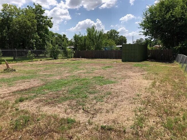
4400 Us Highway 183 S
Austin-Round Rock-San Marcos, TX
Blue Bonnet Gardens
296254
N72FT OF LOT 36 BLUE BONNET GARDENS
Sfr
Travis
X
Texas
48453C0620K
36
2024
0.35 AC
2025
Southeast
002432
Austin
980 SF
DEMOGRAPHICS near 4400 Us Highway 183 S
1 Mile
3 Mile
5 Mile
2024 Total Population
1,469
27,742
143,748
2029 Population
1,617
30,622
157,142
Pop Growth 2024-2029
+ 10.07%
+ 10.38%
+ 9.32%
Average Age
35
34
34
2024 Total Households
522
8,950
53,729
HH Growth 2024-2029
+ 10.73%
+ 11.73%
+ 10.26%
Median Household Inc
$99,717
$74,465
$61,079
Avg Household Size
2.70
2.80
2.50
2024 Avg HH Vehicles
2.00
2.00
2.00
Median Home Value
$264,948
$273,449
$278,396
Median Year Built
2010
2010
1999
Nearby Places
Map Layers
Map Styles
 Street
 Aerial
- Restaurants
- Banks
- Shops
- Fitness
- Groceries
PUBLIC TRANSPORTATION
COMMUTER RAIL
DRIVE
WALK
Distance
16 min
9.3 mi
AIRPORT
Austin-Bergstrom International
DRIVE
WALK
Distance
Austin-Bergstrom International
10 min
3.5 mi
SALE & LEASE HISTORY
LISTING DATE
SALE/LEASE

Feb 18, 2022
For Lease
Aug 08, 2024
For Sale
Nearby Properties
Address
Land Use
TOTAL SIZE
Lot Size
Zoning
Address
Land Use
TOTAL SIZE
Lot Size
Zoning
942.08 AC
Address
Land Use
TOTAL SIZE
Lot Size
Zoning
307,610 SF
8.95 AC
Address
Land Use
TOTAL SIZE
Lot Size
Zoning
290,643 SF
13.59 AC
Address
Land Use
TOTAL SIZE
Lot Size
Zoning
255,483 SF
35 AC
Address
Land Use
TOTAL SIZE
Lot Size
Zoning
648 SF
3,655.24 AC
Address
Land Use
TOTAL SIZE
Lot Size
Zoning
335,913 SF
13.83 AC
Address
Land Use
TOTAL SIZE
Lot Size
Zoning
390,384 SF
34.08 AC
Address
Land Use
TOTAL SIZE
Lot Size
Zoning
287,925 SF
9.92 AC
Address
Land Use
TOTAL SIZE
Lot Size
Zoning
427,350 SF
3.63 AC
Address
Land Use
TOTAL SIZE
Lot Size
Zoning
193,788 SF
107.16 AC
Address
Land Use
TOTAL SIZE
Lot Size
Zoning
602,470 SF
67.47 AC
Address
Land Use
TOTAL SIZE
Lot Size
Zoning
206,608 SF
10.61 AC
Address
Land Use
TOTAL SIZE
Lot Size
Zoning
288,174 SF
18.91 AC
Address
Land Use
TOTAL SIZE
Lot Size
Zoning
262,576 SF
15.68 AC
Address
Land Use
TOTAL SIZE
Lot Size
Zoning
323,360 SF
20.93 AC
Address
Land Use
TOTAL SIZE
Lot Size
Zoning
162,000 SF
12.62 AC
Address
Land Use
TOTAL SIZE
Lot Size
Zoning
368,244 SF
93.34 AC
Address
Land Use
TOTAL SIZE
Lot Size
Zoning
353,770 SF
23.97 AC
Address
Land Use
TOTAL SIZE
Lot Size
Zoning
326,400 SF
26.12 AC
Address
Land Use
TOTAL SIZE
Lot Size
Zoning
345,600 SF
49.73 AC
Address
Land Use
TOTAL SIZE
Lot Size
Zoning
214,303 SF
11.32 AC
Address
Land Use
TOTAL SIZE
Lot Size
Zoning
351,255 SF
12.45 AC
Address
Land Use
TOTAL SIZE
Lot Size
Zoning
257,600 SF
26.83 AC
Address
Land Use
TOTAL SIZE
Lot Size
Zoning
221,646 SF
6.71 AC
Address
Land Use
TOTAL SIZE
Lot Size
Zoning
249,216 SF
20.19 AC
Address
Land Use
TOTAL SIZE
Lot Size
Zoning
166,770 SF
13.51 AC
Address
Land Use
TOTAL SIZE
Lot Size
Zoning
172,800 SF
22.82 AC
Address
Land Use
TOTAL SIZE
Lot Size
Zoning
247,104 SF
9.39 AC
Address
Land Use
TOTAL SIZE
Lot Size
Zoning
348,838 SF
4.16 AC
Address
Land Use
TOTAL SIZE
Lot Size
Zoning
264,765 SF
23.37 AC
The World's #1 Commercial Real Estate Marketplace
Connect with us
© 2026 CoStar Group
The information above has been obtained from sources believed reliable. While we do not doubt its accuracy we have not verified it and make no guarantee, warranty or representation about it. It is your responsibility to independently confirm its accuracy and completeness. Any projections, opinions, assumptions, or estimates used are for example only and do not represent the current or future performance of the property. The value of this transaction to you depends on tax and other factors which should be evaluated by your tax, financial, and legal advisors. You and your advisors should conduct a careful, independent investigation of the property to determine to your satisfaction the suitability of the property for your needs.