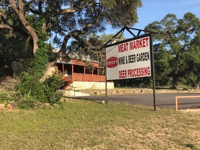
Property Record
4400 Us Highway 281 N, Spring Branch, TX 78070

Property Detail
4400 Us Highway 281 N
74-0236-0008-00
A-236 SUR-452 C HANZ, ACRES 1.41
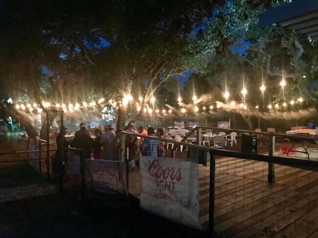
Commercialnec
Comal
B and X Area of moderate flood hazard, usually the area between the limits of the 100-year and 500-year floods.
Texas
2024
1.41 AC
2025
Comal County
310703
San Antonio
4,629 SF
San Antonio-New Braunfels, TX
NEARBY LISTINGS FOR SALE OR LEASE
DEMOGRAPHICS near 4400 Us Highway 281 N
1 mile
3 mile
5 mile
2025 Total Population
2,662
11,520
27,519
2030 Population
3,134
13,610
32,533
Pop Growth 2025-2030
+ 17.73%
+ 18.14%
+ 18.22%
Average Age
44
43
42
2025 Total Households
1,012
4,157
9,829
HH Growth 2025-2030
+ 17.89%
+ 18.16%
+ 18.23%
Median Household Inc
$107,730
$133,035
$134,583
Avg Household Size
2.60
2.70
2.80
2025 Avg HH Vehicles
3.00
3.00
3.00
Median Home Value
$666,824
$634,525
$566,051
Median Year Built
2010
2009
2008
Nearby Places
Map Layers
Map Styles
 Street
 Aerial
Layers
 Traffic
 Biking
Places
Listings with unknown addresses are not visible on the map
- Restaurants
- Banks
- Shops
- Fitness
- Groceries
PUBLIC TRANSPORTATION
AIRPORT
San Antonio International
Drive
Walk
Distance
San Antonio International
25 min
20.9 mi
SALE & LEASE HISTORY
LISTING DATE
SALE/LEASE

Jan 12, 2022
For Sale
Apr 26, 2022
For Sale
Nearby Properties
Address
Land Use
TOTAL SIZE
Lot Size
Zoning
Address
Land Use
TOTAL SIZE
Lot Size
Zoning
269,288 SF
14.67 AC
Address
Land Use
TOTAL SIZE
Lot Size
Zoning
128,094 SF
26.63 AC
Address
Land Use
TOTAL SIZE
Lot Size
Zoning
60,591 SF
3.88 AC
Address
Land Use
TOTAL SIZE
Lot Size
Zoning
190,105 SF
19.23 AC
Address
Land Use
TOTAL SIZE
Lot Size
Zoning
47,845 SF
4.65 AC
Address
Land Use
TOTAL SIZE
Lot Size
Zoning
Address
Land Use
TOTAL SIZE
Lot Size
Zoning
101,914 SF
19.55 AC
Address
Land Use
TOTAL SIZE
Lot Size
Zoning
62,956 SF
12.97 AC
Address
Land Use
TOTAL SIZE
Lot Size
Zoning
54,329 SF
3.07 AC
Address
Land Use
TOTAL SIZE
Lot Size
Zoning
50,318 SF
19.62 AC
Address
Land Use
TOTAL SIZE
Lot Size
Zoning
103,535 SF
14.40 AC
Address
Land Use
TOTAL SIZE
Lot Size
Zoning
53,381 SF
15.01 AC
Address
Land Use
TOTAL SIZE
Lot Size
Zoning
32,964 SF
6.98 AC
Address
Land Use
TOTAL SIZE
Lot Size
Zoning
39,230 SF
22.05 AC
Address
Land Use
TOTAL SIZE
Lot Size
Zoning
23,357 SF
3.09 AC
Address
Land Use
TOTAL SIZE
Lot Size
Zoning
19,840 SF
12.42 AC
Address
Land Use
TOTAL SIZE
Lot Size
Zoning
1,800 SF
6.12 AC
Address
Land Use
TOTAL SIZE
Lot Size
Zoning
17.94 AC
Address
Land Use
TOTAL SIZE
Lot Size
Zoning
Address
Land Use
TOTAL SIZE
Lot Size
Zoning
16,789 SF
2.61 AC
Address
Land Use
TOTAL SIZE
Lot Size
Zoning
3,200 SF
2.26 AC
Address
Land Use
TOTAL SIZE
Lot Size
Zoning
24,762 SF
3.98 AC
Address
Land Use
TOTAL SIZE
Lot Size
Zoning
13.41 AC
Address
Land Use
TOTAL SIZE
Lot Size
Zoning
23,088 SF
2.88 AC
Address
Land Use
TOTAL SIZE
Lot Size
Zoning
99,412 SF
8.01 AC
Address
Land Use
TOTAL SIZE
Lot Size
Zoning
16,248 SF
2.66 AC
Address
Land Use
TOTAL SIZE
Lot Size
Zoning
19,250 SF
1.96 AC
Address
Land Use
TOTAL SIZE
Lot Size
Zoning
12,600 SF
1.64 AC
Address
Land Use
TOTAL SIZE
Lot Size
Zoning
23,561 SF
122.24 AC
Address
Land Use
TOTAL SIZE
Lot Size
Zoning
20,125 SF
3.54 AC
The World's #1 Commercial Real Estate Marketplace
Connect with us
© 2026 CoStar Group
The information above has been obtained from sources believed reliable. While we do not doubt its accuracy we have not verified it and make no guarantee, warranty or representation about it. It is your responsibility to independently confirm its accuracy and completeness. Any projections, opinions, assumptions, or estimates used are for example only and do not represent the current or future performance of the property. The value of this transaction to you depends on tax and other factors which should be evaluated by your tax, financial, and legal advisors. You and your advisors should conduct a careful, independent investigation of the property to determine to your satisfaction the suitability of the property for your needs.