Property Record
4401 Avenue A, Lubbock, TX 79404


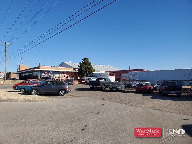
Property Detail
4401 Avenue A
Lubbock, TX
BURLINGTON IND #2 BLK 4 W470 OF L 1
R54434
Lubbock
Industrialgeneral
Texas
AE The base floodplain where base flood elevations are provided. AE Zones are now used on new format FIRMs instead of A1-A30 Zones.
10
2024
3.13 AC
2025
Southeast Inner Loop
002500
Lubbock
14,798 SF
NEARBY LISTINGS FOR SALE OR LEASE
DEMOGRAPHICS near 4401 Avenue A
1 mile
3 mile
5 mile
2025 Total Population
6,167
61,969
147,524
2030 Population
6,454
64,815
153,339
Pop Growth 2025-2030
+ 4.65%
+ 4.59%
+ 3.94%
Average Age
36
35
36
2025 Total Households
2,150
23,658
56,058
HH Growth 2025-2030
+ 4.93%
+ 5.00%
+ 4.45%
Median Household Inc
$42,500
$44,690
$49,431
Avg Household Size
2.70
2.40
2.40
2025 Avg HH Vehicles
2.00
2.00
2.00
Median Home Value
$71,573
$136,692
$165,571
Median Year Built
1968
1968
1974
Nearby Places
Map Layers
Map Styles
 Street
 Aerial
Transit
 Traffic
 Biking
Places
Listings with unknown addresses are not visible on the map
- Restaurants
- Banks
- Shops
- Fitness
- Groceries
PUBLIC TRANSPORTATION
AIRPORT
Lubbock Preston Smith International
Drive
Walk
Distance
Lubbock Preston Smith International
24 min
13.2 mi
Freight Ports
Tulsa Port Of Catoosa
Drive
Walk
Distance
Tulsa Port Of Catoosa
506 min
468.9 mi
SALE & LEASE HISTORY
LISTING DATE
SALE/LEASE

Dec 20, 2019
For Sale
Nearby Properties
Address
Land Use
TOTAL SIZE
Lot Size
Zoning
Address
Land Use
TOTAL SIZE
Lot Size
Zoning
281,000 SF
6.19 AC
Address
Land Use
TOTAL SIZE
Lot Size
Zoning
79,376 SF
11.25 AC
Address
Land Use
TOTAL SIZE
Lot Size
Zoning
15,506 SF
18.67 AC
Address
Land Use
TOTAL SIZE
Lot Size
Zoning
353,616 SF
5.24 AC
Address
Land Use
TOTAL SIZE
Lot Size
Zoning
709,350 SF
98.60 AC
Address
Land Use
TOTAL SIZE
Lot Size
Zoning
21,110 SF
13.02 AC
Address
Land Use
TOTAL SIZE
Lot Size
Zoning
321,540 SF
10.87 AC
Address
Land Use
TOTAL SIZE
Lot Size
Zoning
120,867 SF
3.41 AC
Address
Land Use
TOTAL SIZE
Lot Size
Zoning
230,286 SF
8.01 AC
Address
Land Use
TOTAL SIZE
Lot Size
Zoning
122,016 SF
1.13 AC
Address
Land Use
TOTAL SIZE
Lot Size
Zoning
400,401 SF
2.76 AC
Address
Land Use
TOTAL SIZE
Lot Size
Zoning
176,165 SF
36.61 AC
Address
Land Use
TOTAL SIZE
Lot Size
Zoning
219,352 SF
21.90 AC
Address
Land Use
TOTAL SIZE
Lot Size
Zoning
92,624 SF
2.77 AC
Address
Land Use
TOTAL SIZE
Lot Size
Zoning
202,206 SF
18.86 AC
Address
Land Use
TOTAL SIZE
Lot Size
Zoning
7.68 AC
Address
Land Use
TOTAL SIZE
Lot Size
Zoning
167,208 SF
10.09 AC
Address
Land Use
TOTAL SIZE
Lot Size
Zoning
64,317 SF
4.50 AC
Address
Land Use
TOTAL SIZE
Lot Size
Zoning
157,644 SF
9.69 AC
Address
Land Use
TOTAL SIZE
Lot Size
Zoning
115,670 SF
2.28 AC
Address
Land Use
TOTAL SIZE
Lot Size
Zoning
76,680 SF
4.95 AC
Address
Land Use
TOTAL SIZE
Lot Size
Zoning
88,998 SF
7.56 AC
Address
Land Use
TOTAL SIZE
Lot Size
Zoning
253,852 SF
17.98 AC
Address
Land Use
TOTAL SIZE
Lot Size
Zoning
421,200 SF
43.22 AC
Address
Land Use
TOTAL SIZE
Lot Size
Zoning
119,200 SF
8.44 AC
Address
Land Use
TOTAL SIZE
Lot Size
Zoning
175,122 SF
1.44 AC
Address
Land Use
TOTAL SIZE
Lot Size
Zoning
205,150 SF
23.43 AC
Address
Land Use
TOTAL SIZE
Lot Size
Zoning
77,344 SF
4.76 AC
Address
Land Use
TOTAL SIZE
Lot Size
Zoning
150,000 SF
216.67 AC
Address
Land Use
TOTAL SIZE
Lot Size
Zoning
80,599 SF
1.64 AC
The World's #1 Commercial Real Estate Marketplace
Connect with us
© 2026 CoStar Group
The information above has been obtained from sources believed reliable. While we do not doubt its accuracy we have not verified it and make no guarantee, warranty or representation about it. It is your responsibility to independently confirm its accuracy and completeness. Any projections, opinions, assumptions, or estimates used are for example only and do not represent the current or future performance of the property. The value of this transaction to you depends on tax and other factors which should be evaluated by your tax, financial, and legal advisors. You and your advisors should conduct a careful, independent investigation of the property to determine to your satisfaction the suitability of the property for your needs.