Property Record
4401 E 10Th St, Indianapolis, IN 46201

Save to a Folder
{{folder.Name}}
{{folder.ListingIds.length}} Properties
{{folder.ListingIds.length}} Property
Create a New Folder
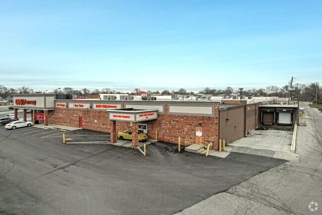
Property Detail
4401 E 10Th St
49-10-04-110-003.000-101
BEG 880.6FT W & 60FT S OF NE COR S4 T15 R4E220FT NL X 846FT EL CONT 4.273 AC
Regionalshoppingcenterormallwithanchorstore
MARION
B and X Area of moderate flood hazard, usually the area between the limits of the 100-year and 500-year floods.
Indiana
2025
4.27 AC
2025
Lawrence/East County
354900
Indianapolis
98,150 SF
Indianapolis-Carmel-Greenwood, IN
NEARBY LISTINGS FOR SALE OR LEASE
DEMOGRAPHICS near 4401 E 10Th St
1 mile
3 mile
5 mile
2025 Total Population
21,632
117,997
279,983
2030 Population
22,410
122,173
288,285
Pop Growth 2025-2030
+ 3.60%
+ 3.54%
+ 2.97%
Average Age
37
37
37
2025 Total Households
9,210
50,432
121,184
HH Growth 2025-2030
+ 3.41%
+ 3.47%
+ 3.07%
Median Household Inc
$49,234
$53,284
$57,540
Avg Household Size
2.30
2.20
2.20
2025 Avg HH Vehicles
1.00
1.00
1.00
Median Home Value
$171,070
$192,283
$202,112
Median Year Built
1946
1951
1955
Nearby Places
Map Layers
Map Styles
 Street
 Aerial
Layers
 Traffic
 Biking
Places
Listings with unknown addresses are not visible on the map
- Restaurants
- Banks
- Shops
- Fitness
- Groceries
PUBLIC TRANSPORTATION
COMMUTER RAIL
Drive
Walk
Distance
10 min
5.1 mi
AIRPORT
Indianapolis International
Drive
Walk
Distance
Indianapolis International
33 min
17.9 mi
SALE & LEASE HISTORY
LISTING DATE
SALE/LEASE

Sep 25, 2016
For Lease
Sep 25, 2016
For Lease
Nearby Properties
Address
Land Use
TOTAL SIZE
Lot Size
Zoning
Address
Land Use
TOTAL SIZE
Lot Size
Zoning
41.83 AC
ZO01
Address
Land Use
TOTAL SIZE
Lot Size
Zoning
25,146 SF
28.58 AC
ZO01
Address
Land Use
TOTAL SIZE
Lot Size
Zoning
1,202,700 SF
77.25 AC
ZO01
Address
Land Use
TOTAL SIZE
Lot Size
Zoning
217,895 SF
3.43 AC
ZO01
Address
Land Use
TOTAL SIZE
Lot Size
Zoning
309,006 SF
1.48 AC
ZO01
Address
Land Use
TOTAL SIZE
Lot Size
Zoning
47.10 AC
ZO01
Address
Land Use
TOTAL SIZE
Lot Size
Zoning
18,320 SF
2.05 AC
ZO01
Address
Land Use
TOTAL SIZE
Lot Size
Zoning
4,564 SF
2.32 AC
ZO01
Address
Land Use
TOTAL SIZE
Lot Size
Zoning
3.82 AC
ZO01
Address
Land Use
TOTAL SIZE
Lot Size
Zoning
3.64 AC
ZO01
Address
Land Use
TOTAL SIZE
Lot Size
Zoning
193,498 SF
2.69 AC
ZO01
Address
Land Use
TOTAL SIZE
Lot Size
Zoning
2.12 AC
ZO01
Address
Land Use
TOTAL SIZE
Lot Size
Zoning
713,497 SF
69.91 AC
ZO01
Address
Land Use
TOTAL SIZE
Lot Size
Zoning
83,616 SF
3.57 AC
ZO01
Address
Land Use
TOTAL SIZE
Lot Size
Zoning
3,288 SF
3.65 AC
ZO01
Address
Land Use
TOTAL SIZE
Lot Size
Zoning
147,649 SF
1.01 AC
ZO01
Address
Land Use
TOTAL SIZE
Lot Size
Zoning
2,451 SF
0.46 AC
ZO01
Address
Land Use
TOTAL SIZE
Lot Size
Zoning
3,523 SF
2.39 AC
ZO01
Address
Land Use
TOTAL SIZE
Lot Size
Zoning
193,800 SF
1.88 AC
ZO01
Address
Land Use
TOTAL SIZE
Lot Size
Zoning
2,720 SF
1.33 AC
ZO01
Address
Land Use
TOTAL SIZE
Lot Size
Zoning
0.44 AC
ZO01
Address
Land Use
TOTAL SIZE
Lot Size
Zoning
2,331 SF
1.38 AC
ZO01
Address
Land Use
TOTAL SIZE
Lot Size
Zoning
55,047 SF
2.01 AC
ZO01
Address
Land Use
TOTAL SIZE
Lot Size
Zoning
3,280 SF
1.04 AC
ZO01
Address
Land Use
TOTAL SIZE
Lot Size
Zoning
11,000 SF
0.71 AC
ZO01
Address
Land Use
TOTAL SIZE
Lot Size
Zoning
13,631 SF
0.84 AC
ZO01
Address
Land Use
TOTAL SIZE
Lot Size
Zoning
29,624 SF
2.56 AC
ZO01
Address
Land Use
TOTAL SIZE
Lot Size
Zoning
2,772 SF
1.68 AC
ZO01
Address
Land Use
TOTAL SIZE
Lot Size
Zoning
81,013 SF
1.23 AC
ZO01
Address
Land Use
TOTAL SIZE
Lot Size
Zoning
39,840 SF
0.57 AC
ZO01
The World's #1 Commercial Real Estate Marketplace
Connect with us
© 2026 CoStar Group
The information above has been obtained from sources believed reliable. While we do not doubt its accuracy we have not verified it and make no guarantee, warranty or representation about it. It is your responsibility to independently confirm its accuracy and completeness. Any projections, opinions, assumptions, or estimates used are for example only and do not represent the current or future performance of the property. The value of this transaction to you depends on tax and other factors which should be evaluated by your tax, financial, and legal advisors. You and your advisors should conduct a careful, independent investigation of the property to determine to your satisfaction the suitability of the property for your needs.