Property Record
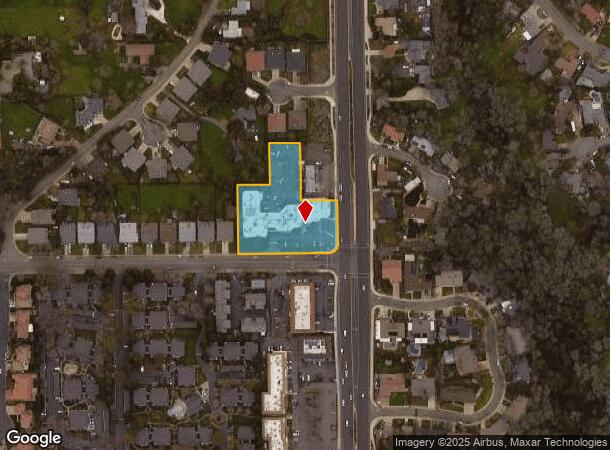
4401 N Hazel Ave, Fair Oaks, CA 95628


Current Lease Availabilities
NEARBY LISTINGS FOR SALE OR LEASE
Property Detail
4401 N Hazel Ave
246-0620-048
Fair Oaks Tract
Officebuilding
PARCEL A, P.M.34-47, TOGETHER WITH, THE WEST 100, OF THE EAST 355, OF THE SOUTH 200, OF PARCEL A, P.M.2-32
X
Sacramento
06067C0113H
California
2024
1.64 AC
2025
Carmichael/Fair Oaks
008006
Sacramento
32,117 SF
Sacramento-Roseville-Folsom, CA
DEMOGRAPHICS near 4401 N Hazel Ave
1 Mile
3 Mile
5 Mile
2024 Total Population
6,989
69,244
206,481
2029 Population
7,022
69,585
207,699
Pop Growth 2024-2029
+ 0.47%
+ 0.49%
+ 0.59%
Average Age
47
44
42
2024 Total Households
2,892
28,416
80,275
HH Growth 2024-2029
+ 0.48%
+ 0.46%
+ 0.60%
Median Household Inc
$117,191
$101,273
$93,332
Avg Household Size
2.40
2.40
2.50
2024 Avg HH Vehicles
2.00
2.00
2.00
Median Home Value
$691,150
$625,900
$544,361
Median Year Built
1980
1980
1979
Nearby Places
Map Layers
Map Styles
 Street
 Aerial
- Restaurants
- Banks
- Shops
- Fitness
- Groceries
PUBLIC TRANSPORTATION
AIRPORT
Sacramento International
DRIVE
WALK
Distance
Sacramento International
38 min
25.8 mi
Freight Ports
Port of Stockton
DRIVE
WALK
Distance
Port of Stockton
75 min
64.4 mi
Nearby Properties
Address
Land Use
TOTAL SIZE
Lot Size
Zoning
Address
Land Use
TOTAL SIZE
Lot Size
Zoning
SPA (ASPA)
Address
Land Use
TOTAL SIZE
Lot Size
Zoning
304,607 SF
14.70 AC
LC
Address
Land Use
TOTAL SIZE
Lot Size
Zoning
115,076 SF
22.09 AC
SP-INDUSTR
Address
Land Use
TOTAL SIZE
Lot Size
Zoning
287,131 SF
32.53 AC
C-3 (PD)
Address
Land Use
TOTAL SIZE
Lot Size
Zoning
7.94 AC
RD-25
Address
Land Use
TOTAL SIZE
Lot Size
Zoning
199,580 SF
10.29 AC
RD20
Address
Land Use
TOTAL SIZE
Lot Size
Zoning
202,776 SF
12.17 AC
RD-25 (PC)
Address
Land Use
TOTAL SIZE
Lot Size
Zoning
269,928 SF
246.95 AC
SPA
Address
Land Use
TOTAL SIZE
Lot Size
Zoning
2,146.73 AC
SPA
Address
Land Use
TOTAL SIZE
Lot Size
Zoning
241,672 SF
18.54 AC
SC
Address
Land Use
TOTAL SIZE
Lot Size
Zoning
14.54 AC
SPA (ASPA)
Address
Land Use
TOTAL SIZE
Lot Size
Zoning
163,800 SF
9.13 AC
SP-IND/OP
Address
Land Use
TOTAL SIZE
Lot Size
Zoning
12,548 SF
14.36 AC
RD-30
Address
Land Use
TOTAL SIZE
Lot Size
Zoning
55,579 SF
44.38 AC
M-2
Address
Land Use
TOTAL SIZE
Lot Size
Zoning
84,387 SF
3.52 AC
LC
Address
Land Use
TOTAL SIZE
Lot Size
Zoning
99,568 SF
10.92 AC
RD-5
Address
Land Use
TOTAL SIZE
Lot Size
Zoning
52,992 SF
4.07 AC
M-1 (PD)
Address
Land Use
TOTAL SIZE
Lot Size
Zoning
91,983 SF
3.27 AC
SPA
Address
Land Use
TOTAL SIZE
Lot Size
Zoning
112,065 SF
8.52 AC
RD20
Address
Land Use
TOTAL SIZE
Lot Size
Zoning
78,379 SF
4.91 AC
RD20
Address
Land Use
TOTAL SIZE
Lot Size
Zoning
82,499 SF
4.74 AC
RD-30
Address
Land Use
TOTAL SIZE
Lot Size
Zoning
52,595 SF
4.48 AC
LC
Address
Land Use
TOTAL SIZE
Lot Size
Zoning
104,750 SF
5.66 AC
RD-20
Address
Land Use
TOTAL SIZE
Lot Size
Zoning
121,416 SF
8.22 AC
SP-IND/OP
Address
Land Use
TOTAL SIZE
Lot Size
Zoning
87,942 SF
9.03 AC
SPA
Address
Land Use
TOTAL SIZE
Lot Size
Zoning
939,277 SF
58.75 AC
SPA
Address
Land Use
TOTAL SIZE
Lot Size
Zoning
85,320 SF
4 AC
SPA
Address
Land Use
TOTAL SIZE
Lot Size
Zoning
2,646.76 AC
SPA
Address
Land Use
TOTAL SIZE
Lot Size
Zoning
2,940 SF
4.97 AC
RD10
Address
Land Use
TOTAL SIZE
Lot Size
Zoning
105,703 SF
4.75 AC
RD-30 BP
The World's #1 Commercial Real Estate Marketplace
Connect with us
© 2026 CoStar Group
The information above has been obtained from sources believed reliable. While we do not doubt its accuracy we have not verified it and make no guarantee, warranty or representation about it. It is your responsibility to independently confirm its accuracy and completeness. Any projections, opinions, assumptions, or estimates used are for example only and do not represent the current or future performance of the property. The value of this transaction to you depends on tax and other factors which should be evaluated by your tax, financial, and legal advisors. You and your advisors should conduct a careful, independent investigation of the property to determine to your satisfaction the suitability of the property for your needs.