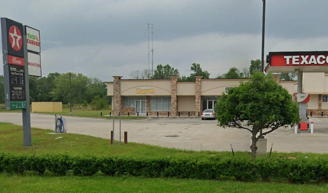
Property Record
4401 N Main St, Liberty, TX 77575

NEARBY LISTINGS FOR SALE OR LEASE
Property Detail
4401 N Main St
Houston-The Woodlands-Sugar Land, TX
Geo Orr
000091-000427-000
000091 GEO ORR, TRACT 427, ACRES 8.5855
Commercialnec
Liberty
AE
Texas
48291C0435D
427
2024
8.59 AC
2025
Liberty County
701200
Houston
9,600 SF
DEMOGRAPHICS near 4401 N Main St
1 Mile
3 Mile
5 Mile
2024 Total Population
846
9,113
13,745
2029 Population
1,102
11,897
17,861
Pop Growth 2024-2029
+ 30.26%
+ 30.55%
+ 29.95%
Average Age
37
38
38
2024 Total Households
288
3,185
4,889
HH Growth 2024-2029
+ 29.17%
+ 29.39%
+ 28.57%
Median Household Inc
$42,954
$47,748
$53,024
Avg Household Size
2.80
2.70
2.70
2024 Avg HH Vehicles
2.00
2.00
2.00
Median Home Value
$193,136
$157,764
$157,738
Median Year Built
2001
1978
1979
Nearby Places
Map Layers
Map Styles
 Street
 Aerial
- Restaurants
- Banks
- Shops
- Fitness
- Groceries
PUBLIC TRANSPORTATION
AIRPORT
George Bush Intcntl/Houston
DRIVE
WALK
Distance
George Bush Intcntl/Houston
62 min
41.7 mi
Freight Ports
Port of Houston
DRIVE
WALK
Distance
Port of Houston
58 min
43.1 mi
SALE & LEASE HISTORY
LISTING DATE
SALE/LEASE

Feb 17, 2023
For Lease
Nearby Properties
Address
Land Use
TOTAL SIZE
Lot Size
Zoning
Address
Land Use
TOTAL SIZE
Lot Size
Zoning
175,007 SF
17.24 AC
Address
Land Use
TOTAL SIZE
Lot Size
Zoning
142,289 SF
42.96 AC
Address
Land Use
TOTAL SIZE
Lot Size
Zoning
215,653 SF
22.62 AC
Address
Land Use
TOTAL SIZE
Lot Size
Zoning
96,387 SF
8.82 AC
Address
Land Use
TOTAL SIZE
Lot Size
Zoning
38,468 SF
7.49 AC
Address
Land Use
TOTAL SIZE
Lot Size
Zoning
54,753 SF
39.82 AC
Address
Land Use
TOTAL SIZE
Lot Size
Zoning
5,561 SF
1,243.20 AC
Address
Land Use
TOTAL SIZE
Lot Size
Zoning
85,428 SF
10.57 AC
Address
Land Use
TOTAL SIZE
Lot Size
Zoning
35,070 SF
5 AC
Address
Land Use
TOTAL SIZE
Lot Size
Zoning
34,570 SF
5.48 AC
Address
Land Use
TOTAL SIZE
Lot Size
Zoning
60,193 SF
56.61 AC
Address
Land Use
TOTAL SIZE
Lot Size
Zoning
22,958 SF
116.97 AC
Address
Land Use
TOTAL SIZE
Lot Size
Zoning
26,724 SF
1.10 AC
Address
Land Use
TOTAL SIZE
Lot Size
Zoning
27,415 SF
7.32 AC
Address
Land Use
TOTAL SIZE
Lot Size
Zoning
26,545 SF
2.18 AC
Address
Land Use
TOTAL SIZE
Lot Size
Zoning
24,352 SF
8 AC
Address
Land Use
TOTAL SIZE
Lot Size
Zoning
31,384 SF
4 AC
Address
Land Use
TOTAL SIZE
Lot Size
Zoning
40,520 SF
4.07 AC
Address
Land Use
TOTAL SIZE
Lot Size
Zoning
38,429 SF
2.88 AC
Address
Land Use
TOTAL SIZE
Lot Size
Zoning
48,083 SF
3.32 AC
Address
Land Use
TOTAL SIZE
Lot Size
Zoning
6,728 SF
4.67 AC
Address
Land Use
TOTAL SIZE
Lot Size
Zoning
29.12 AC
Address
Land Use
TOTAL SIZE
Lot Size
Zoning
60,352 SF
3.08 AC
Address
Land Use
TOTAL SIZE
Lot Size
Zoning
28,821 SF
2.05 AC
Address
Land Use
TOTAL SIZE
Lot Size
Zoning
74,418 SF
7.60 AC
Address
Land Use
TOTAL SIZE
Lot Size
Zoning
19,962 SF
4.50 AC
Address
Land Use
TOTAL SIZE
Lot Size
Zoning
46,350 SF
3 AC
Address
Land Use
TOTAL SIZE
Lot Size
Zoning
17,720 SF
2.25 AC
Address
Land Use
TOTAL SIZE
Lot Size
Zoning
25,446 SF
4 AC
The World's #1 Commercial Real Estate Marketplace
Connect with us
© 2025 CoStar Group
The information above has been obtained from sources believed reliable. While we do not doubt its accuracy we have not verified it and make no guarantee, warranty or representation about it. It is your responsibility to independently confirm its accuracy and completeness. Any projections, opinions, assumptions, or estimates used are for example only and do not represent the current or future performance of the property. The value of this transaction to you depends on tax and other factors which should be evaluated by your tax, financial, and legal advisors. You and your advisors should conduct a careful, independent investigation of the property to determine to your satisfaction the suitability of the property for your needs.