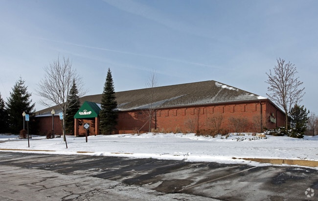
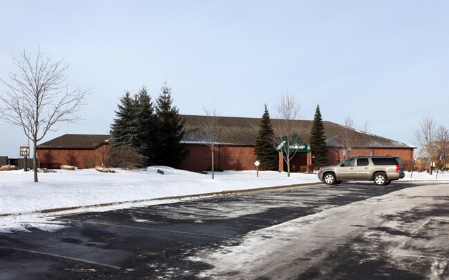
Property Record
44011 Five Mile Rd, Plymouth, MI 48170
NEARBY LISTINGS FOR SALE OR LEASE
Property Detail
44011 Five Mile Rd
Detroit-Warren-Dearborn, MI
Rollins Acres
78-013-01-0001-301
22B1 PT OF NE 1/4 SEC 22 T1S R8E BEG S 3DEG 04M 00S E 1007.05 FT FROM NE COR SEC 22 TH S 3DEG 04M 00S E 1157.95FT TH ON A CURVE TO LEFT RAD 2532.83 ARC 734.12FT TH S 87D 36M 40S W 2128.48FT TH N 2DEG 18M 30S W 1636.80 FT TH N 87D 27M 30S E 2669.54 FT
Hotel
Wayne
X
Michigan
26163C0038E
0001
2025
55.65 AC
2025
Southern I-275 Corridor
562400
Detroit
334,346 SF
DEMOGRAPHICS near 44011 Five Mile Rd
1 Mile
3 Mile
5 Mile
2024 Total Population
3,745
55,901
154,335
2029 Population
3,580
53,628
148,740
Pop Growth 2024-2029
(4.41%)
(4.07%)
(3.63%)
Average Age
44
44
43
2024 Total Households
1,471
23,797
61,894
HH Growth 2024-2029
(4.15%)
(3.93%)
(3.61%)
Median Household Inc
$149,543
$113,002
$111,520
Avg Household Size
2.50
2.30
2.40
2024 Avg HH Vehicles
2.00
2.00
2.00
Median Home Value
$491,057
$399,334
$345,052
Median Year Built
1999
1977
1978
Nearby Places
Map Layers
Map Styles
 Street
 Aerial
- Restaurants
- Banks
- Shops
- Fitness
- Groceries
PUBLIC TRANSPORTATION
AIRPORT
Detroit Metro Wayne County
DRIVE
WALK
Distance
Detroit Metro Wayne County
29 min
22.0 mi
Windsor International
DRIVE
WALK
Distance
Windsor International
54 min
35.1 mi
Freight Ports
Port of Toledo
DRIVE
WALK
Distance
Port of Toledo
78 min
63.6 mi
Nearby Properties
Address
Land Use
TOTAL SIZE
Lot Size
Zoning
Address
Land Use
TOTAL SIZE
Lot Size
Zoning
1,005,040 SF
Address
Land Use
TOTAL SIZE
Lot Size
Zoning
234,403 SF
74.21 AC
OS
Address
Land Use
TOTAL SIZE
Lot Size
Zoning
250,699 SF
16.89 AC
SH
Address
Land Use
TOTAL SIZE
Lot Size
Zoning
182,121 SF
10.85 AC
HPUD
Address
Land Use
TOTAL SIZE
Lot Size
Zoning
517,265 SF
116.72 AC
Address
Land Use
TOTAL SIZE
Lot Size
Zoning
102,878 SF
10.48 AC
CJ
Address
Land Use
TOTAL SIZE
Lot Size
Zoning
192,478 SF
IND
Address
Land Use
TOTAL SIZE
Lot Size
Zoning
114,894 SF
4.94 AC
ARC
Address
Land Use
TOTAL SIZE
Lot Size
Zoning
5,339 SF
20.10 AC
R-3
Address
Land Use
TOTAL SIZE
Lot Size
Zoning
306,061 SF
26.36 AC
TAR
Address
Land Use
TOTAL SIZE
Lot Size
Zoning
117.35 AC
Address
Land Use
TOTAL SIZE
Lot Size
Zoning
361,807 SF
18.77 AC
M-2
Address
Land Use
TOTAL SIZE
Lot Size
Zoning
225,164 SF
25.66 AC
IND
Address
Land Use
TOTAL SIZE
Lot Size
Zoning
283,710 SF
IND
Address
Land Use
TOTAL SIZE
Lot Size
Zoning
80,574 SF
19.95 AC
7MIPUD
Address
Land Use
TOTAL SIZE
Lot Size
Zoning
9,706 SF
40.41 AC
RM-1
Address
Land Use
TOTAL SIZE
Lot Size
Zoning
221,508 SF
26.03 AC
IND
Address
Land Use
TOTAL SIZE
Lot Size
Zoning
113,292 SF
15.79 AC
IND
Address
Land Use
TOTAL SIZE
Lot Size
Zoning
99,826 SF
ORT
Address
Land Use
TOTAL SIZE
Lot Size
Zoning
123,225 SF
9 AC
CJ/ARC
Address
Land Use
TOTAL SIZE
Lot Size
Zoning
110,220 SF
0.78 AC
CBD
Address
Land Use
TOTAL SIZE
Lot Size
Zoning
46.60 AC
R-3
Address
Land Use
TOTAL SIZE
Lot Size
Zoning
78,164 SF
5.51 AC
PUD
Address
Land Use
TOTAL SIZE
Lot Size
Zoning
976 SF
26.85 AC
RM-1
Address
Land Use
TOTAL SIZE
Lot Size
Zoning
152,414 SF
13.91 AC
RM-1
Address
Land Use
TOTAL SIZE
Lot Size
Zoning
103,075 SF
8.15 AC
PUD
Address
Land Use
TOTAL SIZE
Lot Size
Zoning
172,094 SF
11.84 AC
M-2
Address
Land Use
TOTAL SIZE
Lot Size
Zoning
19.68 AC
RM-1
Address
Land Use
TOTAL SIZE
Lot Size
Zoning
113,994 SF
6.32 AC
SH
The World's #1 Commercial Real Estate Marketplace
Connect with us
© 2026 CoStar Group
The information above has been obtained from sources believed reliable. While we do not doubt its accuracy we have not verified it and make no guarantee, warranty or representation about it. It is your responsibility to independently confirm its accuracy and completeness. Any projections, opinions, assumptions, or estimates used are for example only and do not represent the current or future performance of the property. The value of this transaction to you depends on tax and other factors which should be evaluated by your tax, financial, and legal advisors. You and your advisors should conduct a careful, independent investigation of the property to determine to your satisfaction the suitability of the property for your needs.