Property Record
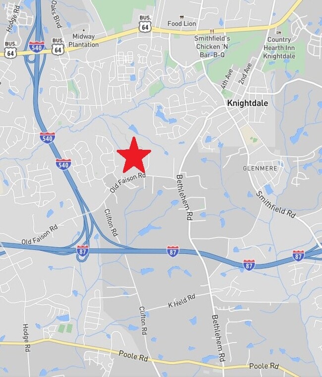
4402 Old Faison Rd, Knightdale, NC 27545


This Property Is For Sale
NEARBY LISTINGS FOR SALE OR LEASE
Property Detail
4402 Old Faison Rd
1743.02-88-6921-000
FAISON
Farms
Wake
X
North Carolina
3720174300K
19 AC
2025
Northeast Wake County
2025
Raleigh/Durham
054115
Raleigh, NC
DEMOGRAPHICS near 4402 Old Faison Rd
1 Mile
3 Mile
5 Mile
2024 Total Population
8,040
37,442
99,264
2029 Population
8,658
40,731
108,182
Pop Growth 2024-2029
+ 7.69%
+ 8.78%
+ 8.98%
Average Age
37
37
37
2024 Total Households
2,969
13,888
36,040
HH Growth 2024-2029
+ 7.75%
+ 8.86%
+ 9.05%
Median Household Inc
$66,900
$72,038
$75,327
Avg Household Size
2.70
2.60
2.70
2024 Avg HH Vehicles
2.00
2.00
2.00
Median Home Value
$254,651
$265,939
$252,849
Median Year Built
2000
1999
1999
Nearby Places
Map Layers
Map Styles
 Street
 Aerial
- Restaurants
- Banks
- Shops
- Fitness
- Groceries
PUBLIC TRANSPORTATION
AIRPORT
Raleigh-Durham International
DRIVE
WALK
Distance
Raleigh-Durham International
36 min
23.6 mi
Freight Ports
Port of Wilmington
DRIVE
WALK
Distance
Port of Wilmington
159 min
135.1 mi
Nearby Properties
Address
Land Use
TOTAL SIZE
Lot Size
Zoning
Address
Land Use
TOTAL SIZE
Lot Size
Zoning
358,360 SF
20.25 AC
HBCD
Address
Land Use
TOTAL SIZE
Lot Size
Zoning
507,000 SF
46.54 AC
MI PU
Address
Land Use
TOTAL SIZE
Lot Size
Zoning
320,135 SF
17.75 AC
NMX
Address
Land Use
TOTAL SIZE
Lot Size
Zoning
313,755 SF
22.44 AC
PD
Address
Land Use
TOTAL SIZE
Lot Size
Zoning
261,096 SF
17.30 AC
NMX
Address
Land Use
TOTAL SIZE
Lot Size
Zoning
403,802 SF
25.39 AC
RMX
Address
Land Use
TOTAL SIZE
Lot Size
Zoning
263,074 SF
83.23 AC
GR8
Address
Land Use
TOTAL SIZE
Lot Size
Zoning
209,019 SF
5 AC
NMX P
Address
Land Use
TOTAL SIZE
Lot Size
Zoning
280,020 SF
15.44 AC
MI
Address
Land Use
TOTAL SIZE
Lot Size
Zoning
222,108 SF
21.81 AC
UR12
Address
Land Use
TOTAL SIZE
Lot Size
Zoning
250,778 SF
16.51 AC
UR12
Address
Land Use
TOTAL SIZE
Lot Size
Zoning
240,000 SF
16.77 AC
MI
Address
Land Use
TOTAL SIZE
Lot Size
Zoning
299,965 SF
16.34 AC
RMX
Address
Land Use
TOTAL SIZE
Lot Size
Zoning
206,543 SF
19.91 AC
UR12
Address
Land Use
TOTAL SIZE
Lot Size
Zoning
411,764 SF
59.16 AC
MI
Address
Land Use
TOTAL SIZE
Lot Size
Zoning
204,000 SF
19.83 AC
MI CD
Address
Land Use
TOTAL SIZE
Lot Size
Zoning
165,191 SF
17.76 AC
HB
Address
Land Use
TOTAL SIZE
Lot Size
Zoning
250,120 SF
17.38 AC
MI CD
Address
Land Use
TOTAL SIZE
Lot Size
Zoning
208,125 SF
26.29 AC
MI
Address
Land Use
TOTAL SIZE
Lot Size
Zoning
180,000 SF
24.61 AC
MI CD
Address
Land Use
TOTAL SIZE
Lot Size
Zoning
155,462 SF
4.57 AC
NMX P
Address
Land Use
TOTAL SIZE
Lot Size
Zoning
159,522 SF
9.66 AC
MI
Address
Land Use
TOTAL SIZE
Lot Size
Zoning
121,658 SF
5.51 AC
NMX
Address
Land Use
TOTAL SIZE
Lot Size
Zoning
96,023 SF
18.79 AC
MI
Address
Land Use
TOTAL SIZE
Lot Size
Zoning
150,000 SF
7.09 AC
MI
Address
Land Use
TOTAL SIZE
Lot Size
Zoning
148,661 SF
7.80 AC
MI
Address
Land Use
TOTAL SIZE
Lot Size
Zoning
138,588 SF
19.07 AC
HB CD
Address
Land Use
TOTAL SIZE
Lot Size
Zoning
103,924 SF
16.92 AC
GR8
Address
Land Use
TOTAL SIZE
Lot Size
Zoning
111,921 SF
8.05 AC
UR12
Address
Land Use
TOTAL SIZE
Lot Size
Zoning
120,000 SF
7.40 AC
MI
The World's #1 Commercial Real Estate Marketplace
Connect with us
© 2025 CoStar Group
The information above has been obtained from sources believed reliable. While we do not doubt its accuracy we have not verified it and make no guarantee, warranty or representation about it. It is your responsibility to independently confirm its accuracy and completeness. Any projections, opinions, assumptions, or estimates used are for example only and do not represent the current or future performance of the property. The value of this transaction to you depends on tax and other factors which should be evaluated by your tax, financial, and legal advisors. You and your advisors should conduct a careful, independent investigation of the property to determine to your satisfaction the suitability of the property for your needs.