Property Record
4405 Sardis Church Rd, Monroe, NC 28110


NEARBY LISTINGS FOR SALE OR LEASE
Property Detail
4405 Sardis Church Rd
07-045-002-A
Alta Acsm Land Title Survey Repared For
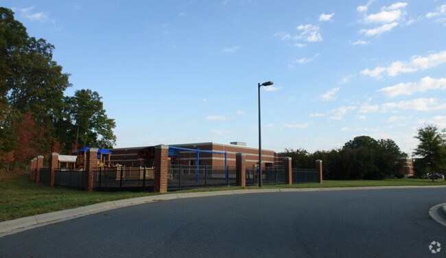
Publicschool
6897-193 LESS 7356-309
X
Union
3710541800J
North Carolina
2025
3.06 AC
2025
Union County
020312
Charlotte
20,159 SF
Charlotte-Concord-Gastonia, NC-SC
DEMOGRAPHICS near 4405 Sardis Church Rd
1 Mile
3 Mile
5 Mile
2024 Total Population
6,359
36,707
91,339
2029 Population
7,027
41,368
102,400
Pop Growth 2024-2029
+ 10.50%
+ 12.70%
+ 12.11%
Average Age
36
38
39
2024 Total Households
2,162
12,660
32,088
HH Growth 2024-2029
+ 10.68%
+ 12.92%
+ 12.31%
Median Household Inc
$91,076
$81,245
$86,390
Avg Household Size
2.90
2.90
2.80
2024 Avg HH Vehicles
2.00
2.00
2.00
Median Home Value
$247,136
$272,897
$299,981
Median Year Built
1996
2001
2000
Nearby Places
Map Layers
Map Styles
 Street
 Aerial
- Restaurants
- Banks
- Shops
- Fitness
- Groceries
PUBLIC TRANSPORTATION
AIRPORT
Charlotte/Douglas International
DRIVE
WALK
Distance
Charlotte/Douglas International
40 min
25.0 mi
Concord-Padgett Regional
DRIVE
WALK
Distance
Concord-Padgett Regional
37 min
27.3 mi
Freight Ports
North Charleston Terminal
DRIVE
WALK
Distance
North Charleston Terminal
233 min
193.6 mi
Nearby Properties
Address
Land Use
TOTAL SIZE
Lot Size
Zoning
Address
Land Use
TOTAL SIZE
Lot Size
Zoning
12.30 AC
SF-1 INDIA
Address
Land Use
TOTAL SIZE
Lot Size
Zoning
18.05 AC
CBD INDIAN
Address
Land Use
TOTAL SIZE
Lot Size
Zoning
27,900 SF
15.59 AC
MFR INDIAN
Address
Land Use
TOTAL SIZE
Lot Size
Zoning
227,659 SF
26.46 AC
MFR INDIAN
Address
Land Use
TOTAL SIZE
Lot Size
Zoning
166,254 SF
99.20 AC
G-I MONROE
Address
Land Use
TOTAL SIZE
Lot Size
Zoning
83,808 SF
23.45 AC
CD MONROE
Address
Land Use
TOTAL SIZE
Lot Size
Zoning
23.16 AC
CD MONROE
Address
Land Use
TOTAL SIZE
Lot Size
Zoning
498,729 SF
78.21 AC
RBD INDIAN
Address
Land Use
TOTAL SIZE
Lot Size
Zoning
98,929 SF
50.34 AC
SF-1 INDIA
Address
Land Use
TOTAL SIZE
Lot Size
Zoning
49,710 SF
14.20 AC
CZ INDIAN
Address
Land Use
TOTAL SIZE
Lot Size
Zoning
75,923 SF
7.29 AC
SF-1 INDIA
Address
Land Use
TOTAL SIZE
Lot Size
Zoning
159,892 SF
15.84 AC
G-I MONROE
Address
Land Use
TOTAL SIZE
Lot Size
Zoning
103,100 SF
28.55 AC
RBD INDIAN
Address
Land Use
TOTAL SIZE
Lot Size
Zoning
2,968 SF
9.34 AC
R-20 UNION
Address
Land Use
TOTAL SIZE
Lot Size
Zoning
209,960 SF
26.64 AC
RBD INDIAN
Address
Land Use
TOTAL SIZE
Lot Size
Zoning
86,960 SF
14.13 AC
SF-1 INDIA
Address
Land Use
TOTAL SIZE
Lot Size
Zoning
97,318 SF
27.57 AC
RA-40 UNIO
Address
Land Use
TOTAL SIZE
Lot Size
Zoning
79,930 SF
261.95 AC
RBD INDIAN
Address
Land Use
TOTAL SIZE
Lot Size
Zoning
45.21 AC
RBD INDIAN
Address
Land Use
TOTAL SIZE
Lot Size
Zoning
232,678 SF
63 AC
RBD INDIAN
Address
Land Use
TOTAL SIZE
Lot Size
Zoning
45,053 SF
15.03 AC
RBD INDIAN
Address
Land Use
TOTAL SIZE
Lot Size
Zoning
69,298 SF
10.29 AC
GBD INDIAN
Address
Land Use
TOTAL SIZE
Lot Size
Zoning
15.33 AC
Address
Land Use
TOTAL SIZE
Lot Size
Zoning
139,853 SF
16.30 AC
RBD INDIAN
Address
Land Use
TOTAL SIZE
Lot Size
Zoning
52,379 SF
2.11 AC
GBD INDIAN
Address
Land Use
TOTAL SIZE
Lot Size
Zoning
40,680 SF
15.13 AC
Address
Land Use
TOTAL SIZE
Lot Size
Zoning
64,402 SF
43.06 AC
SF-1 INDIA
Address
Land Use
TOTAL SIZE
Lot Size
Zoning
20,202 SF
3.30 AC
SF-1 INDIA
Address
Land Use
TOTAL SIZE
Lot Size
Zoning
75,951 SF
5.82 AC
LI INDIAN
Address
Land Use
TOTAL SIZE
Lot Size
Zoning
30.42 AC
HC UNION C
The World's #1 Commercial Real Estate Marketplace
Connect with us
© 2026 CoStar Group
The information above has been obtained from sources believed reliable. While we do not doubt its accuracy we have not verified it and make no guarantee, warranty or representation about it. It is your responsibility to independently confirm its accuracy and completeness. Any projections, opinions, assumptions, or estimates used are for example only and do not represent the current or future performance of the property. The value of this transaction to you depends on tax and other factors which should be evaluated by your tax, financial, and legal advisors. You and your advisors should conduct a careful, independent investigation of the property to determine to your satisfaction the suitability of the property for your needs.