Property Record
4405 W Pierson Rd, Flint, MI 48504


Property Detail
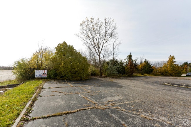
4405 W Pierson Rd
Flint, MI
E 175 FT OF NW 1/4 OF NW 1/4 EXCEPT N 350 FT SEC 33 T8N R6E 4.09 A (79)
14-33-100-007
GENESEE
Commercialacreage
Michigan
B and X Area of moderate flood hazard, usually the area between the limits of the 100-year and 500-year floods.
4.09 AC
2025
Flint
2025
Detroit
000900
NEARBY LISTINGS FOR SALE OR LEASE
DEMOGRAPHICS near 4405 W Pierson Rd
1 mile
3 mile
5 mile
2025 Total Population
1,584
37,635
105,026
2030 Population
1,590
37,699
105,944
Pop Growth 2025-2030
+ 0.38%
+ 0.17%
+ 0.87%
Average Age
42
41
41
2025 Total Households
743
15,456
43,477
HH Growth 2025-2030
0.00%
+ 0.17%
+ 0.88%
Median Household Inc
$47,500
$44,584
$47,020
Avg Household Size
2.10
2.30
2.30
2025 Avg HH Vehicles
2.00
2.00
1.00
Median Home Value
$131,106
$106,965
$99,541
Median Year Built
1981
1963
1961
Nearby Places
Map Layers
Map Styles
 Street
 Aerial
Layers
 Traffic
 Biking
Places
Listings with unknown addresses are not visible on the map
- Restaurants
- Banks
- Shops
- Fitness
- Groceries
PUBLIC TRANSPORTATION
AIRPORT
Bishop International
Drive
Walk
Distance
Bishop International
25 min
10.6 mi
SALE & LEASE HISTORY
LISTING DATE
SALE/LEASE

Nov 11, 2016
For Sale
May 24, 2021
For Sale
Nearby Properties
Address
Land Use
TOTAL SIZE
Lot Size
Zoning
Address
Land Use
TOTAL SIZE
Lot Size
Zoning
101,590 SF
5.54 AC
Address
Land Use
TOTAL SIZE
Lot Size
Zoning
571,389 SF
584 AC
Address
Land Use
TOTAL SIZE
Lot Size
Zoning
23,500 SF
4.96 AC
Address
Land Use
TOTAL SIZE
Lot Size
Zoning
290,502 SF
272.83 AC
Address
Land Use
TOTAL SIZE
Lot Size
Zoning
157,068 SF
160 AC
Address
Land Use
TOTAL SIZE
Lot Size
Zoning
11.97 AC
Address
Land Use
TOTAL SIZE
Lot Size
Zoning
10.30 AC
Address
Land Use
TOTAL SIZE
Lot Size
Zoning
41,298 SF
9.49 AC
Address
Land Use
TOTAL SIZE
Lot Size
Zoning
Address
Land Use
TOTAL SIZE
Lot Size
Zoning
59,173 SF
11.43 AC
Address
Land Use
TOTAL SIZE
Lot Size
Zoning
Address
Land Use
TOTAL SIZE
Lot Size
Zoning
224,263 SF
24.98 AC
CC
Address
Land Use
TOTAL SIZE
Lot Size
Zoning
11.12 AC
Address
Land Use
TOTAL SIZE
Lot Size
Zoning
101,744 SF
4.90 AC
TN-2
Address
Land Use
TOTAL SIZE
Lot Size
Zoning
33.39 AC
Address
Land Use
TOTAL SIZE
Lot Size
Zoning
13,296 SF
2.79 AC
Address
Land Use
TOTAL SIZE
Lot Size
Zoning
9.46 AC
Address
Land Use
TOTAL SIZE
Lot Size
Zoning
13.20 AC
Address
Land Use
TOTAL SIZE
Lot Size
Zoning
Address
Land Use
TOTAL SIZE
Lot Size
Zoning
2.45 AC
Address
Land Use
TOTAL SIZE
Lot Size
Zoning
5.10 AC
Address
Land Use
TOTAL SIZE
Lot Size
Zoning
62,121 SF
6.23 AC
B-2 CC GEN
Address
Land Use
TOTAL SIZE
Lot Size
Zoning
45,370 SF
12.58 AC
Address
Land Use
TOTAL SIZE
Lot Size
Zoning
104.81 AC
Address
Land Use
TOTAL SIZE
Lot Size
Zoning
Address
Land Use
TOTAL SIZE
Lot Size
Zoning
5.70 AC
Address
Land Use
TOTAL SIZE
Lot Size
Zoning
2.02 AC
Address
Land Use
TOTAL SIZE
Lot Size
Zoning
1.41 AC
Address
Land Use
TOTAL SIZE
Lot Size
Zoning
19.75 AC
Address
Land Use
TOTAL SIZE
Lot Size
Zoning
3.32 AC
The World's #1 Commercial Real Estate Marketplace
Connect with us
© 2026 CoStar Group
The information above has been obtained from sources believed reliable. While we do not doubt its accuracy we have not verified it and make no guarantee, warranty or representation about it. It is your responsibility to independently confirm its accuracy and completeness. Any projections, opinions, assumptions, or estimates used are for example only and do not represent the current or future performance of the property. The value of this transaction to you depends on tax and other factors which should be evaluated by your tax, financial, and legal advisors. You and your advisors should conduct a careful, independent investigation of the property to determine to your satisfaction the suitability of the property for your needs.