Property Record
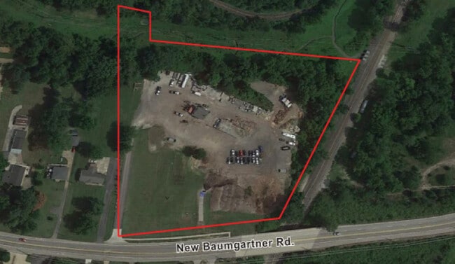
4409 Baumgartner Rd, Saint Louis, MO 63129

Property Detail
4409 Baumgartner Rd
32K-32-0112
SECTION 15-43-6 BDY ADJ (AKA BAUMGARTNER ROAD) PARCEL A & PARCEL PT B
Warehouse
Saint Louis
NU
Missouri
AE The base floodplain where base flood elevations are provided. AE Zones are now used on new format FIRMs instead of A1-A30 Zones.
7.22 AC
2024
South County
2025
St. Louis
220449
St. Louis, MO-IL
1,344 SF
NEARBY LISTINGS FOR SALE OR LEASE
DEMOGRAPHICS near 4409 Baumgartner Rd
1 mile
3 mile
5 mile
2025 Total Population
3,323
66,589
128,584
2030 Population
3,249
65,686
127,380
Pop Growth 2025-2030
(2.23%)
(1.36%)
(0.94%)
Average Age
44
44
44
2025 Total Households
1,242
27,619
53,829
HH Growth 2025-2030
(2.25%)
(1.37%)
(0.96%)
Median Household Inc
$131,731
$94,089
$85,502
Avg Household Size
2.60
2.40
2.30
2025 Avg HH Vehicles
2.00
2.00
2.00
Median Home Value
$297,735
$284,677
$271,833
Median Year Built
1980
1978
1976
Nearby Places
Map Layers
Map Styles
 Street
 Aerial
Layers
 Traffic
 Biking
Places
Listings with unknown addresses are not visible on the map
- Restaurants
- Banks
- Shops
- Fitness
- Groceries
PUBLIC TRANSPORTATION
AIRPORT
St Louis Lambert International
Drive
Walk
Distance
St Louis Lambert International
42 min
26.0 mi
Scott AFB/Midamerica St Louis
Drive
Walk
Distance
Scott AFB/Midamerica St Louis
57 min
39.3 mi
Freight Ports
Tulsa Port of Inola
Drive
Walk
Distance
Tulsa Port of Inola
421 min
380.1 mi
SALE & LEASE HISTORY
LISTING DATE
SALE/LEASE

Sep 17, 2021
For Sale
Sep 11, 2023
For Lease
Nov 07, 2022
For Sale
Nearby Properties
Address
Land Use
TOTAL SIZE
Lot Size
Zoning
Address
Land Use
TOTAL SIZE
Lot Size
Zoning
31.25 AC
R2
Address
Land Use
TOTAL SIZE
Lot Size
Zoning
225,758 SF
16.85 AC
R4
Address
Land Use
TOTAL SIZE
Lot Size
Zoning
140,783 SF
15.51 AC
C-8
Address
Land Use
TOTAL SIZE
Lot Size
Zoning
342,288 SF
19.97 AC
R7
Address
Land Use
TOTAL SIZE
Lot Size
Zoning
27.92 AC
R2
Address
Land Use
TOTAL SIZE
Lot Size
Zoning
53,714 SF
59.99 AC
FPNU
Address
Land Use
TOTAL SIZE
Lot Size
Zoning
26.62 AC
R3
Address
Land Use
TOTAL SIZE
Lot Size
Zoning
221,771 SF
25.15 AC
CT1
Address
Land Use
TOTAL SIZE
Lot Size
Zoning
237,114 SF
18.12 AC
M1
Address
Land Use
TOTAL SIZE
Lot Size
Zoning
900 SF
82.33 AC
NU
Address
Land Use
TOTAL SIZE
Lot Size
Zoning
163,144 SF
14.14 AC
C-8
Address
Land Use
TOTAL SIZE
Lot Size
Zoning
1,268 SF
19.85 AC
R2
Address
Land Use
TOTAL SIZE
Lot Size
Zoning
315,332 SF
53.99 AC
CT1
Address
Land Use
TOTAL SIZE
Lot Size
Zoning
143,076 SF
18.99 AC
C-8
Address
Land Use
TOTAL SIZE
Lot Size
Zoning
127,090 SF
11.28 AC
C-8
Address
Land Use
TOTAL SIZE
Lot Size
Zoning
188,205 SF
14.86 AC
R2
Address
Land Use
TOTAL SIZE
Lot Size
Zoning
205,040 SF
13.93 AC
M
Address
Land Use
TOTAL SIZE
Lot Size
Zoning
58,287 SF
18.90 AC
NU
Address
Land Use
TOTAL SIZE
Lot Size
Zoning
197.30 AC
PS
Address
Land Use
TOTAL SIZE
Lot Size
Zoning
183,528 SF
20.63 AC
R6A
Address
Land Use
TOTAL SIZE
Lot Size
Zoning
59,500 SF
17.78 AC
M
Address
Land Use
TOTAL SIZE
Lot Size
Zoning
36,724 SF
16.28 AC
C-8
Address
Land Use
TOTAL SIZE
Lot Size
Zoning
130,680 SF
9.99 AC
R7
Address
Land Use
TOTAL SIZE
Lot Size
Zoning
170,620 SF
8.62 AC
CT1
Address
Land Use
TOTAL SIZE
Lot Size
Zoning
8.89 AC
R3
Address
Land Use
TOTAL SIZE
Lot Size
Zoning
147,060 SF
7.42 AC
R6
Address
Land Use
TOTAL SIZE
Lot Size
Zoning
170,082 SF
5.49 AC
R6
Address
Land Use
TOTAL SIZE
Lot Size
Zoning
151,960 SF
10.88 AC
R2
Address
Land Use
TOTAL SIZE
Lot Size
Zoning
118,196 SF
13.33 AC
Address
Land Use
TOTAL SIZE
Lot Size
Zoning
13.03 AC
NU
The World's #1 Commercial Real Estate Marketplace
Connect with us
© 2026 CoStar Group
The information above has been obtained from sources believed reliable. While we do not doubt its accuracy we have not verified it and make no guarantee, warranty or representation about it. It is your responsibility to independently confirm its accuracy and completeness. Any projections, opinions, assumptions, or estimates used are for example only and do not represent the current or future performance of the property. The value of this transaction to you depends on tax and other factors which should be evaluated by your tax, financial, and legal advisors. You and your advisors should conduct a careful, independent investigation of the property to determine to your satisfaction the suitability of the property for your needs.