Property Record
441 N Central Ave, Oviedo, FL 32765

NEARBY LISTINGS FOR SALE OR LEASE
Property Detail
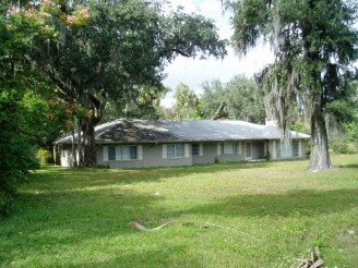
441 N Central Ave
Orlando-Kissimmee-Sanford, FL
Oak Ridge
10-21-31-503-0000-0160
LOTS 16 17 18 23 24 & 25 & PT VACD ALLEY S ADJ OAK RIDGE PB 3 PG 49
Officebuilding
Seminole
X
Florida
12117C0190F
16
2025
1.52 AC
2025
Casselberry
021313
Orlando
6,437 SF
DEMOGRAPHICS near 441 N Central Ave
1 Mile
3 Mile
5 Mile
2024 Total Population
7,639
44,544
113,829
2029 Population
7,851
46,111
117,943
Pop Growth 2024-2029
+ 2.78%
+ 3.52%
+ 3.61%
Average Age
39
40
39
2024 Total Households
2,655
15,987
40,521
HH Growth 2024-2029
+ 2.79%
+ 3.58%
+ 3.59%
Median Household Inc
$99,720
$91,629
$90,109
Avg Household Size
2.90
2.70
2.70
2024 Avg HH Vehicles
2.00
2.00
2.00
Median Home Value
$417,843
$374,680
$374,351
Median Year Built
1993
1993
1994
Nearby Places
Map Layers
Map Styles
 Street
 Aerial
- Restaurants
- Banks
- Shops
- Fitness
- Groceries
PUBLIC TRANSPORTATION
AIRPORT
Orlando Sanford International
DRIVE
WALK
Distance
Orlando Sanford International
17 min
10.4 mi
Orlando International
DRIVE
WALK
Distance
Orlando International
34 min
25.4 mi
Freight Ports
Port Canaveral
DRIVE
WALK
Distance
Port Canaveral
67 min
48.4 mi
Nearby Properties
Address
Land Use
TOTAL SIZE
Lot Size
Zoning
Address
Land Use
TOTAL SIZE
Lot Size
Zoning
581 SF
29.77 AC
Address
Land Use
TOTAL SIZE
Lot Size
Zoning
276,300 SF
3.34 AC
A1
Address
Land Use
TOTAL SIZE
Lot Size
Zoning
5,938 SF
9.14 AC
Address
Land Use
TOTAL SIZE
Lot Size
Zoning
183,886 SF
47.67 AC
A1
Address
Land Use
TOTAL SIZE
Lot Size
Zoning
9.23 AC
Address
Land Use
TOTAL SIZE
Lot Size
Zoning
98,868 SF
3.02 AC
Address
Land Use
TOTAL SIZE
Lot Size
Zoning
4,380 SF
20.01 AC
A1
Address
Land Use
TOTAL SIZE
Lot Size
Zoning
906 SF
15.85 AC
C1
Address
Land Use
TOTAL SIZE
Lot Size
Zoning
25,480 SF
23.86 AC
PUD
Address
Land Use
TOTAL SIZE
Lot Size
Zoning
412,265 SF
52.13 AC
PLI
Address
Land Use
TOTAL SIZE
Lot Size
Zoning
10,500 SF
21.76 AC
PUD
Address
Land Use
TOTAL SIZE
Lot Size
Zoning
193,990 SF
27.51 AC
C2
Address
Land Use
TOTAL SIZE
Lot Size
Zoning
158,927 SF
5.41 AC
MUDSF
Address
Land Use
TOTAL SIZE
Lot Size
Zoning
193,241 SF
25.77 AC
R3A
Address
Land Use
TOTAL SIZE
Lot Size
Zoning
144,594 SF
19.94 AC
R3A
Address
Land Use
TOTAL SIZE
Lot Size
Zoning
280,330 SF
14.77 AC
MUDNDD
Address
Land Use
TOTAL SIZE
Lot Size
Zoning
586,237 SF
43.13 AC
Address
Land Use
TOTAL SIZE
Lot Size
Zoning
121,389 SF
30.79 AC
A1
Address
Land Use
TOTAL SIZE
Lot Size
Zoning
4.07 AC
Address
Land Use
TOTAL SIZE
Lot Size
Zoning
77,228 SF
3.52 AC
PUD
Address
Land Use
TOTAL SIZE
Lot Size
Zoning
85,813 SF
11.62 AC
PUD
Address
Land Use
TOTAL SIZE
Lot Size
Zoning
54,582 SF
11.30 AC
Address
Land Use
TOTAL SIZE
Lot Size
Zoning
123,117 SF
21.68 AC
A1
Address
Land Use
TOTAL SIZE
Lot Size
Zoning
4,800 SF
8.27 AC
MUDCHR
Address
Land Use
TOTAL SIZE
Lot Size
Zoning
91,847 SF
12.03 AC
C2
Address
Land Use
TOTAL SIZE
Lot Size
Zoning
114,129 SF
12 AC
A1
Address
Land Use
TOTAL SIZE
Lot Size
Zoning
72,120 SF
7.67 AC
C2
Address
Land Use
TOTAL SIZE
Lot Size
Zoning
162,352 SF
12.49 AC
Address
Land Use
TOTAL SIZE
Lot Size
Zoning
17,170 SF
50.47 AC
PUD
Address
Land Use
TOTAL SIZE
Lot Size
Zoning
125,273 SF
12.25 AC
PUD
The World's #1 Commercial Real Estate Marketplace
Connect with us
© 2026 CoStar Group
The information above has been obtained from sources believed reliable. While we do not doubt its accuracy we have not verified it and make no guarantee, warranty or representation about it. It is your responsibility to independently confirm its accuracy and completeness. Any projections, opinions, assumptions, or estimates used are for example only and do not represent the current or future performance of the property. The value of this transaction to you depends on tax and other factors which should be evaluated by your tax, financial, and legal advisors. You and your advisors should conduct a careful, independent investigation of the property to determine to your satisfaction the suitability of the property for your needs.