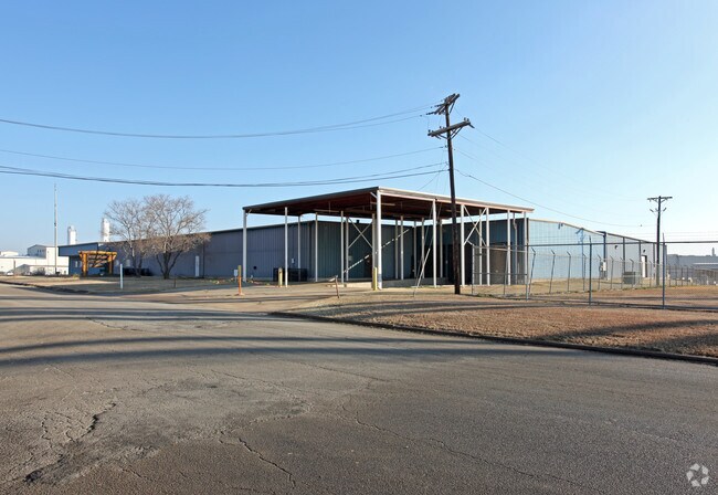
Property Record
4410 Ed Rutherford Rd, Greenville, TX 75402

Property Detail
4410 Ed Rutherford Rd
Dallas-Fort Worth-Arlington, TX
S2900 F & F METAL PRODUCTS ADDITION BLK 1 LOT 1 ACRES 3.005
23648
Hunt
Industrialgeneral
Texas
B and X Area of moderate flood hazard, usually the area between the limits of the 100-year and 500-year floods.
1
2025
3.01 AC
2025
Hunt County
961300
Dallas/Ft Worth
42,086 SF
NEARBY LISTINGS FOR SALE OR LEASE
DEMOGRAPHICS near 4410 Ed Rutherford Rd
1 mile
3 mile
5 mile
2025 Total Population
929
20,860
35,863
2030 Population
1,081
24,327
41,854
Pop Growth 2025-2030
+ 16.36%
+ 16.62%
+ 16.71%
Average Age
35
36
37
2025 Total Households
382
7,785
13,476
HH Growth 2025-2030
+ 16.49%
+ 16.88%
+ 17.02%
Median Household Inc
$48,833
$58,791
$66,695
Avg Household Size
2.40
2.60
2.60
2025 Avg HH Vehicles
1.00
2.00
2.00
Median Home Value
$191,428
$205,169
$233,570
Median Year Built
1985
1979
1983
Nearby Places
Map Layers
Map Styles
 Street
 Aerial
Layers
 Traffic
 Biking
Places
Listings with unknown addresses are not visible on the map
- Restaurants
- Banks
- Shops
- Fitness
- Groceries
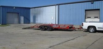
SALE & LEASE HISTORY
LISTING DATE
SALE/LEASE

Mar 21, 2019
For Sale
Mar 21, 2019
For Sale
Nearby Properties
Address
Land Use
TOTAL SIZE
Lot Size
Zoning
Address
Land Use
TOTAL SIZE
Lot Size
Zoning
243,495 SF
18.01 AC
Address
Land Use
TOTAL SIZE
Lot Size
Zoning
Address
Land Use
TOTAL SIZE
Lot Size
Zoning
333,000 SF
1.14 AC
Address
Land Use
TOTAL SIZE
Lot Size
Zoning
311,060 SF
92.32 AC
Address
Land Use
TOTAL SIZE
Lot Size
Zoning
351,598 SF
77.05 AC
Address
Land Use
TOTAL SIZE
Lot Size
Zoning
144,437 SF
4.96 AC
Address
Land Use
TOTAL SIZE
Lot Size
Zoning
144,327 SF
24.79 AC
Address
Land Use
TOTAL SIZE
Lot Size
Zoning
1,040,000 SF
93.75 AC
Address
Land Use
TOTAL SIZE
Lot Size
Zoning
346,383 SF
27.64 AC
C
Address
Land Use
TOTAL SIZE
Lot Size
Zoning
246,730 SF
21.80 AC
C
Address
Land Use
TOTAL SIZE
Lot Size
Zoning
278,577 SF
19.62 AC
Address
Land Use
TOTAL SIZE
Lot Size
Zoning
43,516 SF
108.86 AC
Address
Land Use
TOTAL SIZE
Lot Size
Zoning
81,021 SF
1.07 AC
Address
Land Use
TOTAL SIZE
Lot Size
Zoning
136,151 SF
6.50 AC
Address
Land Use
TOTAL SIZE
Lot Size
Zoning
155,301 SF
8.01 AC
C
Address
Land Use
TOTAL SIZE
Lot Size
Zoning
316,991 SF
49.61 AC
I
Address
Land Use
TOTAL SIZE
Lot Size
Zoning
284,091 SF
29.47 AC
I
Address
Land Use
TOTAL SIZE
Lot Size
Zoning
79,118 SF
9.70 AC
Address
Land Use
TOTAL SIZE
Lot Size
Zoning
119,765 SF
5.30 AC
2F
Address
Land Use
TOTAL SIZE
Lot Size
Zoning
135,300 SF
17.50 AC
Address
Land Use
TOTAL SIZE
Lot Size
Zoning
91,384 SF
14.61 AC
MF
Address
Land Use
TOTAL SIZE
Lot Size
Zoning
115,908 SF
12.80 AC
Address
Land Use
TOTAL SIZE
Lot Size
Zoning
46,858 SF
3.96 AC
Address
Land Use
TOTAL SIZE
Lot Size
Zoning
92,176 SF
5.26 AC
Address
Land Use
TOTAL SIZE
Lot Size
Zoning
99,850 SF
10.62 AC
Address
Land Use
TOTAL SIZE
Lot Size
Zoning
121,332 SF
5.70 AC
MF1
Address
Land Use
TOTAL SIZE
Lot Size
Zoning
109,264 SF
5.82 AC
Address
Land Use
TOTAL SIZE
Lot Size
Zoning
72,104 SF
5.55 AC
Address
Land Use
TOTAL SIZE
Lot Size
Zoning
44,000 SF
5.28 AC
Address
Land Use
TOTAL SIZE
Lot Size
Zoning
118,022 SF
11.38 AC
The World's #1 Commercial Real Estate Marketplace
Connect with us
© 2026 CoStar Group
The information above has been obtained from sources believed reliable. While we do not doubt its accuracy we have not verified it and make no guarantee, warranty or representation about it. It is your responsibility to independently confirm its accuracy and completeness. Any projections, opinions, assumptions, or estimates used are for example only and do not represent the current or future performance of the property. The value of this transaction to you depends on tax and other factors which should be evaluated by your tax, financial, and legal advisors. You and your advisors should conduct a careful, independent investigation of the property to determine to your satisfaction the suitability of the property for your needs.