Property Record
4417 Commons Dr E, Destin, FL 32541
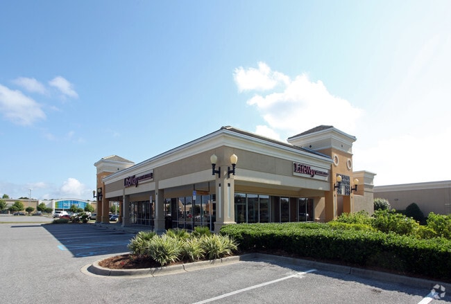

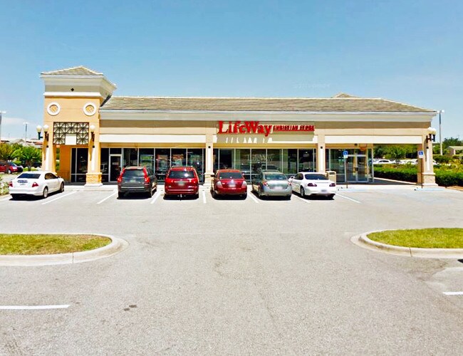
Property Detail
4417 Commons Dr E
Crestview-Fort Walton Beach-Destin, FL
BEG INT W R/W MIDBAY BRIDGE RD & N R/W US98 S79 DEG W713 FT N10 DEG W115 FT THC ALG CURVE E71 FT N3 DEG E28 FT THC ALG CURVE CONCAVE SW38 FT THC NWLY ALG CURVE 61 FT N77 DEG W 35 FT THC NWLY ALG CURVE 68 FT S24 DEG W5 FT N65 DEG W22 FT THC SWLY ALG C
00-2S-22-0000-0001-A17T
OKALOOSA
Regionalshoppingcenterormallwithanchorstore
Florida
B and X Area of moderate flood hazard, usually the area between the limits of the 100-year and 500-year floods.
a17t
2025
20.75 AC
2025
Fort Walton Beach
023304
Other Market Areas
223,790 SF
NEARBY LISTINGS FOR SALE OR LEASE
DEMOGRAPHICS near 4417 Commons Dr E
1 mile
3 mile
5 mile
2025 Total Population
3,003
20,072
36,755
2030 Population
3,394
22,580
41,480
Pop Growth 2025-2030
+ 13.02%
+ 12.50%
+ 12.86%
Average Age
47
46
47
2025 Total Households
1,406
9,239
16,897
HH Growth 2025-2030
+ 12.87%
+ 12.79%
+ 13.39%
Median Household Inc
$116,128
$97,672
$97,410
Avg Household Size
2.10
2.20
2.10
2025 Avg HH Vehicles
2.00
2.00
2.00
Median Home Value
$788,154
$687,475
$559,665
Median Year Built
2002
2000
1997
Nearby Places
Map Layers
Map Styles
 Street
 Aerial
Transit
 Traffic
 Biking
Places
Listings with unknown addresses are not visible on the map
- Restaurants
- Banks
- Shops
- Fitness
- Groceries
PUBLIC TRANSPORTATION
AIRPORT
Eglin AFB/Destin-Ft Walton Beach
Drive
Walk
Distance
Eglin AFB/Destin-Ft Walton Beach
45 min
17.8 mi
Freight Ports
Port of Panama City
Drive
Walk
Distance
Port of Panama City
71 min
46.6 mi
SALE & LEASE HISTORY
LISTING DATE
SALE/LEASE

Oct 09, 2019
For Lease
Nearby Properties
Address
Land Use
TOTAL SIZE
Lot Size
Zoning
Address
Land Use
TOTAL SIZE
Lot Size
Zoning
619,795 SF
47.80 AC
Address
Land Use
TOTAL SIZE
Lot Size
Zoning
110,181 SF
3.48 AC
Address
Land Use
TOTAL SIZE
Lot Size
Zoning
148,945 SF
12.83 AC
Address
Land Use
TOTAL SIZE
Lot Size
Zoning
125,459 SF
12.57 AC
Address
Land Use
TOTAL SIZE
Lot Size
Zoning
29,385 SF
211.96 AC
Address
Land Use
TOTAL SIZE
Lot Size
Zoning
135,360 SF
16 AC
Address
Land Use
TOTAL SIZE
Lot Size
Zoning
181,240 SF
11.20 AC
Address
Land Use
TOTAL SIZE
Lot Size
Zoning
5.19 AC
GULFFR
Address
Land Use
TOTAL SIZE
Lot Size
Zoning
19,401 SF
6.66 AC
Address
Land Use
TOTAL SIZE
Lot Size
Zoning
164,408 SF
7.98 AC
Address
Land Use
TOTAL SIZE
Lot Size
Zoning
53,437 SF
29.97 AC
Address
Land Use
TOTAL SIZE
Lot Size
Zoning
92.71 AC
Address
Land Use
TOTAL SIZE
Lot Size
Zoning
195,622 SF
17.68 AC
Address
Land Use
TOTAL SIZE
Lot Size
Zoning
124,578 SF
13.85 AC
Address
Land Use
TOTAL SIZE
Lot Size
Zoning
135,154 SF
15.22 AC
Address
Land Use
TOTAL SIZE
Lot Size
Zoning
56,375 SF
3.51 AC
Address
Land Use
TOTAL SIZE
Lot Size
Zoning
28,327 SF
1.45 AC
Address
Land Use
TOTAL SIZE
Lot Size
Zoning
66,001 SF
1.25 AC
HWY 98
Address
Land Use
TOTAL SIZE
Lot Size
Zoning
113,053 SF
7.25 AC
Address
Land Use
TOTAL SIZE
Lot Size
Zoning
36,890 SF
2.23 AC
Address
Land Use
TOTAL SIZE
Lot Size
Zoning
231,112 SF
23.03 AC
Address
Land Use
TOTAL SIZE
Lot Size
Zoning
6,630 SF
25.69 AC
Address
Land Use
TOTAL SIZE
Lot Size
Zoning
49,123 SF
2.36 AC
Address
Land Use
TOTAL SIZE
Lot Size
Zoning
201,131 SF
11.29 AC
Address
Land Use
TOTAL SIZE
Lot Size
Zoning
154,725 SF
15.69 AC
Address
Land Use
TOTAL SIZE
Lot Size
Zoning
33,420 SF
2.56 AC
Address
Land Use
TOTAL SIZE
Lot Size
Zoning
56,505 SF
2.34 AC
Address
Land Use
TOTAL SIZE
Lot Size
Zoning
1,768 SF
7.20 AC
Address
Land Use
TOTAL SIZE
Lot Size
Zoning
74,803 SF
6.97 AC
The World's #1 Commercial Real Estate Marketplace
Connect with us
© 2026 CoStar Group
The information above has been obtained from sources believed reliable. While we do not doubt its accuracy we have not verified it and make no guarantee, warranty or representation about it. It is your responsibility to independently confirm its accuracy and completeness. Any projections, opinions, assumptions, or estimates used are for example only and do not represent the current or future performance of the property. The value of this transaction to you depends on tax and other factors which should be evaluated by your tax, financial, and legal advisors. You and your advisors should conduct a careful, independent investigation of the property to determine to your satisfaction the suitability of the property for your needs.