Property Record
442 Corinth Rd, Queensbury, NY 12804
NEARBY LISTINGS FOR SALE OR LEASE
-
-
View all Queensbury listings for sale on LoopNet.com
Property Detail
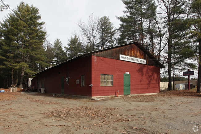
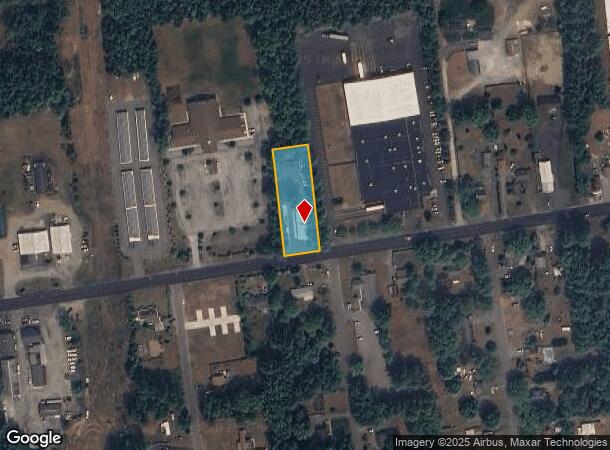
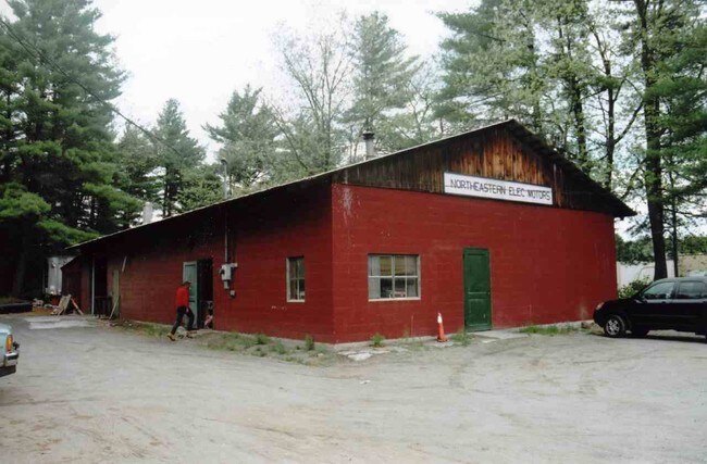
442 Corinth Rd
Glens Falls, NY
NORTHEASTERN ELECTRICAL M 100'RF 126.-1-41.2
523400-308-015-0001-039-000-0000
Warren
Warehouse
New York
2025
39.000
2024
0.69 AC
070802
Warren County
3,200 SF
Albany/Schenectady/Troy
DEMOGRAPHICS near 442 Corinth Rd
1 Mile
3 Mile
5 Mile
2024 Total Population
3,785
25,887
51,681
2029 Population
3,727
25,670
51,628
Pop Growth 2024-2029
(1.53%)
(0.84%)
(0.10%)
Average Age
42
43
43
2024 Total Households
1,416
10,771
22,312
HH Growth 2024-2029
(1.62%)
(0.96%)
(0.20%)
Median Household Inc
$94,367
$86,795
$78,133
Avg Household Size
2.60
2.40
2.30
2024 Avg HH Vehicles
2.00
2.00
2.00
Median Home Value
$261,071
$232,470
$224,518
Median Year Built
1987
1981
1976
Nearby Places
- Restaurants
- Banks
- Shops
- Fitness
- Groceries
Nearby Properties
Address
Land Use
TOTAL SIZE
Lot Size
Zoning
Address
Land Use
TOTAL SIZE
Lot Size
Zoning
40.23 AC
RP
Address
Land Use
TOTAL SIZE
Lot Size
Zoning
115.90 AC
WR
Address
Land Use
TOTAL SIZE
Lot Size
Zoning
154,236 SF
104.60 AC
RR-3A
Address
Land Use
TOTAL SIZE
Lot Size
Zoning
Address
Land Use
TOTAL SIZE
Lot Size
Zoning
191,130 SF
20.09 AC
R-1A
Address
Land Use
TOTAL SIZE
Lot Size
Zoning
Address
Land Use
TOTAL SIZE
Lot Size
Zoning
1,110 SF
89.24 AC
R4
Address
Land Use
TOTAL SIZE
Lot Size
Zoning
792 SF
48.99 AC
MDR
Address
Land Use
TOTAL SIZE
Lot Size
Zoning
144,029 SF
28.34 AC
R1
Address
Land Use
TOTAL SIZE
Lot Size
Zoning
31,456 SF
15.49 AC
MDR
Address
Land Use
TOTAL SIZE
Lot Size
Zoning
Address
Land Use
TOTAL SIZE
Lot Size
Zoning
215,447 SF
17.74 AC
CI
Address
Land Use
TOTAL SIZE
Lot Size
Zoning
130,142 SF
20.71 AC
CI
Address
Land Use
TOTAL SIZE
Lot Size
Zoning
1,600 SF
42.56 AC
SPLIT
Address
Land Use
TOTAL SIZE
Lot Size
Zoning
Address
Land Use
TOTAL SIZE
Lot Size
Zoning
16.20 AC
R1
Address
Land Use
TOTAL SIZE
Lot Size
Zoning
37,514 SF
4.88 AC
PRD
Address
Land Use
TOTAL SIZE
Lot Size
Zoning
71,996 SF
40.15 AC
RR-3A
Address
Land Use
TOTAL SIZE
Lot Size
Zoning
76,451 SF
23.20 AC
R2
Address
Land Use
TOTAL SIZE
Lot Size
Zoning
128,398 SF
12.23 AC
CI
Address
Land Use
TOTAL SIZE
Lot Size
Zoning
64,654 SF
4.03 AC
GC1
Address
Land Use
TOTAL SIZE
Lot Size
Zoning
87,388 SF
18.79 AC
CI
Address
Land Use
TOTAL SIZE
Lot Size
Zoning
60,597 SF
2.50 AC
ESC
Address
Land Use
TOTAL SIZE
Lot Size
Zoning
2,200 SF
23.19 AC
NR
Address
Land Use
TOTAL SIZE
Lot Size
Zoning
55,069 SF
6.76 AC
CI-18
Address
Land Use
TOTAL SIZE
Lot Size
Zoning
127,890 SF
4.36 AC
R-M
Address
Land Use
TOTAL SIZE
Lot Size
Zoning
11,068 SF
6.90 AC
CLI
Address
Land Use
TOTAL SIZE
Lot Size
Zoning
94,992 SF
10.62 AC
CI
Address
Land Use
TOTAL SIZE
Lot Size
Zoning
302,484 SF
4.49 AC
GC1
Address
Land Use
TOTAL SIZE
Lot Size
Zoning
48,840 SF
9.34 AC
R-M
The World's #1 Commercial Real Estate Marketplace
Connect with us
© 2025 CoStar Group
The information above has been obtained from sources believed reliable. While we do not doubt its accuracy we have not verified it and make no guarantee, warranty or representation about it. It is your responsibility to independently confirm its accuracy and completeness. Any projections, opinions, assumptions, or estimates used are for example only and do not represent the current or future performance of the property. The value of this transaction to you depends on tax and other factors which should be evaluated by your tax, financial, and legal advisors. You and your advisors should conduct a careful, independent investigation of the property to determine to your satisfaction the suitability of the property for your needs.