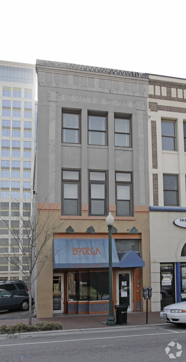
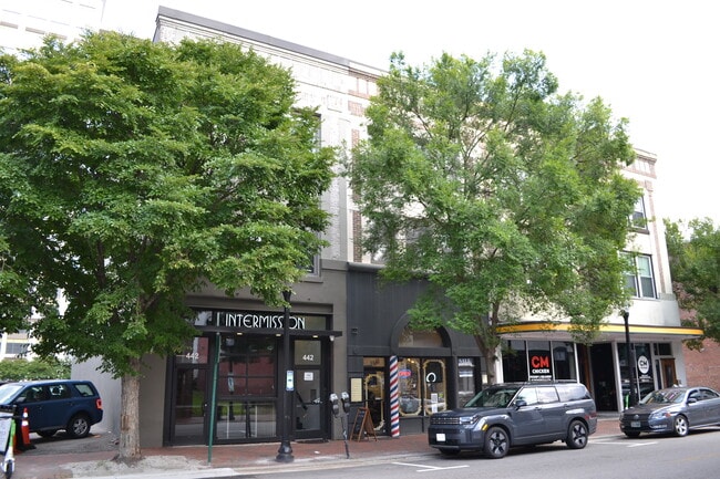
Property Record
442 Granby St, Norfolk, VA 23510
Current Lease Availabilities
NEARBY LISTINGS FOR SALE OR LEASE
Property Detail
442 Granby St
09120800
20.8 FT
Commercialofficeresidentialmixeduse
Norfolk City
X
Virginia
5101040056H
0.05 AC
2025
Downtown Norfolk
2025
Hampton Roads
004900
Virginia Beach-Norfolk-Newport News, VA-NC
6,150 SF
DEMOGRAPHICS near 442 Granby St
1 Mile
3 Mile
5 Mile
2024 Total Population
17,050
114,976
259,360
2029 Population
16,818
114,189
257,536
Pop Growth 2024-2029
(1.36%)
(0.68%)
(0.70%)
Average Age
37
36
37
2024 Total Households
9,034
46,998
105,142
HH Growth 2024-2029
(1.70%)
(1.06%)
(1.00%)
Median Household Inc
$62,197
$49,815
$56,200
Avg Household Size
1.80
2.20
2.30
2024 Avg HH Vehicles
1.00
1.00
2.00
Median Home Value
$391,973
$231,322
$227,077
Median Year Built
1974
1963
1965
Nearby Places
- Restaurants
- Banks
- Shops
- Fitness
- Groceries
PUBLIC TRANSPORTATION
TRANSIT/SUBWAY
Monticello (Tide Light Rail - Hampton Roads Transit (HRT))
DRIVE
WALK
Distance
Monticello (Tide Light Rail - Hampton Roads Transit (HRT))
1 min
3 min
0.1 mi
York Street / Freemason (Tide Light Rail - Hampton Roads Transit (HRT))
DRIVE
WALK
Distance
York Street / Freemason (Tide Light Rail - Hampton Roads Transit (HRT))
2 min
7 min
0.4 mi
MacArthur Square (Tide Light Rail - Hampton Roads Transit (HRT))
DRIVE
WALK
Distance
MacArthur Square (Tide Light Rail - Hampton Roads Transit (HRT))
2 min
8 min
0.4 mi
Civic Plaza (Tide Light Rail - Hampton Roads Transit (HRT))
DRIVE
WALK
Distance
Civic Plaza (Tide Light Rail - Hampton Roads Transit (HRT))
3 min
13 min
0.7 mi
COMMUTER RAIL
DRIVE
WALK
Distance
4 min
1.4 mi
AIRPORT
Norfolk International
DRIVE
WALK
Distance
Norfolk International
14 min
6.9 mi
Newport News/Williamsburg International
DRIVE
WALK
Distance
Newport News/Williamsburg International
45 min
28.2 mi
Freight Ports
Virginia Port Authority - Portsmouth
DRIVE
WALK
Distance
Virginia Port Authority - Portsmouth
13 min
4.3 mi
Nearby Properties
Address
Land Use
TOTAL SIZE
Lot Size
Zoning
Address
Land Use
TOTAL SIZE
Lot Size
Zoning
331,760 SF
24.97 AC
Address
Land Use
TOTAL SIZE
Lot Size
Zoning
5,704 SF
4.67 AC
D2
Address
Land Use
TOTAL SIZE
Lot Size
Zoning
85,756 SF
3.59 AC
D5
Address
Land Use
TOTAL SIZE
Lot Size
Zoning
421,540 SF
2.37 AC
Address
Land Use
TOTAL SIZE
Lot Size
Zoning
192,422 SF
10.70 AC
D4
Address
Land Use
TOTAL SIZE
Lot Size
Zoning
250,766 SF
31.14 AC
NMU
Address
Land Use
TOTAL SIZE
Lot Size
Zoning
390,960 SF
4.43 AC
Address
Land Use
TOTAL SIZE
Lot Size
Zoning
73,136 SF
5.34 AC
IN2
Address
Land Use
TOTAL SIZE
Lot Size
Zoning
55.11 AC
IN2
Address
Land Use
TOTAL SIZE
Lot Size
Zoning
92.17 AC
OSP
Address
Land Use
TOTAL SIZE
Lot Size
Zoning
421,856 SF
2.64 AC
D1
Address
Land Use
TOTAL SIZE
Lot Size
Zoning
971,654 SF
6.01 AC
D2
Address
Land Use
TOTAL SIZE
Lot Size
Zoning
310,912 SF
3.94 AC
Address
Land Use
TOTAL SIZE
Lot Size
Zoning
689,954 SF
63.25 AC
Address
Land Use
TOTAL SIZE
Lot Size
Zoning
473,072 SF
9.72 AC
SD
Address
Land Use
TOTAL SIZE
Lot Size
Zoning
68,643 SF
24.68 AC
Address
Land Use
TOTAL SIZE
Lot Size
Zoning
192,270 SF
1.99 AC
D2
Address
Land Use
TOTAL SIZE
Lot Size
Zoning
126,088 SF
4.91 AC
C2
Address
Land Use
TOTAL SIZE
Lot Size
Zoning
363,974 SF
1.49 AC
Address
Land Use
TOTAL SIZE
Lot Size
Zoning
66,718 SF
4.09 AC
D5
Address
Land Use
TOTAL SIZE
Lot Size
Zoning
4.92 AC
IN1
Address
Land Use
TOTAL SIZE
Lot Size
Zoning
356,598 SF
1.84 AC
D2
Address
Land Use
TOTAL SIZE
Lot Size
Zoning
50,384 SF
0.74 AC
Address
Land Use
TOTAL SIZE
Lot Size
Zoning
291,748 SF
3.40 AC
G1
Address
Land Use
TOTAL SIZE
Lot Size
Zoning
91,982 SF
22.78 AC
IN1
Address
Land Use
TOTAL SIZE
Lot Size
Zoning
79,577 SF
3.04 AC
C2
Address
Land Use
TOTAL SIZE
Lot Size
Zoning
35,091 SF
0.71 AC
Address
Land Use
TOTAL SIZE
Lot Size
Zoning
197,074 SF
6.69 AC
Address
Land Use
TOTAL SIZE
Lot Size
Zoning
640,920 SF
3.67 AC
HCEF
Address
Land Use
TOTAL SIZE
Lot Size
Zoning
188,152 SF
16.93 AC
The World's #1 Commercial Real Estate Marketplace
Connect with us
© 2025 CoStar Group
The information above has been obtained from sources believed reliable. While we do not doubt its accuracy we have not verified it and make no guarantee, warranty or representation about it. It is your responsibility to independently confirm its accuracy and completeness. Any projections, opinions, assumptions, or estimates used are for example only and do not represent the current or future performance of the property. The value of this transaction to you depends on tax and other factors which should be evaluated by your tax, financial, and legal advisors. You and your advisors should conduct a careful, independent investigation of the property to determine to your satisfaction the suitability of the property for your needs.