Property Record
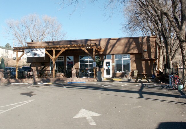
442 High St, Lyons, CO 80540


Property Detail
442 High St
Boulder, CO
W 37.5 FT LOT 7 & LOT 8 BLK 30 LYONS
1203184-06-016
BOULDER
Restaurantbuilding
Colorado
C and X Area of minimal flood hazard, usually depicted on FIRMs as above the 500-year flood level.
7
2025
0.30 AC
2026
Longmont
013601
Denver
2,793 SF
NEARBY LISTINGS FOR SALE OR LEASE
DEMOGRAPHICS near 442 High St
1 mile
3 mile
5 mile
2025 Total Population
1,612
2,370
3,221
2030 Population
1,494
2,211
3,070
Pop Growth 2025-2030
(7.32%)
(6.71%)
(4.69%)
Average Age
45
46
46
2025 Total Households
665
968
1,325
HH Growth 2025-2030
(7.52%)
(6.82%)
(4.68%)
Median Household Inc
$121,461
$122,618
$125,538
Avg Household Size
2.40
2.40
2.40
2025 Avg HH Vehicles
2.00
2.00
2.00
Median Home Value
$894,821
$909,817
$908,812
Median Year Built
1991
1992
1991
Nearby Places
Map Layers
Map Styles
 Street
 Aerial
Layers
 Traffic
 Biking
Places
Listings with unknown addresses are not visible on the map
- Restaurants
- Banks
- Shops
- Fitness
- Groceries
SALE & LEASE HISTORY
LISTING DATE
SALE/LEASE

Jan 27, 2022
For Sale
Nearby Properties
Address
Land Use
TOTAL SIZE
Lot Size
Zoning
Address
Land Use
TOTAL SIZE
Lot Size
Zoning
580.83 AC
F
Address
Land Use
TOTAL SIZE
Lot Size
Zoning
160.63 AC
A
Address
Land Use
TOTAL SIZE
Lot Size
Zoning
2,660 SF
40.23 AC
A
Address
Land Use
TOTAL SIZE
Lot Size
Zoning
86.98 AC
A
Address
Land Use
TOTAL SIZE
Lot Size
Zoning
122.09 AC
A
Address
Land Use
TOTAL SIZE
Lot Size
Zoning
284.27 AC
A
Address
Land Use
TOTAL SIZE
Lot Size
Zoning
36.08 AC
A
Address
Land Use
TOTAL SIZE
Lot Size
Zoning
435.06 AC
A
Address
Land Use
TOTAL SIZE
Lot Size
Zoning
372.98 AC
F
Address
Land Use
TOTAL SIZE
Lot Size
Zoning
83.04 AC
F
Address
Land Use
TOTAL SIZE
Lot Size
Zoning
Address
Land Use
TOTAL SIZE
Lot Size
Zoning
44.48 AC
F
Address
Land Use
TOTAL SIZE
Lot Size
Zoning
69.85 AC
A
Address
Land Use
TOTAL SIZE
Lot Size
Zoning
34.68 AC
A
Address
Land Use
TOTAL SIZE
Lot Size
Zoning
235.51 AC
F
Address
Land Use
TOTAL SIZE
Lot Size
Zoning
222.67 AC
A
Address
Land Use
TOTAL SIZE
Lot Size
Zoning
115.74 AC
A
Address
Land Use
TOTAL SIZE
Lot Size
Zoning
201.25 AC
A
Address
Land Use
TOTAL SIZE
Lot Size
Zoning
179.14 AC
A
Address
Land Use
TOTAL SIZE
Lot Size
Zoning
180.63 AC
A
Address
Land Use
TOTAL SIZE
Lot Size
Zoning
208 AC
A
Address
Land Use
TOTAL SIZE
Lot Size
Zoning
165.22 AC
A
Address
Land Use
TOTAL SIZE
Lot Size
Zoning
147.54 AC
F
Address
Land Use
TOTAL SIZE
Lot Size
Zoning
1,456 SF
157.13 AC
A
Address
Land Use
TOTAL SIZE
Lot Size
Zoning
15.62 AC
A
Address
Land Use
TOTAL SIZE
Lot Size
Zoning
29.06 AC
A
Address
Land Use
TOTAL SIZE
Lot Size
Zoning
14.04 AC
A
Address
Land Use
TOTAL SIZE
Lot Size
Zoning
13.29 AC
A
Address
Land Use
TOTAL SIZE
Lot Size
Zoning
20.02 AC
F
Address
Land Use
TOTAL SIZE
Lot Size
Zoning
11.52 AC
The World's #1 Commercial Real Estate Marketplace
Connect with us
© 2026 CoStar Group
The information above has been obtained from sources believed reliable. While we do not doubt its accuracy we have not verified it and make no guarantee, warranty or representation about it. It is your responsibility to independently confirm its accuracy and completeness. Any projections, opinions, assumptions, or estimates used are for example only and do not represent the current or future performance of the property. The value of this transaction to you depends on tax and other factors which should be evaluated by your tax, financial, and legal advisors. You and your advisors should conduct a careful, independent investigation of the property to determine to your satisfaction the suitability of the property for your needs.