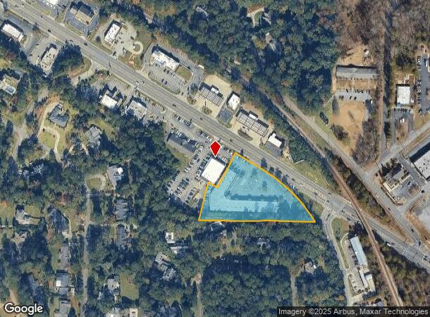
Property Record
4420 Forsyth Rd, Macon, GA 31210

NEARBY LISTINGS FOR SALE OR LEASE
Property Detail
4420 Forsyth Rd
M062-0056
Survey For Eagle West Llc
Stripcommercialcenter
Bibb
X
Georgia
13021C0127G
333
2025
2.33 AC
2025
Suburban Macon
012101
Atlanta
24,521 SF
Macon-Bibb County, GA
DEMOGRAPHICS near 4420 Forsyth Rd
1 mile
3 mile
5 mile
2024 Total Population
4,631
37,917
94,080
2029 Population
4,538
37,227
93,149
Pop Growth 2024-2029
(2.01%)
(1.82%)
(0.99%)
Average Age
38
39
38
2024 Total Households
1,975
16,023
39,231
HH Growth 2024-2029
(1.97%)
(1.87%)
(0.92%)
Median Household Inc
$70,334
$58,253
$49,539
Avg Household Size
2.30
2.30
2.30
2024 Avg HH Vehicles
2.00
2.00
2.00
Median Home Value
$246,721
$167,845
$162,524
Median Year Built
1978
1972
1976
Nearby Places
Map Layers
Map Styles
 Street
 Aerial
Transit
 Traffic
 Biking
Places
Listings with unknown addresses are not visible on the map
- Restaurants
- Banks
- Shops
- Fitness
- Groceries
SALE & LEASE HISTORY
LISTING DATE
SALE/LEASE

Sep 25, 2016
For Lease
Oct 29, 2018
For Lease
Jul 06, 2024
For Lease
Jan 31, 2018
For Sale
Nearby Properties
Address
Land Use
TOTAL SIZE
Lot Size
Zoning
Address
Land Use
TOTAL SIZE
Lot Size
Zoning
Address
Land Use
TOTAL SIZE
Lot Size
Zoning
3,005 SF
195.02 AC
R-1AAA
Address
Land Use
TOTAL SIZE
Lot Size
Zoning
2,114 SF
48.22 AC
PDR
Address
Land Use
TOTAL SIZE
Lot Size
Zoning
196,702 SF
37.72 AC
PDE
Address
Land Use
TOTAL SIZE
Lot Size
Zoning
194,734 SF
6.37 AC
C-2
Address
Land Use
TOTAL SIZE
Lot Size
Zoning
71,021 SF
8.94 AC
PDC
Address
Land Use
TOTAL SIZE
Lot Size
Zoning
231,774 SF
21.27 AC
R-1AAA
Address
Land Use
TOTAL SIZE
Lot Size
Zoning
51,786 SF
21.05 AC
PDR
Address
Land Use
TOTAL SIZE
Lot Size
Zoning
1,039 SF
14.79 AC
PDR
Address
Land Use
TOTAL SIZE
Lot Size
Zoning
86,912 SF
5.39 AC
PDE
Address
Land Use
TOTAL SIZE
Lot Size
Zoning
1,452 SF
12.16 AC
R-3
Address
Land Use
TOTAL SIZE
Lot Size
Zoning
6,720 SF
16.69 AC
PDR
Address
Land Use
TOTAL SIZE
Lot Size
Zoning
4,030 SF
11.99 AC
A
Address
Land Use
TOTAL SIZE
Lot Size
Zoning
85,556 SF
10.50 AC
R-1A
Address
Land Use
TOTAL SIZE
Lot Size
Zoning
2,366 SF
14.46 AC
PDE
Address
Land Use
TOTAL SIZE
Lot Size
Zoning
3,268 SF
9.29 AC
R-3
Address
Land Use
TOTAL SIZE
Lot Size
Zoning
40,560 SF
19.20 AC
R-2
Address
Land Use
TOTAL SIZE
Lot Size
Zoning
110,745 SF
4.99 AC
PDE
Address
Land Use
TOTAL SIZE
Lot Size
Zoning
143,280 SF
5.06 AC
HR-3
Address
Land Use
TOTAL SIZE
Lot Size
Zoning
63,654 SF
14.67 AC
C-2
Address
Land Use
TOTAL SIZE
Lot Size
Zoning
23,520 SF
12.78 AC
R-3
Address
Land Use
TOTAL SIZE
Lot Size
Zoning
3,600 SF
24.71 AC
R-1AAA
Address
Land Use
TOTAL SIZE
Lot Size
Zoning
2,816 SF
12.46 AC
R-2
Address
Land Use
TOTAL SIZE
Lot Size
Zoning
16,320 SF
8.60 AC
R-3
Address
Land Use
TOTAL SIZE
Lot Size
Zoning
48,524 SF
1.80 AC
C-2
Address
Land Use
TOTAL SIZE
Lot Size
Zoning
50,918 SF
2 AC
C-2
Address
Land Use
TOTAL SIZE
Lot Size
Zoning
117,083 SF
8.32 AC
PDR
Address
Land Use
TOTAL SIZE
Lot Size
Zoning
20,572 SF
16.08 AC
R-3
Address
Land Use
TOTAL SIZE
Lot Size
Zoning
16,180 SF
9.52 AC
C-1
Address
Land Use
TOTAL SIZE
Lot Size
Zoning
76,578 SF
13.60 AC
R-1AAA
The World's #1 Commercial Real Estate Marketplace
Connect with us
© 2026 CoStar Group
The information above has been obtained from sources believed reliable. While we do not doubt its accuracy we have not verified it and make no guarantee, warranty or representation about it. It is your responsibility to independently confirm its accuracy and completeness. Any projections, opinions, assumptions, or estimates used are for example only and do not represent the current or future performance of the property. The value of this transaction to you depends on tax and other factors which should be evaluated by your tax, financial, and legal advisors. You and your advisors should conduct a careful, independent investigation of the property to determine to your satisfaction the suitability of the property for your needs.