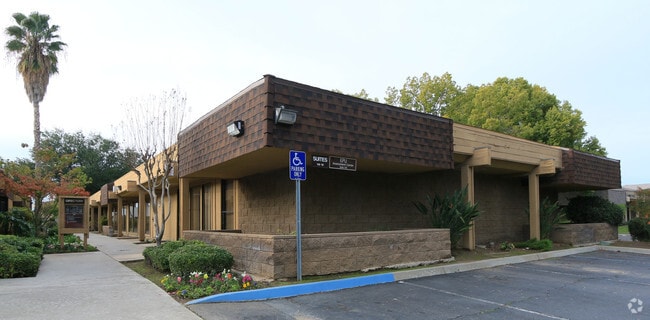
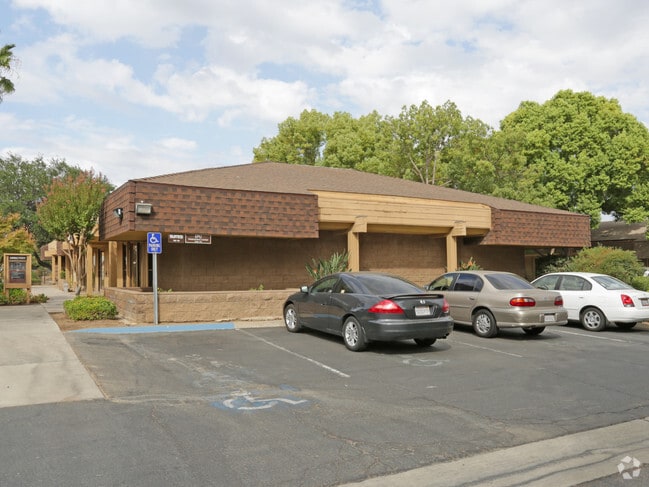
Property Record
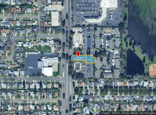
4420 N 1St St, Fresno, CA 93726

Current Lease Availabilities
NEARBY LISTINGS FOR SALE OR LEASE
Property Detail
4420 N 1St St
428-050-11
PAR A P/M 78-76 BK 32 PG 76
Officebuilding
Fresno
X
California
06019C1570H
0.48 AC
2025
Shaw
2025
Fresno
005301
Fresno, CA
5,208 SF
DEMOGRAPHICS near 4420 N 1St St
1 Mile
3 Mile
5 Mile
2024 Total Population
21,949
164,188
421,014
2029 Population
22,345
167,502
429,229
Pop Growth 2024-2029
+ 1.80%
+ 2.02%
+ 1.95%
Average Age
35
35
36
2024 Total Households
7,283
57,471
145,535
HH Growth 2024-2029
+ 1.78%
+ 2.04%
+ 1.98%
Median Household Inc
$55,573
$51,505
$55,747
Avg Household Size
2.90
2.70
2.80
2024 Avg HH Vehicles
2.00
2.00
2.00
Median Home Value
$243,436
$274,668
$295,198
Median Year Built
1962
1966
1972
Nearby Places
- Restaurants
- Banks
- Shops
- Fitness
- Groceries
PUBLIC TRANSPORTATION
COMMUTER RAIL
DRIVE
WALK
Distance
9 min
5.7 mi
AIRPORT
Fresno Yosemite International
DRIVE
WALK
Distance
Fresno Yosemite International
10 min
5.2 mi
Nearby Properties
Address
Land Use
TOTAL SIZE
Lot Size
Zoning
Address
Land Use
TOTAL SIZE
Lot Size
Zoning
574,093 SF
25.54 AC
C3
Address
Land Use
TOTAL SIZE
Lot Size
Zoning
39,888 SF
23.72 AC
C3
Address
Land Use
TOTAL SIZE
Lot Size
Zoning
451,977 SF
24.16 AC
SPLIT
Address
Land Use
TOTAL SIZE
Lot Size
Zoning
693,292 SF
29.86 AC
CP
Address
Land Use
TOTAL SIZE
Lot Size
Zoning
81,545 SF
3.18 AC
CP
Address
Land Use
TOTAL SIZE
Lot Size
Zoning
241,133 SF
13.61 AC
R3
Address
Land Use
TOTAL SIZE
Lot Size
Zoning
121,491 SF
4.52 AC
R3
Address
Land Use
TOTAL SIZE
Lot Size
Zoning
208,444 SF
11.75 AC
R3
Address
Land Use
TOTAL SIZE
Lot Size
Zoning
157,702 SF
4.61 AC
R2A
Address
Land Use
TOTAL SIZE
Lot Size
Zoning
110,456 SF
6.56 AC
RMX
Address
Land Use
TOTAL SIZE
Lot Size
Zoning
126,346 SF
5.49 AC
CP
Address
Land Use
TOTAL SIZE
Lot Size
Zoning
126,346 SF
5.31 AC
CP
Address
Land Use
TOTAL SIZE
Lot Size
Zoning
141,477 SF
5.45 AC
R4
Address
Land Use
TOTAL SIZE
Lot Size
Zoning
218,838 SF
19.06 AC
R2
Address
Land Use
TOTAL SIZE
Lot Size
Zoning
69,399 SF
7.31 AC
CP
Address
Land Use
TOTAL SIZE
Lot Size
Zoning
66,997 SF
2.84 AC
CP
Address
Land Use
TOTAL SIZE
Lot Size
Zoning
669,447 SF
0.01 AC
C3
Address
Land Use
TOTAL SIZE
Lot Size
Zoning
250,412 SF
16.09 AC
RM3
Address
Land Use
TOTAL SIZE
Lot Size
Zoning
87,767 SF
4.40 AC
CP
Address
Land Use
TOTAL SIZE
Lot Size
Zoning
152,392 SF
14.95 AC
C6
Address
Land Use
TOTAL SIZE
Lot Size
Zoning
70,168 SF
4.97 AC
R3
Address
Land Use
TOTAL SIZE
Lot Size
Zoning
179,240 SF
12 AC
C3
Address
Land Use
TOTAL SIZE
Lot Size
Zoning
203,687 SF
10.63 AC
R3
Address
Land Use
TOTAL SIZE
Lot Size
Zoning
69,853 SF
7.13 AC
CP
Address
Land Use
TOTAL SIZE
Lot Size
Zoning
245,178 SF
17.13 AC
R2
Address
Land Use
TOTAL SIZE
Lot Size
Zoning
75,461 SF
3.74 AC
CP
Address
Land Use
TOTAL SIZE
Lot Size
Zoning
121,250 SF
9.51 AC
R3
Address
Land Use
TOTAL SIZE
Lot Size
Zoning
67,394 SF
2.41 AC
C2
Address
Land Use
TOTAL SIZE
Lot Size
Zoning
80,771 SF
7.47 AC
C2
Address
Land Use
TOTAL SIZE
Lot Size
Zoning
216,459 SF
16.28 AC
SPLIT
The World's #1 Commercial Real Estate Marketplace
Connect with us
© 2025 CoStar Group
The information above has been obtained from sources believed reliable. While we do not doubt its accuracy we have not verified it and make no guarantee, warranty or representation about it. It is your responsibility to independently confirm its accuracy and completeness. Any projections, opinions, assumptions, or estimates used are for example only and do not represent the current or future performance of the property. The value of this transaction to you depends on tax and other factors which should be evaluated by your tax, financial, and legal advisors. You and your advisors should conduct a careful, independent investigation of the property to determine to your satisfaction the suitability of the property for your needs.