Property Record
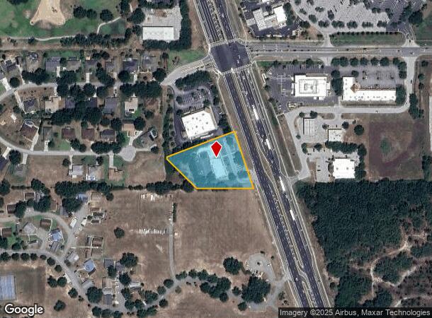
4420 S Us Highway 27, Clermont, FL 34711


NEARBY LISTINGS FOR SALE OR LEASE
Property Detail
4420 S Us Highway 27
Orlando-Kissimmee-Sanford, FL
Second Addition To Vista Subdivision
09-23-26-0003-000-01300
FROM NW COR OF SW 1/4 RUN N 88DEG 16MIN 08SEC E 1168.60 FT TO A POINT THAT IS 216.11 FT WLY OF SWLY R/W LINE OF US HWY 27 RUN S 01DEG 43MIN 52SEC E 118.38 FT THENCE FROM A TANGENT BEARING OF N 62DEG 00MIN 46SEC E RUN NLY ALONG THE ARC OF A CURVE SAID
Stripcommercialcenter
Lake
X
Florida
12069C0675E
13
2024
1.65 AC
2026
Lake County
031316
Orlando
9,657 SF
DEMOGRAPHICS near 4420 S Us Highway 27
1 Mile
3 Mile
5 Mile
2024 Total Population
6,159
35,540
74,195
2029 Population
7,197
41,479
86,359
Pop Growth 2024-2029
+ 16.85%
+ 16.71%
+ 16.39%
Average Age
50
44
42
2024 Total Households
2,557
13,508
27,834
HH Growth 2024-2029
+ 16.46%
+ 16.45%
+ 16.24%
Median Household Inc
$68,415
$85,036
$84,099
Avg Household Size
2.40
2.60
2.60
2024 Avg HH Vehicles
2.00
2.00
2.00
Median Home Value
$283,464
$317,634
$322,818
Median Year Built
2004
2005
2003
Nearby Places
Map Layers
Map Styles
 Street
 Aerial
- Restaurants
- Banks
- Shops
- Fitness
- Groceries
PUBLIC TRANSPORTATION
AIRPORT
Orlando International
DRIVE
WALK
Distance
Orlando International
49 min
35.2 mi
SALE & LEASE HISTORY
LISTING DATE
SALE/LEASE

Sep 25, 2016
For Lease
Oct 19, 2021
For Lease
Mar 12, 2021
For Lease
Nearby Properties
Address
Land Use
TOTAL SIZE
Lot Size
Zoning
Address
Land Use
TOTAL SIZE
Lot Size
Zoning
326,899 SF
20.77 AC
Address
Land Use
TOTAL SIZE
Lot Size
Zoning
303,624 SF
10.75 AC
Address
Land Use
TOTAL SIZE
Lot Size
Zoning
299,214 SF
25.01 AC
PUD
Address
Land Use
TOTAL SIZE
Lot Size
Zoning
321,012 SF
22.55 AC
PUD
Address
Land Use
TOTAL SIZE
Lot Size
Zoning
179,290 SF
23.79 AC
Address
Land Use
TOTAL SIZE
Lot Size
Zoning
192,907 SF
16.43 AC
PUD
Address
Land Use
TOTAL SIZE
Lot Size
Zoning
273,592 SF
91.55 AC
R6
Address
Land Use
TOTAL SIZE
Lot Size
Zoning
Address
Land Use
TOTAL SIZE
Lot Size
Zoning
2,000 SF
30.62 AC
CFD
Address
Land Use
TOTAL SIZE
Lot Size
Zoning
106,799 SF
9.06 AC
MP
Address
Land Use
TOTAL SIZE
Lot Size
Zoning
124,634 SF
18.57 AC
Address
Land Use
TOTAL SIZE
Lot Size
Zoning
200,439 SF
21.03 AC
C2
Address
Land Use
TOTAL SIZE
Lot Size
Zoning
153,522 SF
29.72 AC
PUD
Address
Land Use
TOTAL SIZE
Lot Size
Zoning
227,034 SF
29.20 AC
Address
Land Use
TOTAL SIZE
Lot Size
Zoning
79,771 SF
13.15 AC
PUD
Address
Land Use
TOTAL SIZE
Lot Size
Zoning
109,254 SF
5.54 AC
Address
Land Use
TOTAL SIZE
Lot Size
Zoning
123.98 AC
Address
Land Use
TOTAL SIZE
Lot Size
Zoning
102,086 SF
5.32 AC
Address
Land Use
TOTAL SIZE
Lot Size
Zoning
72,600 SF
5.73 AC
Address
Land Use
TOTAL SIZE
Lot Size
Zoning
99,348 SF
34.10 AC
R1A
Address
Land Use
TOTAL SIZE
Lot Size
Zoning
46,996 SF
7.93 AC
CP
Address
Land Use
TOTAL SIZE
Lot Size
Zoning
128.65 AC
A
Address
Land Use
TOTAL SIZE
Lot Size
Zoning
108,772 SF
12 AC
Address
Land Use
TOTAL SIZE
Lot Size
Zoning
49,972 SF
10.25 AC
CFD
Address
Land Use
TOTAL SIZE
Lot Size
Zoning
44,188 SF
4.27 AC
PUD
Address
Land Use
TOTAL SIZE
Lot Size
Zoning
31,364 SF
0.39 AC
Address
Land Use
TOTAL SIZE
Lot Size
Zoning
26.47 AC
A
Address
Land Use
TOTAL SIZE
Lot Size
Zoning
72,081 SF
24.35 AC
Address
Land Use
TOTAL SIZE
Lot Size
Zoning
51,408 SF
10.26 AC
Address
Land Use
TOTAL SIZE
Lot Size
Zoning
67.08 AC
A
The World's #1 Commercial Real Estate Marketplace
Connect with us
© 2025 CoStar Group
The information above has been obtained from sources believed reliable. While we do not doubt its accuracy we have not verified it and make no guarantee, warranty or representation about it. It is your responsibility to independently confirm its accuracy and completeness. Any projections, opinions, assumptions, or estimates used are for example only and do not represent the current or future performance of the property. The value of this transaction to you depends on tax and other factors which should be evaluated by your tax, financial, and legal advisors. You and your advisors should conduct a careful, independent investigation of the property to determine to your satisfaction the suitability of the property for your needs.