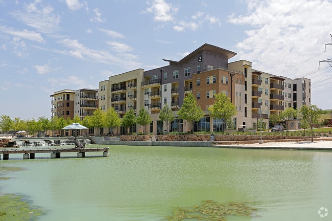
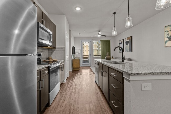
Property Record
4420 State Highway 121, Lewisville, TX 75056

Property Detail
4420 State Highway 121
Dallas-Fort Worth-Arlington, TX
A1138A A. SINGLETON, TR 3C,4A, 20.5489 ACRES
R309088
DENTON
Commercialacreage
Texas
B and X Area of moderate flood hazard, usually the area between the limits of the 100-year and 500-year floods.
20.55 AC
2024
Carrollton
2025
Dallas/Ft Worth
021517
NEARBY LISTINGS FOR SALE OR LEASE
DEMOGRAPHICS near 4420 State Highway 121
1 mile
3 mile
5 mile
2025 Total Population
13,296
101,523
257,330
2030 Population
15,374
113,852
288,325
Pop Growth 2025-2030
+ 15.63%
+ 12.14%
+ 12.04%
Average Age
37
39
39
2025 Total Households
5,320
39,909
105,352
HH Growth 2025-2030
+ 15.66%
+ 12.42%
+ 12.38%
Median Household Inc
$117,161
$118,017
$107,274
Avg Household Size
2.50
2.50
2.40
2025 Avg HH Vehicles
2.00
2.00
2.00
Median Home Value
$656,351
$485,370
$489,600
Median Year Built
2011
2005
1998
Nearby Places
Map Layers
Map Styles
 Street
 Aerial
Transit
 Traffic
 Biking
Places
Listings with unknown addresses are not visible on the map
- Restaurants
- Banks
- Shops
- Fitness
- Groceries
PUBLIC TRANSPORTATION
COMMUTER RAIL
Old Town Station (A-train - Denton County Transportation Authority)
Drive
Walk
Distance
Old Town Station (A-train - Denton County Transportation Authority)
10 min
6.5 mi
Hebron Station (A-train - Denton County Transportation Authority)
Drive
Walk
Distance
Hebron Station (A-train - Denton County Transportation Authority)
12 min
7.4 mi
AIRPORT
Dallas-Fort Worth International
Drive
Walk
Distance
Dallas-Fort Worth International
21 min
17.7 mi
Dallas Love Field
Drive
Walk
Distance
Dallas Love Field
32 min
22.2 mi
Freight Ports
Port of Shreveport
Drive
Walk
Distance
Port of Shreveport
235 min
215.5 mi
Nearby Properties
Address
Land Use
TOTAL SIZE
Lot Size
Zoning
Address
Land Use
TOTAL SIZE
Lot Size
Zoning
542,570 SF
75.67 AC
Address
Land Use
TOTAL SIZE
Lot Size
Zoning
526,369 SF
45.84 AC
Address
Land Use
TOTAL SIZE
Lot Size
Zoning
598,569 SF
86.50 AC
Address
Land Use
TOTAL SIZE
Lot Size
Zoning
1,817,951 SF
82 AC
Address
Land Use
TOTAL SIZE
Lot Size
Zoning
537,274 SF
20.91 AC
Address
Land Use
TOTAL SIZE
Lot Size
Zoning
578,457 SF
31.79 AC
Address
Land Use
TOTAL SIZE
Lot Size
Zoning
559,657 SF
30.49 AC
Address
Land Use
TOTAL SIZE
Lot Size
Zoning
554,780 SF
23.81 AC
Address
Land Use
TOTAL SIZE
Lot Size
Zoning
512,903 SF
18 AC
Address
Land Use
TOTAL SIZE
Lot Size
Zoning
500,844 SF
24.36 AC
2B
Address
Land Use
TOTAL SIZE
Lot Size
Zoning
460,403 SF
19.26 AC
Address
Land Use
TOTAL SIZE
Lot Size
Zoning
389,014 SF
20.91 AC
Address
Land Use
TOTAL SIZE
Lot Size
Zoning
479,145 SF
17.08 AC
Address
Land Use
TOTAL SIZE
Lot Size
Zoning
448,915 SF
20.37 AC
Address
Land Use
TOTAL SIZE
Lot Size
Zoning
452,164 SF
15.70 AC
2B
Address
Land Use
TOTAL SIZE
Lot Size
Zoning
376,139 SF
3.58 AC
Address
Land Use
TOTAL SIZE
Lot Size
Zoning
462,888 SF
20.17 AC
Address
Land Use
TOTAL SIZE
Lot Size
Zoning
346,269 SF
15.14 AC
Address
Land Use
TOTAL SIZE
Lot Size
Zoning
434,639 SF
16.20 AC
Address
Land Use
TOTAL SIZE
Lot Size
Zoning
343,234 SF
32.41 AC
Address
Land Use
TOTAL SIZE
Lot Size
Zoning
462,429 SF
5.70 AC
Address
Land Use
TOTAL SIZE
Lot Size
Zoning
291,446 SF
16.18 AC
Address
Land Use
TOTAL SIZE
Lot Size
Zoning
285,835 SF
15.61 AC
Address
Land Use
TOTAL SIZE
Lot Size
Zoning
580,201 SF
16.66 AC
Address
Land Use
TOTAL SIZE
Lot Size
Zoning
455,433 SF
14.25 AC
Address
Land Use
TOTAL SIZE
Lot Size
Zoning
364,000 SF
8.11 AC
Address
Land Use
TOTAL SIZE
Lot Size
Zoning
961,306 SF
44.52 AC
Address
Land Use
TOTAL SIZE
Lot Size
Zoning
97,750 SF
69.90 AC
Address
Land Use
TOTAL SIZE
Lot Size
Zoning
262,879 SF
11.97 AC
Address
Land Use
TOTAL SIZE
Lot Size
Zoning
267,413 SF
5.25 AC
The World's #1 Commercial Real Estate Marketplace
Connect with us
© 2026 CoStar Group
The information above has been obtained from sources believed reliable. While we do not doubt its accuracy we have not verified it and make no guarantee, warranty or representation about it. It is your responsibility to independently confirm its accuracy and completeness. Any projections, opinions, assumptions, or estimates used are for example only and do not represent the current or future performance of the property. The value of this transaction to you depends on tax and other factors which should be evaluated by your tax, financial, and legal advisors. You and your advisors should conduct a careful, independent investigation of the property to determine to your satisfaction the suitability of the property for your needs.