Property Record
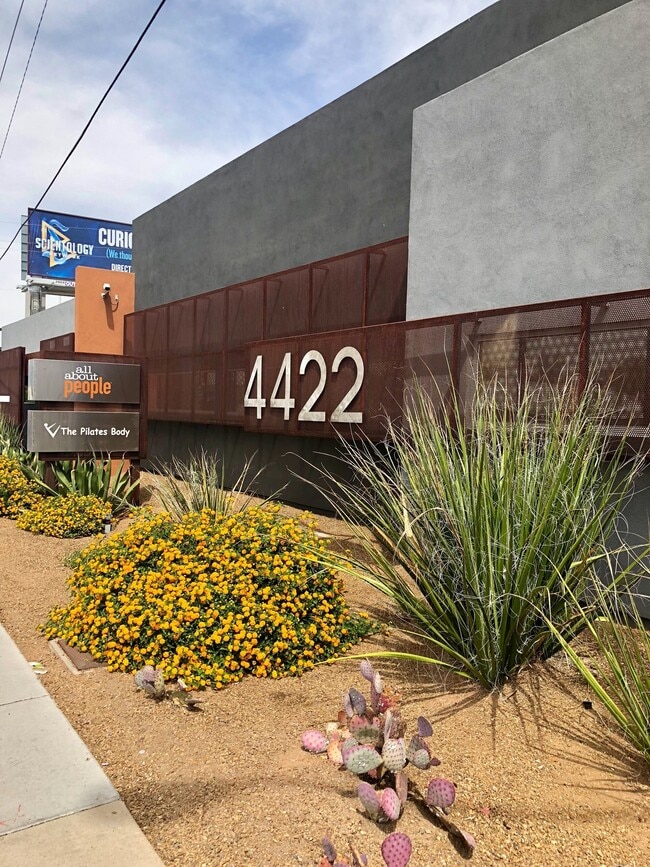
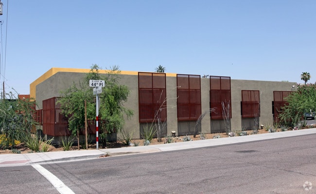
4422 E Indian School Rd, Phoenix, AZ 85018


This Property Is For Sale
Property Detail
4422 E Indian School Rd
171-42-148
VERNADERO PLACE MCR 1028-08
Officebuilding
Maricopa
M-H
Arizona
C and X Area of minimal flood hazard, usually depicted on FIRMs as above the 500-year flood level.
1
2025
0.43 AC
2025
44th Street Corridor
108200
Phoenix
6,512 SF
Phoenix-Mesa-Chandler, AZ
NEARBY LISTINGS FOR SALE OR LEASE
DEMOGRAPHICS near 4422 E Indian School Rd
1 mile
3 mile
5 mile
2024 Total Population
14,563
125,278
301,633
2029 Population
15,084
131,053
316,797
Pop Growth 2024-2029
+ 3.58%
+ 4.61%
+ 5.03%
Average Age
39
39
39
2024 Total Households
6,539
55,080
139,153
HH Growth 2024-2029
+ 3.58%
+ 4.82%
+ 5.25%
Median Household Inc
$111,416
$83,498
$82,817
Avg Household Size
2.20
2.20
2.10
2024 Avg HH Vehicles
2.00
2.00
2.00
Median Home Value
$865,046
$746,161
$666,666
Median Year Built
1966
1974
1976
Nearby Places
Map Layers
Map Styles
 Street
 Aerial
Transit
 Traffic
 Biking
Places
Listings with unknown addresses are not visible on the map
- Restaurants
- Banks
- Shops
- Fitness
- Groceries
PUBLIC TRANSPORTATION
AIRPORT
Phoenix Sky Harbor International
Drive
Walk
Distance
Phoenix Sky Harbor International
12 min
6.1 mi
Phoenix-Mesa Gateway
Drive
Walk
Distance
Phoenix-Mesa Gateway
45 min
30.7 mi
Freight Ports
Port of San Diego
Drive
Walk
Distance
Port of San Diego
405 min
362.1 mi
Nearby Properties
Address
Land Use
TOTAL SIZE
Lot Size
Zoning
Address
Land Use
TOTAL SIZE
Lot Size
Zoning
103,415 SF
4.61 AC
C-T
Address
Land Use
TOTAL SIZE
Lot Size
Zoning
71,306 SF
8.93 AC
M-H
Address
Land Use
TOTAL SIZE
Lot Size
Zoning
3.62 AC
Address
Land Use
TOTAL SIZE
Lot Size
Zoning
969,844 SF
27.97 AC
PAD
Address
Land Use
TOTAL SIZE
Lot Size
Zoning
1,457,213 SF
41.78 AC
PUD
Address
Land Use
TOTAL SIZE
Lot Size
Zoning
322,557 SF
2 AC
C-C
Address
Land Use
TOTAL SIZE
Lot Size
Zoning
953,192 SF
28.99 AC
Address
Land Use
TOTAL SIZE
Lot Size
Zoning
50,161 SF
2.05 AC
M-H
Address
Land Use
TOTAL SIZE
Lot Size
Zoning
244,924 SF
1.90 AC
C2
Address
Land Use
TOTAL SIZE
Lot Size
Zoning
3,010 SF
35.44 AC
R110
Address
Land Use
TOTAL SIZE
Lot Size
Zoning
76,801 SF
4.79 AC
R1-6
Address
Land Use
TOTAL SIZE
Lot Size
Zoning
498,595 SF
9.01 AC
C-C
Address
Land Use
TOTAL SIZE
Lot Size
Zoning
688,550 SF
149.95 AC
R-6
Address
Land Use
TOTAL SIZE
Lot Size
Zoning
410,000 SF
1.86 AC
C-C
Address
Land Use
TOTAL SIZE
Lot Size
Zoning
386,004 SF
37.82 AC
R-6
Address
Land Use
TOTAL SIZE
Lot Size
Zoning
812,968 SF
7.08 AC
Address
Land Use
TOTAL SIZE
Lot Size
Zoning
517,609 SF
1.67 AC
C-C
Address
Land Use
TOTAL SIZE
Lot Size
Zoning
599,524 SF
5.09 AC
R5
Address
Land Use
TOTAL SIZE
Lot Size
Zoning
656,952 SF
3.58 AC
Address
Land Use
TOTAL SIZE
Lot Size
Zoning
517,502 SF
21.26 AC
SUPR
Address
Land Use
TOTAL SIZE
Lot Size
Zoning
567,481 SF
2 AC
Address
Land Use
TOTAL SIZE
Lot Size
Zoning
575,103 SF
2.24 AC
Address
Land Use
TOTAL SIZE
Lot Size
Zoning
62,497 SF
130.73 AC
R-6
Address
Land Use
TOTAL SIZE
Lot Size
Zoning
312,104 SF
1.08 AC
C-2
Address
Land Use
TOTAL SIZE
Lot Size
Zoning
29,100 SF
1.42 AC
M-H
Address
Land Use
TOTAL SIZE
Lot Size
Zoning
282,287 SF
38.68 AC
R-10
Address
Land Use
TOTAL SIZE
Lot Size
Zoning
812,214 SF
4.91 AC
C-C
Address
Land Use
TOTAL SIZE
Lot Size
Zoning
266,869 SF
7.55 AC
C-C
Address
Land Use
TOTAL SIZE
Lot Size
Zoning
426,310 SF
1.44 AC
Address
Land Use
TOTAL SIZE
Lot Size
Zoning
540,981 SF
30.40 AC
CPGCP
The World's #1 Commercial Real Estate Marketplace
Connect with us
© 2026 CoStar Group
The information above has been obtained from sources believed reliable. While we do not doubt its accuracy we have not verified it and make no guarantee, warranty or representation about it. It is your responsibility to independently confirm its accuracy and completeness. Any projections, opinions, assumptions, or estimates used are for example only and do not represent the current or future performance of the property. The value of this transaction to you depends on tax and other factors which should be evaluated by your tax, financial, and legal advisors. You and your advisors should conduct a careful, independent investigation of the property to determine to your satisfaction the suitability of the property for your needs.