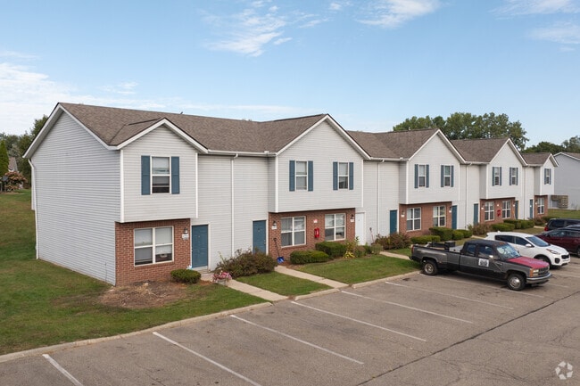
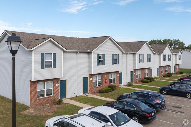
Property Record
4425 W Milham Ave, Portage, MI 49024

NEARBY LISTINGS FOR SALE OR LEASE
-
-
View all Portage listings for sale on LoopNet.com
Property Detail
4425 W Milham Ave
10-00007-065-E
The Reserve Condominium
Commercialnec
PHASE I UNITS NO. 1, 2, 3, 4, 5, 6, 7, 8, 9, 10, 11, 12, 13, 14, 15, 16, 17, 18 19 & 20. ALSO KNOWN AS COMM AT THE N 1/4 COR
X
Kalamazoo
26077C0285E
Michigan
2025
8.09 AC
2025
Portage
002003
West Michigan
4,424 SF
Kalamazoo-Portage, MI
DEMOGRAPHICS near 4425 W Milham Ave
1 Mile
3 Mile
5 Mile
2024 Total Population
7,428
46,539
126,655
2029 Population
7,397
46,225
126,461
Pop Growth 2024-2029
(0.42%)
(0.67%)
(0.15%)
Average Age
39
39
37
2024 Total Households
2,715
19,474
52,588
HH Growth 2024-2029
(0.66%)
(0.73%)
(0.16%)
Median Household Inc
$105,474
$74,578
$60,580
Avg Household Size
2.60
2.30
2.20
2024 Avg HH Vehicles
2.00
2.00
2.00
Median Home Value
$265,432
$245,108
$217,621
Median Year Built
1989
1978
1975
Nearby Places
Map Layers
Map Styles
 Street
 Aerial
- Restaurants
- Banks
- Shops
- Fitness
- Groceries
PUBLIC TRANSPORTATION
COMMUTER RAIL
Kalamazoo (Blue Water - Amtrak, Wolverine - Amtrak)
DRIVE
WALK
Distance
Kalamazoo (Blue Water - Amtrak, Wolverine - Amtrak)
16 min
7.6 mi
AIRPORT
Kalamazoo/Battle Creek International
DRIVE
WALK
Distance
Kalamazoo/Battle Creek International
15 min
6.5 mi
Freight Ports
Port of Toledo
DRIVE
WALK
Distance
Port of Toledo
179 min
147.9 mi
Nearby Properties
Address
Land Use
TOTAL SIZE
Lot Size
Zoning
Address
Land Use
TOTAL SIZE
Lot Size
Zoning
35,119 SF
50.85 AC
RM-1
Address
Land Use
TOTAL SIZE
Lot Size
Zoning
1,703 SF
20.29 AC
R-2
Address
Land Use
TOTAL SIZE
Lot Size
Zoning
204,579 SF
27.80 AC
R-4 MUL
Address
Land Use
TOTAL SIZE
Lot Size
Zoning
424,967 SF
55.60 AC
I-1
Address
Land Use
TOTAL SIZE
Lot Size
Zoning
383,638 SF
25.85 AC
B-2
Address
Land Use
TOTAL SIZE
Lot Size
Zoning
17.31 AC
PD
Address
Land Use
TOTAL SIZE
Lot Size
Zoning
16.71 AC
B-2
Address
Land Use
TOTAL SIZE
Lot Size
Zoning
140,000 SF
22.69 AC
EBT
Address
Land Use
TOTAL SIZE
Lot Size
Zoning
5.04 AC
CPD
Address
Land Use
TOTAL SIZE
Lot Size
Zoning
9.47 AC
Address
Land Use
TOTAL SIZE
Lot Size
Zoning
16.75 AC
CBD
Address
Land Use
TOTAL SIZE
Lot Size
Zoning
128,586 SF
14.27 AC
R-4 MUL
Address
Land Use
TOTAL SIZE
Lot Size
Zoning
5,173 SF
15.81 AC
RM-1
Address
Land Use
TOTAL SIZE
Lot Size
Zoning
61,533 SF
8.42 AC
B-2
Address
Land Use
TOTAL SIZE
Lot Size
Zoning
4.33 AC
C-1
Address
Land Use
TOTAL SIZE
Lot Size
Zoning
1,776 SF
17 AC
PD
Address
Land Use
TOTAL SIZE
Lot Size
Zoning
23,463 SF
15 AC
PD
Address
Land Use
TOTAL SIZE
Lot Size
Zoning
12,480 SF
14.82 AC
RM-1
Address
Land Use
TOTAL SIZE
Lot Size
Zoning
6,874 SF
163.50 AC
PD
Address
Land Use
TOTAL SIZE
Lot Size
Zoning
2.31 AC
CPD
Address
Land Use
TOTAL SIZE
Lot Size
Zoning
216,427 SF
18.83 AC
B-2
Address
Land Use
TOTAL SIZE
Lot Size
Zoning
4.65 AC
CPD
Address
Land Use
TOTAL SIZE
Lot Size
Zoning
13.77 AC
B-2
Address
Land Use
TOTAL SIZE
Lot Size
Zoning
26,700 SF
17 AC
RM-1
Address
Land Use
TOTAL SIZE
Lot Size
Zoning
133,976 SF
15.04 AC
CPD
Address
Land Use
TOTAL SIZE
Lot Size
Zoning
8.83 AC
I-1
Address
Land Use
TOTAL SIZE
Lot Size
Zoning
178,882 SF
10.02 AC
RS-5
Address
Land Use
TOTAL SIZE
Lot Size
Zoning
25,000 SF
5.63 AC
B-3
Address
Land Use
TOTAL SIZE
Lot Size
Zoning
8,040 SF
18.11 AC
RM-1
Address
Land Use
TOTAL SIZE
Lot Size
Zoning
153,637 SF
12.28 AC
PUD
The World's #1 Commercial Real Estate Marketplace
Connect with us
© 2026 CoStar Group
The information above has been obtained from sources believed reliable. While we do not doubt its accuracy we have not verified it and make no guarantee, warranty or representation about it. It is your responsibility to independently confirm its accuracy and completeness. Any projections, opinions, assumptions, or estimates used are for example only and do not represent the current or future performance of the property. The value of this transaction to you depends on tax and other factors which should be evaluated by your tax, financial, and legal advisors. You and your advisors should conduct a careful, independent investigation of the property to determine to your satisfaction the suitability of the property for your needs.