Property Record
443 E State Road 38, Pendleton, IN 46064
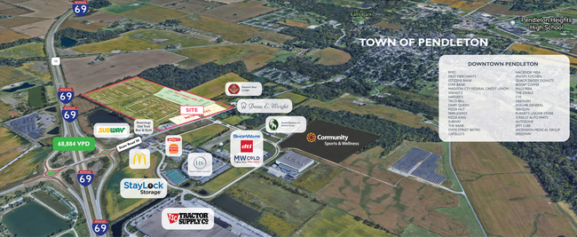

Property Detail
443 E State Road 38
Indianapolis-Carmel-Greenwood, IN
E2 SE 74.5570ACRES STR: 24187 SECTION: PLAT: 00 IN: OUT:
48-14-24-400-002.000-012
MADISON
Agriculturalland
Indiana
B and X Area of moderate flood hazard, usually the area between the limits of the 100-year and 500-year floods.
74.56 AC
2024
Anderson/Madison Cnty
2025
Indianapolis
011400
NEARBY LISTINGS FOR SALE OR LEASE
-
-
View all Pendleton listings for sale on LoopNet.com
DEMOGRAPHICS near 443 E State Road 38
1 mile
3 mile
5 mile
2025 Total Population
160
4,778
19,997
2030 Population
161
4,838
20,357
Pop Growth 2025-2030
+ 0.63%
+ 1.26%
+ 1.80%
Average Age
41
43
43
2025 Total Households
57
1,745
6,883
HH Growth 2025-2030
+ 1.75%
+ 1.26%
+ 1.99%
Median Household Inc
$119,999
$101,181
$85,746
Avg Household Size
2.60
2.50
2.40
2025 Avg HH Vehicles
3.00
2.00
2.00
Median Home Value
$280,768
$311,869
$255,628
Median Year Built
1969
1976
1975
Nearby Places
Map Layers
Map Styles
 Street
 Aerial
Transit
 Traffic
 Biking
Places
Listings with unknown addresses are not visible on the map
- Restaurants
- Banks
- Shops
- Fitness
- Groceries
SALE & LEASE HISTORY
LISTING DATE
SALE/LEASE

Aug 17, 2021
For Sale
Nearby Properties
Address
Land Use
TOTAL SIZE
Lot Size
Zoning
Address
Land Use
TOTAL SIZE
Lot Size
Zoning
11,164 SF
2.53 AC
Address
Land Use
TOTAL SIZE
Lot Size
Zoning
30,799 SF
6.13 AC
Address
Land Use
TOTAL SIZE
Lot Size
Zoning
5.55 AC
Address
Land Use
TOTAL SIZE
Lot Size
Zoning
2,636 SF
0.88 AC
Address
Land Use
TOTAL SIZE
Lot Size
Zoning
3,599 SF
5 AC
Address
Land Use
TOTAL SIZE
Lot Size
Zoning
178.56 AC
Address
Land Use
TOTAL SIZE
Lot Size
Zoning
2,669 SF
3.60 AC
Address
Land Use
TOTAL SIZE
Lot Size
Zoning
8,480 SF
8.17 AC
Address
Land Use
TOTAL SIZE
Lot Size
Zoning
2,349 SF
126.88 AC
Address
Land Use
TOTAL SIZE
Lot Size
Zoning
2,067 SF
6.24 AC
Address
Land Use
TOTAL SIZE
Lot Size
Zoning
2,062 SF
4.57 AC
Address
Land Use
TOTAL SIZE
Lot Size
Zoning
18,480 SF
0.15 AC
Address
Land Use
TOTAL SIZE
Lot Size
Zoning
147.68 AC
Address
Land Use
TOTAL SIZE
Lot Size
Zoning
5.01 AC
Address
Land Use
TOTAL SIZE
Lot Size
Zoning
Address
Land Use
TOTAL SIZE
Lot Size
Zoning
127.94 AC
Address
Land Use
TOTAL SIZE
Lot Size
Zoning
125.83 AC
Address
Land Use
TOTAL SIZE
Lot Size
Zoning
151.39 AC
Address
Land Use
TOTAL SIZE
Lot Size
Zoning
136.97 AC
Address
Land Use
TOTAL SIZE
Lot Size
Zoning
13.64 AC
Address
Land Use
TOTAL SIZE
Lot Size
Zoning
121.47 AC
Address
Land Use
TOTAL SIZE
Lot Size
Zoning
24,050 SF
2 AC
Address
Land Use
TOTAL SIZE
Lot Size
Zoning
40 AC
Address
Land Use
TOTAL SIZE
Lot Size
Zoning
120.70 AC
Address
Land Use
TOTAL SIZE
Lot Size
Zoning
65.40 AC
Address
Land Use
TOTAL SIZE
Lot Size
Zoning
95.83 AC
Address
Land Use
TOTAL SIZE
Lot Size
Zoning
3,200 SF
1.38 AC
Address
Land Use
TOTAL SIZE
Lot Size
Zoning
102.27 AC
Address
Land Use
TOTAL SIZE
Lot Size
Zoning
97.73 AC
The World's #1 Commercial Real Estate Marketplace
Connect with us
© 2026 CoStar Group
The information above has been obtained from sources believed reliable. While we do not doubt its accuracy we have not verified it and make no guarantee, warranty or representation about it. It is your responsibility to independently confirm its accuracy and completeness. Any projections, opinions, assumptions, or estimates used are for example only and do not represent the current or future performance of the property. The value of this transaction to you depends on tax and other factors which should be evaluated by your tax, financial, and legal advisors. You and your advisors should conduct a careful, independent investigation of the property to determine to your satisfaction the suitability of the property for your needs.