Property Record
443 Lookout Point Rd, Selah, WA 98942

NEARBY LISTINGS FOR SALE OR LEASE
-
-
View all Selah listings for sale on LoopNet.com
Property Detail
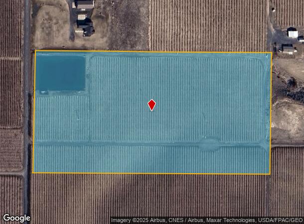
443 Lookout Point Rd
Yakima, WA
Short 85-20
181303-42006
S1/2 SW1/4 SE1/4, EX W 20 FT FOR CO RD
Recreationalacreage
Yakima
X
Washington
53037C1625D
1
2025
19.28 AC
2025
Outlying Yakima County
003200
Yakima
900 SF
DEMOGRAPHICS near 443 Lookout Point Rd
1 Mile
3 Mile
5 Mile
2024 Total Population
727
45,913
118,171
2029 Population
725
46,229
118,932
Pop Growth 2024-2029
(0.28%)
+ 0.69%
+ 0.64%
Average Age
40
39
37
2024 Total Households
261
17,458
43,193
HH Growth 2024-2029
(0.38%)
+ 0.73%
+ 0.63%
Median Household Inc
$85,416
$60,643
$57,884
Avg Household Size
2.70
2.50
2.60
2024 Avg HH Vehicles
2.00
2.00
2.00
Median Home Value
$314,865
$285,890
$265,495
Median Year Built
1985
1973
1973
Nearby Places
Map Layers
Map Styles
 Street
 Aerial
- Restaurants
- Banks
- Shops
- Fitness
- Groceries
PUBLIC TRANSPORTATION
AIRPORT
Yakima Air Trml/McAllister Field
DRIVE
WALK
Distance
Yakima Air Trml/McAllister Field
21 min
9.7 mi
Freight Ports
Port of Tacoma
DRIVE
WALK
Distance
Port of Tacoma
186 min
154.2 mi
Nearby Properties
Address
Land Use
TOTAL SIZE
Lot Size
Zoning
Address
Land Use
TOTAL SIZE
Lot Size
Zoning
499,230 SF
22.57 AC
M1
Address
Land Use
TOTAL SIZE
Lot Size
Zoning
193,955 SF
9.94 AC
C1
Address
Land Use
TOTAL SIZE
Lot Size
Zoning
474,587 SF
18.06 AC
M1
Address
Land Use
TOTAL SIZE
Lot Size
Zoning
132,582 SF
32.50 AC
R1
Address
Land Use
TOTAL SIZE
Lot Size
Zoning
235,222 SF
14.23 AC
M1
Address
Land Use
TOTAL SIZE
Lot Size
Zoning
298,360 SF
15.21 AC
M1
Address
Land Use
TOTAL SIZE
Lot Size
Zoning
501,270 SF
21.09 AC
M1
Address
Land Use
TOTAL SIZE
Lot Size
Zoning
126,988 SF
9.65 AC
R2
Address
Land Use
TOTAL SIZE
Lot Size
Zoning
153,010 SF
26.44 AC
R1
Address
Land Use
TOTAL SIZE
Lot Size
Zoning
65,606 SF
3.39 AC
R2
Address
Land Use
TOTAL SIZE
Lot Size
Zoning
79,293 SF
14.01 AC
R1
Address
Land Use
TOTAL SIZE
Lot Size
Zoning
124,505 SF
13.59 AC
R1
Address
Land Use
TOTAL SIZE
Lot Size
Zoning
98,397 SF
17.48 AC
R1
Address
Land Use
TOTAL SIZE
Lot Size
Zoning
327,890 SF
18.44 AC
M1
Address
Land Use
TOTAL SIZE
Lot Size
Zoning
93,286 SF
8.87 AC
R3
Address
Land Use
TOTAL SIZE
Lot Size
Zoning
162,933 SF
14.96 AC
SCC
Address
Land Use
TOTAL SIZE
Lot Size
Zoning
99,000 SF
5.44 AC
C1
Address
Land Use
TOTAL SIZE
Lot Size
Zoning
196,486 SF
10.61 AC
M1
Address
Land Use
TOTAL SIZE
Lot Size
Zoning
118,830 SF
5.34 AC
LCC
Address
Land Use
TOTAL SIZE
Lot Size
Zoning
53,278 SF
5.44 AC
M1
Address
Land Use
TOTAL SIZE
Lot Size
Zoning
86,547 SF
4.41 AC
R3
Address
Land Use
TOTAL SIZE
Lot Size
Zoning
65,968 SF
1.51 AC
R2
Address
Land Use
TOTAL SIZE
Lot Size
Zoning
255,977 SF
12.08 AC
M1
Address
Land Use
TOTAL SIZE
Lot Size
Zoning
83,430 SF
4.22 AC
SCC
Address
Land Use
TOTAL SIZE
Lot Size
Zoning
173,916 SF
7.27 AC
M1
Address
Land Use
TOTAL SIZE
Lot Size
Zoning
131,100 SF
3.49 AC
M1
Address
Land Use
TOTAL SIZE
Lot Size
Zoning
48,800 SF
4.54 AC
M1
Address
Land Use
TOTAL SIZE
Lot Size
Zoning
42,646 SF
4.54 AC
B1
Address
Land Use
TOTAL SIZE
Lot Size
Zoning
49,899 SF
1.22 AC
R3
Address
Land Use
TOTAL SIZE
Lot Size
Zoning
101,113 SF
18.18 AC
R1
The World's #1 Commercial Real Estate Marketplace
Connect with us
© 2025 CoStar Group
The information above has been obtained from sources believed reliable. While we do not doubt its accuracy we have not verified it and make no guarantee, warranty or representation about it. It is your responsibility to independently confirm its accuracy and completeness. Any projections, opinions, assumptions, or estimates used are for example only and do not represent the current or future performance of the property. The value of this transaction to you depends on tax and other factors which should be evaluated by your tax, financial, and legal advisors. You and your advisors should conduct a careful, independent investigation of the property to determine to your satisfaction the suitability of the property for your needs.