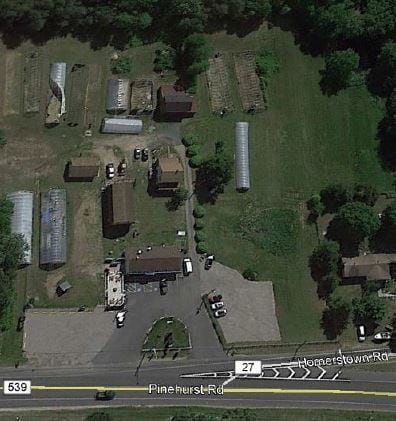
Property Record
443 Route 539, Cream Ridge, NJ 08514

NEARBY LISTINGS FOR SALE OR LEASE
Property Detail
443 Route 539
24-00044-0000-00025
4.81AC
Commercialnec
Ocean
X
New Jersey
34005C0185F
25
2024
4.81 AC
2025
Ocean County
718000
Northern New Jersey
2,458 SF
New York-Jersey City-White Plains, NY-NJ
DEMOGRAPHICS near 443 Route 539
1 Mile
3 Mile
5 Mile
2024 Total Population
1,424
8,963
14,923
2029 Population
1,479
9,415
15,508
Pop Growth 2024-2029
+ 3.86%
+ 5.04%
+ 3.92%
Average Age
41
40
41
2024 Total Households
498
3,154
5,369
HH Growth 2024-2029
+ 3.21%
+ 4.47%
+ 3.48%
Median Household Inc
$101,013
$93,673
$95,280
Avg Household Size
2.80
2.80
2.70
2024 Avg HH Vehicles
2.00
2.00
2.00
Median Home Value
$401,240
$389,844
$395,808
Median Year Built
1989
1986
1984
Nearby Places
Map Layers
Map Styles
 Street
 Aerial
- Restaurants
- Banks
- Shops
- Fitness
- Groceries
PUBLIC TRANSPORTATION
AIRPORT
Trenton Mercer
DRIVE
WALK
Distance
Trenton Mercer
40 min
26.5 mi
Freight Ports
Port of Philadelphia
DRIVE
WALK
Distance
Port of Philadelphia
59 min
39.7 mi
SALE & LEASE HISTORY
LISTING DATE
SALE/LEASE

Dec 10, 2019
For Lease
Dec 05, 2019
For Sale
Nearby Properties
Address
Land Use
TOTAL SIZE
Lot Size
Zoning
Address
Land Use
TOTAL SIZE
Lot Size
Zoning
131.54 AC
L1
Address
Land Use
TOTAL SIZE
Lot Size
Zoning
9,277.54 AC
RD
Address
Land Use
TOTAL SIZE
Lot Size
Zoning
1,115.09 AC
ROS
Address
Land Use
TOTAL SIZE
Lot Size
Zoning
861.77 AC
ROS
Address
Land Use
TOTAL SIZE
Lot Size
Zoning
2,619 SF
50.30 AC
R3
Address
Land Use
TOTAL SIZE
Lot Size
Zoning
680 SF
10 AC
C4
Address
Land Use
TOTAL SIZE
Lot Size
Zoning
14,136 SF
42.79 AC
AR
Address
Land Use
TOTAL SIZE
Lot Size
Zoning
2,160 SF
23.10 AC
HD
Address
Land Use
TOTAL SIZE
Lot Size
Zoning
15.01 AC
L1
Address
Land Use
TOTAL SIZE
Lot Size
Zoning
7,120 SF
131.05 AC
AR
Address
Land Use
TOTAL SIZE
Lot Size
Zoning
7,155 SF
11.71 AC
AR
Address
Land Use
TOTAL SIZE
Lot Size
Zoning
5,102 SF
106.86 AC
PEC
Address
Land Use
TOTAL SIZE
Lot Size
Zoning
24.11 AC
L1
Address
Land Use
TOTAL SIZE
Lot Size
Zoning
1,650 SF
7.04 AC
LI
Address
Land Use
TOTAL SIZE
Lot Size
Zoning
3,482 SF
43.16 AC
AR
Address
Land Use
TOTAL SIZE
Lot Size
Zoning
138.10 AC
PEC
Address
Land Use
TOTAL SIZE
Lot Size
Zoning
20,703 SF
0.43 AC
VB
Address
Land Use
TOTAL SIZE
Lot Size
Zoning
7,764 SF
1 AC
AR
Address
Land Use
TOTAL SIZE
Lot Size
Zoning
36.21 AC
MHP
Address
Land Use
TOTAL SIZE
Lot Size
Zoning
1.88 AC
C2
Address
Land Use
TOTAL SIZE
Lot Size
Zoning
24,000 SF
4.77 AC
CC
Address
Land Use
TOTAL SIZE
Lot Size
Zoning
4,334 SF
2 AC
AR
Address
Land Use
TOTAL SIZE
Lot Size
Zoning
5,286 SF
3 AC
AR
Address
Land Use
TOTAL SIZE
Lot Size
Zoning
89.96 AC
AR
Address
Land Use
TOTAL SIZE
Lot Size
Zoning
2,862 SF
63.02 AC
AR
Address
Land Use
TOTAL SIZE
Lot Size
Zoning
1.01 AC
C4
Address
Land Use
TOTAL SIZE
Lot Size
Zoning
3,088 SF
1.80 AC
C4
Address
Land Use
TOTAL SIZE
Lot Size
Zoning
9,032 SF
1 AC
AR
Address
Land Use
TOTAL SIZE
Lot Size
Zoning
40.49 AC
MHP
Address
Land Use
TOTAL SIZE
Lot Size
Zoning
5,032 SF
2 AC
AR
The World's #1 Commercial Real Estate Marketplace
Connect with us
© 2026 CoStar Group
The information above has been obtained from sources believed reliable. While we do not doubt its accuracy we have not verified it and make no guarantee, warranty or representation about it. It is your responsibility to independently confirm its accuracy and completeness. Any projections, opinions, assumptions, or estimates used are for example only and do not represent the current or future performance of the property. The value of this transaction to you depends on tax and other factors which should be evaluated by your tax, financial, and legal advisors. You and your advisors should conduct a careful, independent investigation of the property to determine to your satisfaction the suitability of the property for your needs.