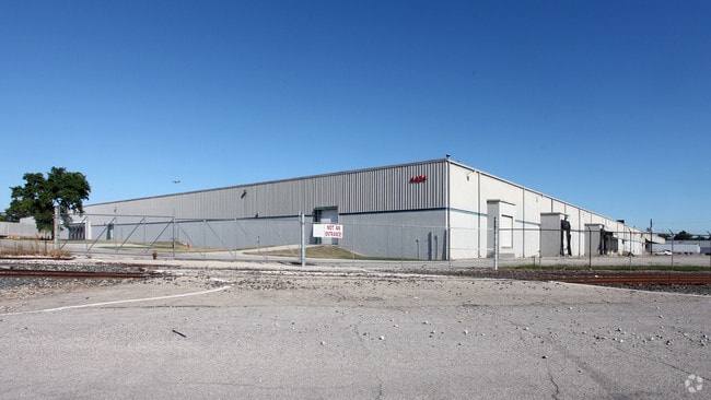
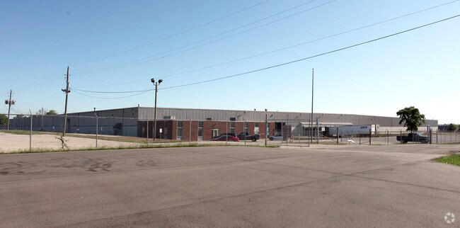
Property Record
4430 Airport Expy, Indianapolis, IN 46241
NEARBY LISTINGS FOR SALE OR LEASE
Property Detail
4430 Airport Expy
49-11-19-105-002.000-900
PT SE1/4 S18 & PT NE1/4 S19 T15 R3 BEG 164.7FT W2161.06FT S NE COR SE1/4 S18 S 600FT IRR SW 402.02FT W 880.6FT IRR NE 335.52FT, E 53, IRR N676.8, E 872.4 TO BEG. 19.08AC
Warehouse
Marion
X
Indiana
18097C0226F
2
2023
17.95 AC
2024
Stout Field
342300
Indianapolis
484,008 SF
Indianapolis-Carmel-Anderson, IN
DEMOGRAPHICS near 4430 Airport Expy
1 Mile
3 Mile
5 Mile
2024 Total Population
6,524
54,863
163,730
2029 Population
6,444
54,466
163,332
Pop Growth 2024-2029
(1.23%)
(0.72%)
(0.24%)
Average Age
37
36
35
2024 Total Households
2,426
20,285
64,449
HH Growth 2024-2029
(1.32%)
(0.82%)
(0.12%)
Median Household Inc
$54,810
$47,754
$54,050
Avg Household Size
2.60
2.60
2.40
2024 Avg HH Vehicles
2.00
2.00
2.00
Median Home Value
$63,053
$95,311
$142,479
Median Year Built
1959
1961
1967
Nearby Places
Map Layers
Map Styles
 Street
 Aerial
- Restaurants
- Banks
- Shops
- Fitness
- Groceries
PUBLIC TRANSPORTATION
AIRPORT
Indianapolis International
DRIVE
WALK
Distance
Indianapolis International
13 min
8.6 mi
Freight Ports
Virginia Port Authority - Richmond
DRIVE
WALK
Distance
Virginia Port Authority - Richmond
1 min
501.2 mi
SALE & LEASE HISTORY
LISTING DATE
SALE/LEASE

Jul 22, 2019
For Lease
Jul 01, 2020
For Lease
Nearby Properties
Address
Land Use
TOTAL SIZE
Lot Size
Zoning
Address
Land Use
TOTAL SIZE
Lot Size
Zoning
5,280 SF
97.87 AC
ZO01
Address
Land Use
TOTAL SIZE
Lot Size
Zoning
434,240 SF
26.25 AC
ZO01
Address
Land Use
TOTAL SIZE
Lot Size
Zoning
9,750 SF
43.46 AC
ZO01
Address
Land Use
TOTAL SIZE
Lot Size
Zoning
366,600 SF
29.05 AC
ZO01
Address
Land Use
TOTAL SIZE
Lot Size
Zoning
49,008 SF
4.80 AC
ZO01
Address
Land Use
TOTAL SIZE
Lot Size
Zoning
4,663 SF
7.98 AC
ZO01
Address
Land Use
TOTAL SIZE
Lot Size
Zoning
600,000 SF
41.64 AC
ZO01
Address
Land Use
TOTAL SIZE
Lot Size
Zoning
133,706 SF
83.24 AC
ZO01
Address
Land Use
TOTAL SIZE
Lot Size
Zoning
1.88 AC
ZO01
Address
Land Use
TOTAL SIZE
Lot Size
Zoning
28,400 SF
22.04 AC
ZO01
Address
Land Use
TOTAL SIZE
Lot Size
Zoning
101,718 SF
49.77 AC
ZO01
Address
Land Use
TOTAL SIZE
Lot Size
Zoning
5,616 SF
9.34 AC
Address
Land Use
TOTAL SIZE
Lot Size
Zoning
595,354 SF
193.41 AC
ZO01
Address
Land Use
TOTAL SIZE
Lot Size
Zoning
20,143 SF
17.10 AC
ZO01
Address
Land Use
TOTAL SIZE
Lot Size
Zoning
537,085 SF
111.99 AC
ZO01
Address
Land Use
TOTAL SIZE
Lot Size
Zoning
161,500 SF
9.95 AC
ZO01
Address
Land Use
TOTAL SIZE
Lot Size
Zoning
1,284 SF
25.09 AC
ZO01
Address
Land Use
TOTAL SIZE
Lot Size
Zoning
18,209 SF
38.23 AC
ZO01
Address
Land Use
TOTAL SIZE
Lot Size
Zoning
4,874 SF
21.37 AC
Address
Land Use
TOTAL SIZE
Lot Size
Zoning
6,794 SF
5.37 AC
ZO01
Address
Land Use
TOTAL SIZE
Lot Size
Zoning
13,974 SF
25.90 AC
ZO01
Address
Land Use
TOTAL SIZE
Lot Size
Zoning
882,000 SF
194.98 AC
ZO01
Address
Land Use
TOTAL SIZE
Lot Size
Zoning
282,183 SF
23.96 AC
ZO01
Address
Land Use
TOTAL SIZE
Lot Size
Zoning
300,160 SF
17.16 AC
ZO01
Address
Land Use
TOTAL SIZE
Lot Size
Zoning
86,701 SF
8.86 AC
ZO01
Address
Land Use
TOTAL SIZE
Lot Size
Zoning
26,755 SF
2.33 AC
Address
Land Use
TOTAL SIZE
Lot Size
Zoning
112,178 SF
23.51 AC
ZO01
Address
Land Use
TOTAL SIZE
Lot Size
Zoning
221,088 SF
16.69 AC
ZO01
Address
Land Use
TOTAL SIZE
Lot Size
Zoning
120,048 SF
12.82 AC
ZO01
The World's #1 Commercial Real Estate Marketplace
Connect with us
© 2026 CoStar Group
The information above has been obtained from sources believed reliable. While we do not doubt its accuracy we have not verified it and make no guarantee, warranty or representation about it. It is your responsibility to independently confirm its accuracy and completeness. Any projections, opinions, assumptions, or estimates used are for example only and do not represent the current or future performance of the property. The value of this transaction to you depends on tax and other factors which should be evaluated by your tax, financial, and legal advisors. You and your advisors should conduct a careful, independent investigation of the property to determine to your satisfaction the suitability of the property for your needs.