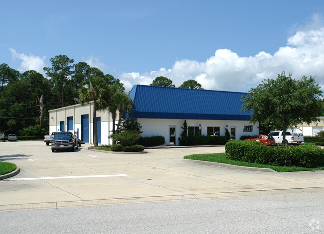
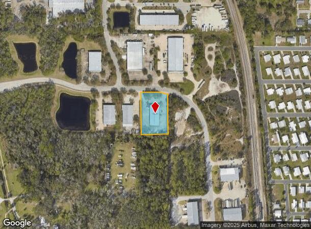
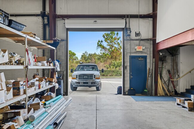
Property Record
4430 Eastport Park Way, Port Orange, FL 32127
NEARBY LISTINGS FOR SALE OR LEASE
Property Detail
4430 Eastport Park Way
Deltona-Daytona Beach-Ormond Beach, FL
Corner
6310-25-00-0030
E 34 FT OF LOT 2 & LOT 3 EXC TRI IN NE CORNER MEAS 158.56 FT ON E/L & & APPROX 172 FT ON W/L & W 2.29 FT OF LOT 4 MEAS ON S/L PER OR 4990 PG 1772
Lightindustrial
Volusia
X
Florida
12127C0388J
2,3
2025
1.16 AC
2025
South Beach Cities
082503
Deltona/Daytona Beach
9,612 SF
DEMOGRAPHICS near 4430 Eastport Park Way
1 Mile
3 Mile
5 Mile
2024 Total Population
7,069
58,958
116,012
2029 Population
7,819
65,796
129,134
Pop Growth 2024-2029
+ 10.61%
+ 11.60%
+ 11.31%
Average Age
48
48
46
2024 Total Households
3,407
27,576
52,837
HH Growth 2024-2029
+ 10.80%
+ 12.00%
+ 11.81%
Median Household Inc
$38,093
$53,728
$54,606
Avg Household Size
2.10
2.10
2.10
2024 Avg HH Vehicles
1.00
2.00
2.00
Median Home Value
$122,082
$226,165
$243,810
Median Year Built
1977
1982
1984
Nearby Places
Map Layers
Map Styles
 Street
 Aerial
- Restaurants
- Banks
- Shops
- Fitness
- Groceries
PUBLIC TRANSPORTATION
AIRPORT
Daytona Beach International
DRIVE
WALK
Distance
Daytona Beach International
16 min
7.9 mi
Orlando Sanford International
DRIVE
WALK
Distance
Orlando Sanford International
57 min
39.2 mi
Nearby Properties
Address
Land Use
TOTAL SIZE
Lot Size
Zoning
Address
Land Use
TOTAL SIZE
Lot Size
Zoning
490,775 SF
34.26 AC
01MH1
Address
Land Use
TOTAL SIZE
Lot Size
Zoning
396,385 SF
10 AC
01A2
Address
Land Use
TOTAL SIZE
Lot Size
Zoning
448,867 SF
5.54 AC
Address
Land Use
TOTAL SIZE
Lot Size
Zoning
408,078 SF
50.07 AC
Address
Land Use
TOTAL SIZE
Lot Size
Zoning
330,883 SF
19.59 AC
Address
Land Use
TOTAL SIZE
Lot Size
Zoning
325,744 SF
12.23 AC
Address
Land Use
TOTAL SIZE
Lot Size
Zoning
300,516 SF
70 AC
A2
Address
Land Use
TOTAL SIZE
Lot Size
Zoning
379,591 SF
21.62 AC
MH1
Address
Land Use
TOTAL SIZE
Lot Size
Zoning
306,467 SF
20.76 AC
Address
Land Use
TOTAL SIZE
Lot Size
Zoning
10,360 SF
1.56 AC
Address
Land Use
TOTAL SIZE
Lot Size
Zoning
150,197 SF
16.07 AC
Address
Land Use
TOTAL SIZE
Lot Size
Zoning
94,338 SF
7.39 AC
Address
Land Use
TOTAL SIZE
Lot Size
Zoning
184,242 SF
14.43 AC
Address
Land Use
TOTAL SIZE
Lot Size
Zoning
9,952 SF
9.30 AC
16RMH
Address
Land Use
TOTAL SIZE
Lot Size
Zoning
201,947 SF
0.23 AC
Address
Land Use
TOTAL SIZE
Lot Size
Zoning
269,160 SF
72.17 AC
16A
Address
Land Use
TOTAL SIZE
Lot Size
Zoning
156,994 SF
47.82 AC
16A
Address
Land Use
TOTAL SIZE
Lot Size
Zoning
155,590 SF
11.08 AC
16R3H
Address
Land Use
TOTAL SIZE
Lot Size
Zoning
8,355 SF
1 AC
MH1
Address
Land Use
TOTAL SIZE
Lot Size
Zoning
9,061 SF
0.23 AC
16RMH
Address
Land Use
TOTAL SIZE
Lot Size
Zoning
148,848 SF
9.99 AC
16R3H
Address
Land Use
TOTAL SIZE
Lot Size
Zoning
3,886 SF
3.99 AC
16RMH
Address
Land Use
TOTAL SIZE
Lot Size
Zoning
Address
Land Use
TOTAL SIZE
Lot Size
Zoning
173,765 SF
0.32 AC
Address
Land Use
TOTAL SIZE
Lot Size
Zoning
9,833 SF
52.38 AC
16RMH
Address
Land Use
TOTAL SIZE
Lot Size
Zoning
131,376 SF
1.88 AC
03T
Address
Land Use
TOTAL SIZE
Lot Size
Zoning
212,782 SF
0.71 AC
Address
Land Use
TOTAL SIZE
Lot Size
Zoning
4,166 SF
51.05 AC
Address
Land Use
TOTAL SIZE
Lot Size
Zoning
157,147 SF
47.79 AC
16A
Address
Land Use
TOTAL SIZE
Lot Size
Zoning
327,223 SF
21.66 AC
The World's #1 Commercial Real Estate Marketplace
Connect with us
© 2025 CoStar Group
The information above has been obtained from sources believed reliable. While we do not doubt its accuracy we have not verified it and make no guarantee, warranty or representation about it. It is your responsibility to independently confirm its accuracy and completeness. Any projections, opinions, assumptions, or estimates used are for example only and do not represent the current or future performance of the property. The value of this transaction to you depends on tax and other factors which should be evaluated by your tax, financial, and legal advisors. You and your advisors should conduct a careful, independent investigation of the property to determine to your satisfaction the suitability of the property for your needs.