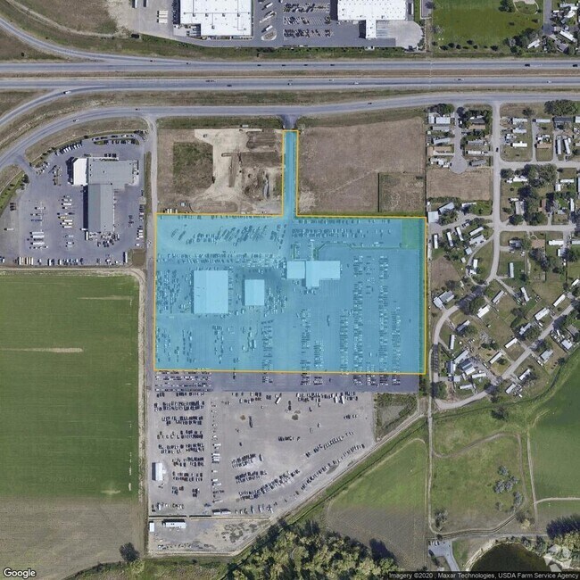
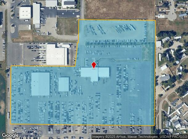
Property Record
4432 S Frontage Rd, Billings, MT 59101
NEARBY LISTINGS FOR SALE OR LEASE
Property Detail
4432 S Frontage Rd
Billings, MT
Willowbrook Subd
03-0927-16-2-10-20-6001
WILLOWBROOK SUBD, S16, T01 S, R26 E, BLOCK 1, LOT 4A2, & LT 5**MULTI DIST** 21.74 AC IN 2T5; 20.22 AC IN O2 (21)
Commercialnec
Yellowstone
X
Montana
30111C1460E
4a2
2024
22.22 AC
2025
Billings
000901
Other Market Areas
70,152 SF
DEMOGRAPHICS near 4432 S Frontage Rd
1 Mile
3 Mile
5 Mile
2024 Total Population
4,523
44,352
93,139
2029 Population
4,910
47,924
100,797
Pop Growth 2024-2029
+ 8.56%
+ 8.05%
+ 8.22%
Average Age
38
39
40
2024 Total Households
1,741
19,305
40,263
HH Growth 2024-2029
+ 8.73%
+ 8.21%
+ 8.41%
Median Household Inc
$62,394
$54,741
$65,010
Avg Household Size
2.50
2.20
2.20
2024 Avg HH Vehicles
2.00
2.00
2.00
Median Home Value
$181,183
$239,480
$278,220
Median Year Built
1973
1962
1974
Nearby Places
Map Layers
Map Styles
 Street
 Aerial
- Restaurants
- Banks
- Shops
- Fitness
- Groceries
PUBLIC TRANSPORTATION
AIRPORT
Billings Logan International
DRIVE
WALK
Distance
Billings Logan International
28 min
9.3 mi
Freight Ports
Port of Everett
DRIVE
WALK
Distance
Port of Everett
883 min
840.1 mi
Nearby Properties
Address
Land Use
TOTAL SIZE
Lot Size
Zoning
Address
Land Use
TOTAL SIZE
Lot Size
Zoning
704,701 SF
9.06 AC
MCPZD
Address
Land Use
TOTAL SIZE
Lot Size
Zoning
198,096 SF
7.48 AC
MCPZD
Address
Land Use
TOTAL SIZE
Lot Size
Zoning
295,400 SF
17 AC
Address
Land Use
TOTAL SIZE
Lot Size
Zoning
9.37 AC
P
Address
Land Use
TOTAL SIZE
Lot Size
Zoning
258,977 SF
18.05 AC
CI
Address
Land Use
TOTAL SIZE
Lot Size
Zoning
213,615 SF
0.96 AC
CBD
Address
Land Use
TOTAL SIZE
Lot Size
Zoning
76,098 SF
0.80 AC
CBD
Address
Land Use
TOTAL SIZE
Lot Size
Zoning
537,468 SF
36.83 AC
CC
Address
Land Use
TOTAL SIZE
Lot Size
Zoning
108,000 SF
2.07 AC
CBD
Address
Land Use
TOTAL SIZE
Lot Size
Zoning
145,168 SF
0.96 AC
CBD
Address
Land Use
TOTAL SIZE
Lot Size
Zoning
218,478 SF
18.19 AC
CI
Address
Land Use
TOTAL SIZE
Lot Size
Zoning
109,714 SF
NC
Address
Land Use
TOTAL SIZE
Lot Size
Zoning
172.22 AC
Address
Land Use
TOTAL SIZE
Lot Size
Zoning
71,600 SF
0.15 AC
CBD
Address
Land Use
TOTAL SIZE
Lot Size
Zoning
177,290 SF
14.59 AC
HC
Address
Land Use
TOTAL SIZE
Lot Size
Zoning
188,907 SF
3.83 AC
CC
Address
Land Use
TOTAL SIZE
Lot Size
Zoning
149,797 SF
12.95 AC
CC
Address
Land Use
TOTAL SIZE
Lot Size
Zoning
234,444 SF
4.98 AC
MCPZD
Address
Land Use
TOTAL SIZE
Lot Size
Zoning
63,650 SF
4.13 AC
MCPZD
Address
Land Use
TOTAL SIZE
Lot Size
Zoning
118,640 SF
12.55 AC
P
Address
Land Use
TOTAL SIZE
Lot Size
Zoning
1,200 SF
57.17 AC
P
Address
Land Use
TOTAL SIZE
Lot Size
Zoning
409,620 SF
27.42 AC
CI
Address
Land Use
TOTAL SIZE
Lot Size
Zoning
141,186 SF
2.62 AC
CBD
Address
Land Use
TOTAL SIZE
Lot Size
Zoning
111,120 SF
1.91 AC
CBD
Address
Land Use
TOTAL SIZE
Lot Size
Zoning
90,220 SF
0.96 AC
CBD
Address
Land Use
TOTAL SIZE
Lot Size
Zoning
85,198 SF
0.48 AC
CBD
Address
Land Use
TOTAL SIZE
Lot Size
Zoning
155,084 SF
13.78 AC
P
Address
Land Use
TOTAL SIZE
Lot Size
Zoning
72,000 SF
0.31 AC
MCPZD
Address
Land Use
TOTAL SIZE
Lot Size
Zoning
167,744 SF
16.45 AC
CI
Address
Land Use
TOTAL SIZE
Lot Size
Zoning
108,563 SF
4.38 AC
CBD
The World's #1 Commercial Real Estate Marketplace
Connect with us
© 2026 CoStar Group
The information above has been obtained from sources believed reliable. While we do not doubt its accuracy we have not verified it and make no guarantee, warranty or representation about it. It is your responsibility to independently confirm its accuracy and completeness. Any projections, opinions, assumptions, or estimates used are for example only and do not represent the current or future performance of the property. The value of this transaction to you depends on tax and other factors which should be evaluated by your tax, financial, and legal advisors. You and your advisors should conduct a careful, independent investigation of the property to determine to your satisfaction the suitability of the property for your needs.