Property Record
44354 Highway 445, Robert, LA 70455


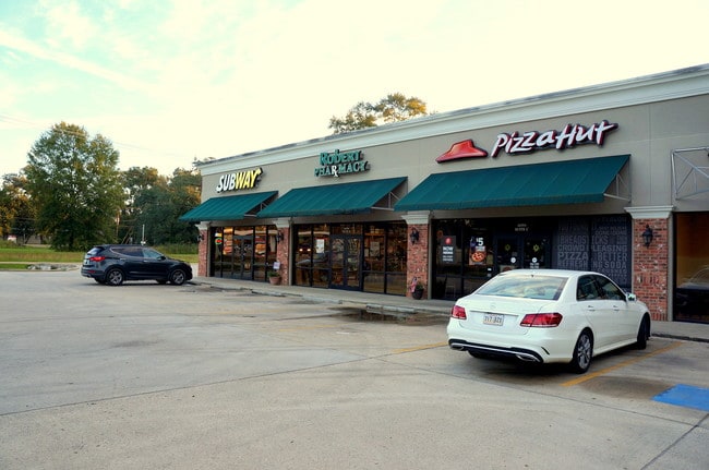
Property Detail
44354 Highway 445
02322501
0.93A IN FRAC NW14 OF NW14 OF SEC 30 T6SR9E B610 P552 B931 P711 B1087 P234-595 B1091 P574 MAP 1091574
Commercialnec
Tangipahoa
AE The base floodplain where base flood elevations are provided. AE Zones are now used on new format FIRMs instead of A1-A30 Zones.
Louisiana
2025
0.93 AC
2025
Louisiana South Area
954602
Other Market Areas
6,000 SF
Hammond, LA
NEARBY LISTINGS FOR SALE OR LEASE
-
-
View all Robert listings for lease on LoopNet.com
DEMOGRAPHICS near 44354 Highway 445
1 mile
3 mile
5 mile
2025 Total Population
644
4,533
18,734
2030 Population
675
4,750
19,615
Pop Growth 2025-2030
+ 4.81%
+ 4.79%
+ 4.70%
Average Age
39
39
38
2025 Total Households
239
1,706
7,193
HH Growth 2025-2030
+ 4.60%
+ 4.98%
+ 4.88%
Median Household Inc
$59,999
$59,398
$62,074
Avg Household Size
2.60
2.60
2.60
2025 Avg HH Vehicles
2.00
2.00
2.00
Median Home Value
$203,906
$225,000
$232,707
Median Year Built
2001
2005
2004
Nearby Places
Map Layers
Map Styles
 Street
 Aerial
Layers
 Traffic
 Biking
Places
Listings with unknown addresses are not visible on the map
- Restaurants
- Banks
- Shops
- Fitness
- Groceries
PUBLIC TRANSPORTATION
COMMUTER RAIL
Hammond Amtrak Station (City of New Orleans - Amtrak)
Drive
Walk
Distance
Hammond Amtrak Station (City of New Orleans - Amtrak)
11 min
7.5 mi
Freight Ports
Port of New Orleans
Drive
Walk
Distance
Port of New Orleans
80 min
56.9 mi
SALE & LEASE HISTORY
LISTING DATE
SALE/LEASE

Nov 07, 2018
For Lease
Nearby Properties
Address
Land Use
TOTAL SIZE
Lot Size
Zoning
Address
Land Use
TOTAL SIZE
Lot Size
Zoning
876,200 SF
117.84 AC
Address
Land Use
TOTAL SIZE
Lot Size
Zoning
455,845 SF
1 AC
Address
Land Use
TOTAL SIZE
Lot Size
Zoning
124,000 SF
23.77 AC
Address
Land Use
TOTAL SIZE
Lot Size
Zoning
42,000 SF
7.46 AC
Address
Land Use
TOTAL SIZE
Lot Size
Zoning
2,200 SF
99.95 AC
Address
Land Use
TOTAL SIZE
Lot Size
Zoning
6,680 SF
55.61 AC
Address
Land Use
TOTAL SIZE
Lot Size
Zoning
6,043 SF
1.74 AC
Address
Land Use
TOTAL SIZE
Lot Size
Zoning
17,490 SF
61.19 AC
Address
Land Use
TOTAL SIZE
Lot Size
Zoning
7,700 SF
3.51 AC
Address
Land Use
TOTAL SIZE
Lot Size
Zoning
5,251 SF
28.13 AC
Address
Land Use
TOTAL SIZE
Lot Size
Zoning
7,150 SF
10.02 AC
Address
Land Use
TOTAL SIZE
Lot Size
Zoning
10,640 SF
1.38 AC
Address
Land Use
TOTAL SIZE
Lot Size
Zoning
17,260 SF
3 AC
Address
Land Use
TOTAL SIZE
Lot Size
Zoning
5,000 SF
2.40 AC
Address
Land Use
TOTAL SIZE
Lot Size
Zoning
Address
Land Use
TOTAL SIZE
Lot Size
Zoning
7,500 SF
6.24 AC
Address
Land Use
TOTAL SIZE
Lot Size
Zoning
9,600 SF
57.35 AC
Address
Land Use
TOTAL SIZE
Lot Size
Zoning
Address
Land Use
TOTAL SIZE
Lot Size
Zoning
20,405 SF
55.30 AC
Address
Land Use
TOTAL SIZE
Lot Size
Zoning
4,689 SF
1.50 AC
Address
Land Use
TOTAL SIZE
Lot Size
Zoning
11,592 SF
24.37 AC
Address
Land Use
TOTAL SIZE
Lot Size
Zoning
5,623 SF
1.89 AC
Address
Land Use
TOTAL SIZE
Lot Size
Zoning
5,707 SF
7.01 AC
Address
Land Use
TOTAL SIZE
Lot Size
Zoning
14,325 SF
1.46 AC
Address
Land Use
TOTAL SIZE
Lot Size
Zoning
16,260 SF
1.46 AC
Address
Land Use
TOTAL SIZE
Lot Size
Zoning
8,125 SF
0.81 AC
Address
Land Use
TOTAL SIZE
Lot Size
Zoning
4,868 SF
1 AC
Address
Land Use
TOTAL SIZE
Lot Size
Zoning
6,450 SF
2.73 AC
Address
Land Use
TOTAL SIZE
Lot Size
Zoning
4,800 SF
1.10 AC
The World's #1 Commercial Real Estate Marketplace
Connect with us
© 2026 CoStar Group
The information above has been obtained from sources believed reliable. While we do not doubt its accuracy we have not verified it and make no guarantee, warranty or representation about it. It is your responsibility to independently confirm its accuracy and completeness. Any projections, opinions, assumptions, or estimates used are for example only and do not represent the current or future performance of the property. The value of this transaction to you depends on tax and other factors which should be evaluated by your tax, financial, and legal advisors. You and your advisors should conduct a careful, independent investigation of the property to determine to your satisfaction the suitability of the property for your needs.