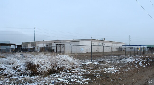
Property Record
444 E Amity Rd, Boise, ID 83716


NEARBY LISTINGS FOR SALE OR LEASE
Property Detail
444 E Amity Rd
S1026449000
PAR #9000 OF SE4 SEC 26 3N 2E
Commercialbuilding
Ada
X
Idaho
16001C0291J
6.51 AC
2024
Southeast Boise
2025
Boise City/Nampa
002100
Boise City, ID
78,990 SF
DEMOGRAPHICS near 444 E Amity Rd
1 Mile
3 Mile
5 Mile
2024 Total Population
6,475
58,024
116,164
2029 Population
7,262
65,934
132,223
Pop Growth 2024-2029
+ 12.15%
+ 13.63%
+ 13.82%
Average Age
41
39
39
2024 Total Households
2,672
24,817
50,600
HH Growth 2024-2029
+ 12.35%
+ 13.97%
+ 14.25%
Median Household Inc
$91,464
$81,620
$71,230
Avg Household Size
2.40
2.20
2.20
2024 Avg HH Vehicles
2.00
2.00
2.00
Median Home Value
$449,586
$477,808
$487,341
Median Year Built
1983
1989
1985
Nearby Places
Map Layers
Map Styles
 Street
 Aerial
- Restaurants
- Banks
- Shops
- Fitness
- Groceries
PUBLIC TRANSPORTATION
AIRPORT
Boise Air Trml/Gowen Field
DRIVE
WALK
Distance
Boise Air Trml/Gowen Field
20 min
6.2 mi
Freight Ports
Port of Portland
DRIVE
WALK
Distance
Port of Portland
483 min
435.6 mi
Nearby Properties
Address
Land Use
TOTAL SIZE
Lot Size
Zoning
Address
Land Use
TOTAL SIZE
Lot Size
Zoning
900,981 SF
86.35 AC
ZC-263
Address
Land Use
TOTAL SIZE
Lot Size
Zoning
251,614 SF
12.62 AC
ZC-245
Address
Land Use
TOTAL SIZE
Lot Size
Zoning
122,110 SF
12.66 AC
ZC-257
Address
Land Use
TOTAL SIZE
Lot Size
Zoning
258,747 SF
3.30 AC
ZC-266
Address
Land Use
TOTAL SIZE
Lot Size
Zoning
356,969 SF
49.72 AC
ZC-269
Address
Land Use
TOTAL SIZE
Lot Size
Zoning
197,268 SF
10.95 AC
R-3
Address
Land Use
TOTAL SIZE
Lot Size
Zoning
203,503 SF
7.93 AC
ZC-243
Address
Land Use
TOTAL SIZE
Lot Size
Zoning
245,240 SF
5.40 AC
R-2
Address
Land Use
TOTAL SIZE
Lot Size
Zoning
214,318 SF
13.77 AC
R-2
Address
Land Use
TOTAL SIZE
Lot Size
Zoning
259,565 SF
4.07 AC
SP-02
Address
Land Use
TOTAL SIZE
Lot Size
Zoning
364,998 SF
40.53 AC
ZC-269
Address
Land Use
TOTAL SIZE
Lot Size
Zoning
10.03 AC
R-3
Address
Land Use
TOTAL SIZE
Lot Size
Zoning
215,141 SF
5.25 AC
SP-01
Address
Land Use
TOTAL SIZE
Lot Size
Zoning
157,347 SF
7.97 AC
R-3
Address
Land Use
TOTAL SIZE
Lot Size
Zoning
366,032 SF
10.79 AC
ZC-248
Address
Land Use
TOTAL SIZE
Lot Size
Zoning
237,251 SF
20.90 AC
ZC-269
Address
Land Use
TOTAL SIZE
Lot Size
Zoning
144,785 SF
2.89 AC
ZC-243
Address
Land Use
TOTAL SIZE
Lot Size
Zoning
220,160 SF
12.70 AC
ZC-269
Address
Land Use
TOTAL SIZE
Lot Size
Zoning
190,180 SF
14.43 AC
R-2
Address
Land Use
TOTAL SIZE
Lot Size
Zoning
237,299 SF
20.32 AC
ZC-269
Address
Land Use
TOTAL SIZE
Lot Size
Zoning
125,305 SF
1.08 AC
ZC-248
Address
Land Use
TOTAL SIZE
Lot Size
Zoning
127,351 SF
4.42 AC
ZC-243
Address
Land Use
TOTAL SIZE
Lot Size
Zoning
50,674 SF
49.82 AC
ZC-258
Address
Land Use
TOTAL SIZE
Lot Size
Zoning
150,147 SF
3.94 AC
SP-01
Address
Land Use
TOTAL SIZE
Lot Size
Zoning
140,088 SF
8.46 AC
R-2
Address
Land Use
TOTAL SIZE
Lot Size
Zoning
161,421 SF
10.05 AC
R-3
Address
Land Use
TOTAL SIZE
Lot Size
Zoning
246,070 SF
15.08 AC
ZC-243
Address
Land Use
TOTAL SIZE
Lot Size
Zoning
173,766 SF
9.53 AC
ZC-245
Address
Land Use
TOTAL SIZE
Lot Size
Zoning
3.41 AC
SP-02
Address
Land Use
TOTAL SIZE
Lot Size
Zoning
187,820 SF
11.39 AC
ZC-269
The World's #1 Commercial Real Estate Marketplace
Connect with us
© 2026 CoStar Group
The information above has been obtained from sources believed reliable. While we do not doubt its accuracy we have not verified it and make no guarantee, warranty or representation about it. It is your responsibility to independently confirm its accuracy and completeness. Any projections, opinions, assumptions, or estimates used are for example only and do not represent the current or future performance of the property. The value of this transaction to you depends on tax and other factors which should be evaluated by your tax, financial, and legal advisors. You and your advisors should conduct a careful, independent investigation of the property to determine to your satisfaction the suitability of the property for your needs.