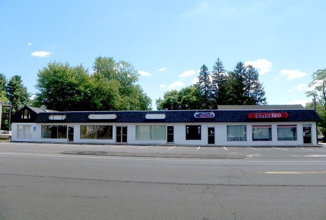
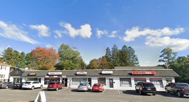
Property Record
444 East St, Plainville, CT 06062

NEARBY LISTINGS FOR SALE OR LEASE
Property Detail
444 East St
PLAI-000042-E000000-000005
Hartford
Storebuilding
Connecticut
X
5
09003C0488G
0.60 AC
2025
Southwest Outlying
2025
Hartford
420601
Hartford-West Hartford-East Hartford, CT
10,712 SF
DEMOGRAPHICS near 444 East St
1 Mile
3 Mile
5 Mile
2024 Total Population
6,618
43,452
153,670
2029 Population
6,591
43,437
153,114
Pop Growth 2024-2029
(0.41%)
(0.03%)
(0.36%)
Average Age
43
43
42
2024 Total Households
2,930
18,927
63,900
HH Growth 2024-2029
(0.44%)
(0.07%)
(0.37%)
Median Household Inc
$74,180
$75,924
$70,339
Avg Household Size
2.20
2.20
2.30
2024 Avg HH Vehicles
2.00
2.00
2.00
Median Home Value
$248,178
$245,230
$245,397
Median Year Built
1969
1971
1963
Nearby Places
Map Layers
Map Styles
 Street
 Aerial
- Restaurants
- Banks
- Shops
- Fitness
- Groceries
PUBLIC TRANSPORTATION
AIRPORT
Bradley International
DRIVE
WALK
Distance
Bradley International
38 min
29.7 mi
Freight Ports
Port of Davisville, RI
DRIVE
WALK
Distance
Port of Davisville, RI
1 min
75.4 mi
SALE & LEASE HISTORY
LISTING DATE
SALE/LEASE

Sep 25, 2016
For Lease
Sep 23, 2016
For Sale
May 09, 2018
For Sale
May 09, 2018
For Lease
Nearby Properties
Address
Land Use
TOTAL SIZE
Lot Size
Zoning
Address
Land Use
TOTAL SIZE
Lot Size
Zoning
77,001 SF
54.59 AC
IP-1
Address
Land Use
TOTAL SIZE
Lot Size
Zoning
100,304 SF
28.80 AC
IP-1
Address
Land Use
TOTAL SIZE
Lot Size
Zoning
134,488 SF
63.26 AC
GC
Address
Land Use
TOTAL SIZE
Lot Size
Zoning
138.27 AC
S1
Address
Land Use
TOTAL SIZE
Lot Size
Zoning
64,822 SF
9.47 AC
TP
Address
Land Use
TOTAL SIZE
Lot Size
Zoning
58,473 SF
18.20 AC
IP-1
Address
Land Use
TOTAL SIZE
Lot Size
Zoning
145,719 SF
17.90 AC
R-15
Address
Land Use
TOTAL SIZE
Lot Size
Zoning
395,492 SF
54.09 AC
R-20/2
Address
Land Use
TOTAL SIZE
Lot Size
Zoning
114,375 SF
12.72 AC
IP-1
Address
Land Use
TOTAL SIZE
Lot Size
Zoning
330,400 SF
36.90 AC
IP-1
Address
Land Use
TOTAL SIZE
Lot Size
Zoning
28.47 AC
R-10
Address
Land Use
TOTAL SIZE
Lot Size
Zoning
288,827 SF
24.01 AC
RI
Address
Land Use
TOTAL SIZE
Lot Size
Zoning
502,440 SF
27.87 AC
I-2
Address
Land Use
TOTAL SIZE
Lot Size
Zoning
17.62 AC
B
Address
Land Use
TOTAL SIZE
Lot Size
Zoning
29.05 AC
R-20
Address
Land Use
TOTAL SIZE
Lot Size
Zoning
149,912 SF
13.66 AC
B
Address
Land Use
TOTAL SIZE
Lot Size
Zoning
3,084 SF
14.90 AC
BG
Address
Land Use
TOTAL SIZE
Lot Size
Zoning
133,720 SF
7.34 AC
IP-1
Address
Land Use
TOTAL SIZE
Lot Size
Zoning
19 AC
GI
Address
Land Use
TOTAL SIZE
Lot Size
Zoning
16.04 AC
B
Address
Land Use
TOTAL SIZE
Lot Size
Zoning
98,463 SF
5.01 AC
I-1
Address
Land Use
TOTAL SIZE
Lot Size
Zoning
106,336 SF
7.63 AC
B2
Address
Land Use
TOTAL SIZE
Lot Size
Zoning
109,212 SF
20.15 AC
B
Address
Land Use
TOTAL SIZE
Lot Size
Zoning
95,940 SF
12 AC
B
Address
Land Use
TOTAL SIZE
Lot Size
Zoning
12.28 AC
R-20/2
Address
Land Use
TOTAL SIZE
Lot Size
Zoning
40 AC
I-2
Address
Land Use
TOTAL SIZE
Lot Size
Zoning
101,495 SF
9.74 AC
B
Address
Land Use
TOTAL SIZE
Lot Size
Zoning
67,503 SF
2.53 AC
B
Address
Land Use
TOTAL SIZE
Lot Size
Zoning
56,734 SF
8.83 AC
R-12
Address
Land Use
TOTAL SIZE
Lot Size
Zoning
97,356 SF
3.40 AC
I
The World's #1 Commercial Real Estate Marketplace
Connect with us
© 2025 CoStar Group
The information above has been obtained from sources believed reliable. While we do not doubt its accuracy we have not verified it and make no guarantee, warranty or representation about it. It is your responsibility to independently confirm its accuracy and completeness. Any projections, opinions, assumptions, or estimates used are for example only and do not represent the current or future performance of the property. The value of this transaction to you depends on tax and other factors which should be evaluated by your tax, financial, and legal advisors. You and your advisors should conduct a careful, independent investigation of the property to determine to your satisfaction the suitability of the property for your needs.