Property Record
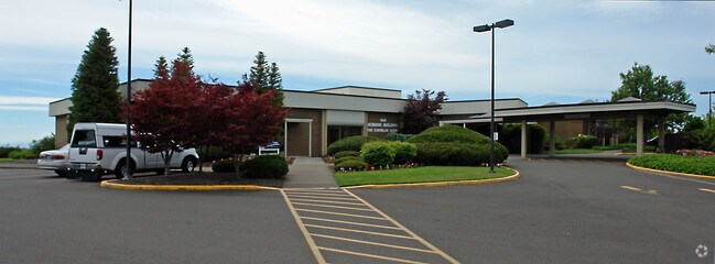
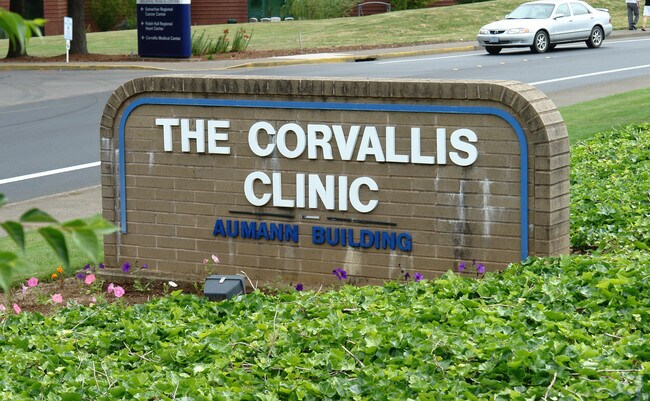
444 Nw Elks Dr, Corvallis, OR 97330

Property Detail
444 Nw Elks Dr
338745
PARTITION PLAT 92-022 LOT PARCEL 1
Commercialbuilding
Benton
P-AO
Oregon
B and X Area of moderate flood hazard, usually the area between the limits of the 100-year and 500-year floods.
1
2024
7.78 AC
2025
Oregon West Area
000500
Other Market Areas
141,297 SF
Corvallis, OR
NEARBY LISTINGS FOR SALE OR LEASE
DEMOGRAPHICS near 444 Nw Elks Dr
1 mile
3 mile
5 mile
2025 Total Population
8,415
52,019
74,203
2030 Population
8,529
54,264
77,065
Pop Growth 2025-2030
+ 1.35%
+ 4.32%
+ 3.86%
Average Age
42
36
38
2025 Total Households
3,707
20,332
29,685
HH Growth 2025-2030
+ 1.32%
+ 4.75%
+ 4.13%
Median Household Inc
$67,112
$59,518
$66,460
Avg Household Size
2.20
2.20
2.20
2025 Avg HH Vehicles
2.00
2.00
2.00
Median Home Value
$397,612
$521,939
$536,837
Median Year Built
1977
1976
1979
Nearby Places
Map Layers
Map Styles
 Street
 Aerial
Transit
 Traffic
 Biking
Places
Listings with unknown addresses are not visible on the map
- Restaurants
- Banks
- Shops
- Fitness
- Groceries
PUBLIC TRANSPORTATION
AIRPORT
Mahlon Sweet Field
Drive
Walk
Distance
Mahlon Sweet Field
64 min
38.7 mi
Nearby Properties
Address
Land Use
TOTAL SIZE
Lot Size
Zoning
Address
Land Use
TOTAL SIZE
Lot Size
Zoning
1,687,456 SF
178.96 AC
OSU
Address
Land Use
TOTAL SIZE
Lot Size
Zoning
Address
Land Use
TOTAL SIZE
Lot Size
Zoning
Address
Land Use
TOTAL SIZE
Lot Size
Zoning
298,527 SF
32.61 AC
PD(RS-3.5)
Address
Land Use
TOTAL SIZE
Lot Size
Zoning
247,098 SF
16.39 AC
OSU
Address
Land Use
TOTAL SIZE
Lot Size
Zoning
321,584 SF
21.48 AC
RS-9
Address
Land Use
TOTAL SIZE
Lot Size
Zoning
195,325 SF
26.28 AC
RS-3.5
Address
Land Use
TOTAL SIZE
Lot Size
Zoning
866,072 SF
52.82 AC
P
Address
Land Use
TOTAL SIZE
Lot Size
Zoning
120,379 SF
11.85 AC
OSU
Address
Land Use
TOTAL SIZE
Lot Size
Zoning
339,006 SF
0.69 AC
RF
Address
Land Use
TOTAL SIZE
Lot Size
Zoning
Address
Land Use
TOTAL SIZE
Lot Size
Zoning
91,272 SF
1.27 AC
OSU
Address
Land Use
TOTAL SIZE
Lot Size
Zoning
330,693 SF
1.25 AC
MUE
Address
Land Use
TOTAL SIZE
Lot Size
Zoning
20.84 AC
GI
Address
Land Use
TOTAL SIZE
Lot Size
Zoning
106,538 SF
4.38 AC
RS-12
Address
Land Use
TOTAL SIZE
Lot Size
Zoning
215,337 SF
16.20 AC
RS-20
Address
Land Use
TOTAL SIZE
Lot Size
Zoning
297,220 SF
2.67 AC
OSU
Address
Land Use
TOTAL SIZE
Lot Size
Zoning
166,415 SF
3.04 AC
OSU
Address
Land Use
TOTAL SIZE
Lot Size
Zoning
47,966 SF
2.44 AC
RS-9
Address
Land Use
TOTAL SIZE
Lot Size
Zoning
176,703 SF
3.43 AC
OSU
Address
Land Use
TOTAL SIZE
Lot Size
Zoning
116,863 SF
2.10 AC
OSU
Address
Land Use
TOTAL SIZE
Lot Size
Zoning
81,113 SF
1.81 AC
PD(RS-20)
Address
Land Use
TOTAL SIZE
Lot Size
Zoning
129,103 SF
6.95 AC
PD(RS-12)
Address
Land Use
TOTAL SIZE
Lot Size
Zoning
85,211 SF
1.15 AC
PD(RS-3.5)
Address
Land Use
TOTAL SIZE
Lot Size
Zoning
146,932 SF
6.41 AC
MUCS
Address
Land Use
TOTAL SIZE
Lot Size
Zoning
74,046 SF
9.53 AC
PD(RS-3.5)
Address
Land Use
TOTAL SIZE
Lot Size
Zoning
218,015 SF
11.69 AC
PD(RS-12)
Address
Land Use
TOTAL SIZE
Lot Size
Zoning
112,216 SF
11.30 AC
PD(NC-MAJO
Address
Land Use
TOTAL SIZE
Lot Size
Zoning
192,991 SF
10.19 AC
GI
Address
Land Use
TOTAL SIZE
Lot Size
Zoning
122,984 SF
2.56 AC
RS-20
The World's #1 Commercial Real Estate Marketplace
Connect with us
© 2026 CoStar Group
The information above has been obtained from sources believed reliable. While we do not doubt its accuracy we have not verified it and make no guarantee, warranty or representation about it. It is your responsibility to independently confirm its accuracy and completeness. Any projections, opinions, assumptions, or estimates used are for example only and do not represent the current or future performance of the property. The value of this transaction to you depends on tax and other factors which should be evaluated by your tax, financial, and legal advisors. You and your advisors should conduct a careful, independent investigation of the property to determine to your satisfaction the suitability of the property for your needs.