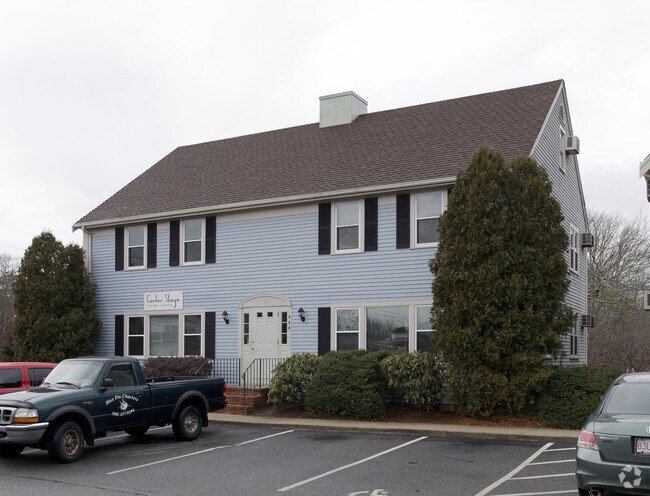
Property Record
444 Waquoit Hwy, East Falmouth, MA 02536
Current Lease Availabilities
NEARBY LISTINGS FOR SALE OR LEASE
Property Detail
444 Waquoit Hwy
FALM-000030-000006-000019-000001-U
Barnstable
Commercialcondominium
Massachusetts
X
1u
25001C0734J
1 AC
2025
Cape Cod
2025
Other Market Areas
014500
Barnstable Town, MA
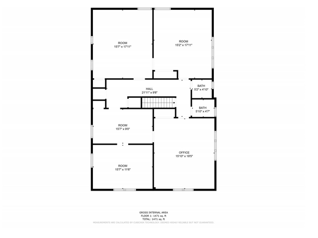
3,840 SF
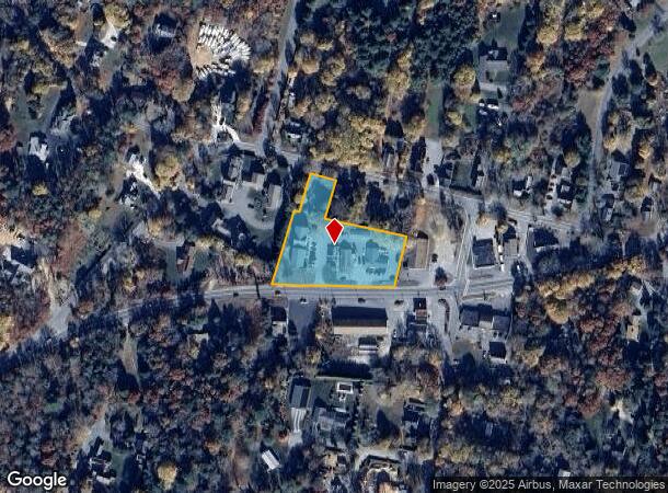
DEMOGRAPHICS near 444 Waquoit Hwy
1 Mile
3 Mile
5 Mile
2024 Total Population
1,851
19,084
39,239
2029 Population
1,914
20,008
40,977
Pop Growth 2024-2029
+ 3.40%
+ 4.84%
+ 4.43%
Average Age
49
51
50
2024 Total Households
799
8,760
17,818
HH Growth 2024-2029
+ 3.13%
+ 4.81%
+ 4.34%
Median Household Inc
$93,388
$84,097
$84,002
Avg Household Size
2.30
2.10
2.10
2024 Avg HH Vehicles
2.00
2.00
2.00
Median Home Value
$519,637
$478,351
$475,713
Median Year Built
1984
1983
1981
Nearby Places
Map Layers
Map Styles
 Street
 Aerial
- Restaurants
- Banks
- Shops
- Fitness
- Groceries
PUBLIC TRANSPORTATION
AIRPORT
Barnstable Municipal-Boardman-Polando Field
DRIVE
WALK
Distance
Barnstable Municipal-Boardman-Polando Field
33 min
16.5 mi
Nantucket Memorial
DRIVE
WALK
Distance
Nantucket Memorial
212 min
47.7 mi
Nearby Properties
Address
Land Use
TOTAL SIZE
Lot Size
Zoning
Address
Land Use
TOTAL SIZE
Lot Size
Zoning
287 AC
R3
Address
Land Use
TOTAL SIZE
Lot Size
Zoning
12,713 SF
29.28 AC
C1
Address
Land Use
TOTAL SIZE
Lot Size
Zoning
10.94 AC
R3
Address
Land Use
TOTAL SIZE
Lot Size
Zoning
181,756 SF
135.43 AC
R5
Address
Land Use
TOTAL SIZE
Lot Size
Zoning
333.20 AC
RA
Address
Land Use
TOTAL SIZE
Lot Size
Zoning
9 AC
C1
Address
Land Use
TOTAL SIZE
Lot Size
Zoning
15.10 AC
C1
Address
Land Use
TOTAL SIZE
Lot Size
Zoning
24.40 AC
R3
Address
Land Use
TOTAL SIZE
Lot Size
Zoning
2,993 SF
67.60 AC
R3
Address
Land Use
TOTAL SIZE
Lot Size
Zoning
65,930 SF
3.97 AC
C1
Address
Land Use
TOTAL SIZE
Lot Size
Zoning
59,880 SF
18.39 AC
PU
Address
Land Use
TOTAL SIZE
Lot Size
Zoning
24.50 AC
C2
Address
Land Use
TOTAL SIZE
Lot Size
Zoning
27.80 AC
R3
Address
Land Use
TOTAL SIZE
Lot Size
Zoning
29,449 SF
45.06 AC
R3
Address
Land Use
TOTAL SIZE
Lot Size
Zoning
41,386 SF
7.59 AC
AGA
Address
Land Use
TOTAL SIZE
Lot Size
Zoning
8,544 SF
20.31 AC
R3
Address
Land Use
TOTAL SIZE
Lot Size
Zoning
6.27 AC
R3
Address
Land Use
TOTAL SIZE
Lot Size
Zoning
8,910 SF
31.84 AC
R5
Address
Land Use
TOTAL SIZE
Lot Size
Zoning
1.26 AC
R3
Address
Land Use
TOTAL SIZE
Lot Size
Zoning
31,520 SF
3.89 AC
I1
Address
Land Use
TOTAL SIZE
Lot Size
Zoning
3,000 SF
260.39 AC
PU
Address
Land Use
TOTAL SIZE
Lot Size
Zoning
Address
Land Use
TOTAL SIZE
Lot Size
Zoning
6.26 AC
R3
Address
Land Use
TOTAL SIZE
Lot Size
Zoning
5.13 AC
Address
Land Use
TOTAL SIZE
Lot Size
Zoning
250.40 AC
R5
Address
Land Use
TOTAL SIZE
Lot Size
Zoning
16.45 AC
R3
Address
Land Use
TOTAL SIZE
Lot Size
Zoning
35.80 AC
R3
Address
Land Use
TOTAL SIZE
Lot Size
Zoning
240 SF
0.86 AC
R3
Address
Land Use
TOTAL SIZE
Lot Size
Zoning
21,396 SF
1.90 AC
C1
Address
Land Use
TOTAL SIZE
Lot Size
Zoning
3.37 AC
C1
The World's #1 Commercial Real Estate Marketplace
Connect with us
© 2025 CoStar Group
The information above has been obtained from sources believed reliable. While we do not doubt its accuracy we have not verified it and make no guarantee, warranty or representation about it. It is your responsibility to independently confirm its accuracy and completeness. Any projections, opinions, assumptions, or estimates used are for example only and do not represent the current or future performance of the property. The value of this transaction to you depends on tax and other factors which should be evaluated by your tax, financial, and legal advisors. You and your advisors should conduct a careful, independent investigation of the property to determine to your satisfaction the suitability of the property for your needs.