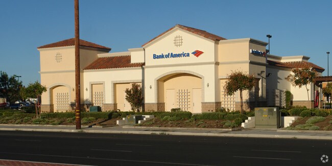
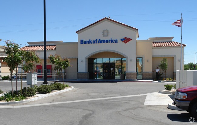
Property Record
44411 20Th St E, Lancaster, CA 93535


Property Detail
44411 20Th St E
3147-041-031
P M 323-67-68 LOT 4
Financialbuilding
LOS ANGELES
LRCP
California
C and X Area of minimal flood hazard, usually depicted on FIRMs as above the 500-year flood level.
4
2024
0.80 AC
2025
Antelope Valley
900609
Los Angeles
4,799 SF
Los Angeles-Long Beach-Glendale, CA
NEARBY LISTINGS FOR SALE OR LEASE
DEMOGRAPHICS near 44411 20Th St E
1 mile
3 mile
5 mile
2025 Total Population
23,649
83,558
131,039
2030 Population
23,421
83,346
131,275
Pop Growth 2025-2030
(0.96%)
(0.25%)
+ 0.18%
Average Age
36
36
37
2025 Total Households
6,659
24,442
41,456
HH Growth 2025-2030
(1.28%)
(0.38%)
+ 0.32%
Median Household Inc
$77,380
$64,172
$66,848
Avg Household Size
3.40
3.30
3.00
2025 Avg HH Vehicles
2.00
2.00
2.00
Median Home Value
$377,330
$344,659
$371,788
Median Year Built
1984
1983
1984
Nearby Places
Map Layers
Map Styles
 Street
 Aerial
Transit
 Traffic
 Biking
Places
Listings with unknown addresses are not visible on the map
- Restaurants
- Banks
- Shops
- Fitness
- Groceries
PUBLIC TRANSPORTATION
COMMUTER RAIL
Lancaster (Antelope Valley Line - Southern California Regional Rail Authority (Metrolink))
Drive
Walk
Distance
Lancaster (Antelope Valley Line - Southern California Regional Rail Authority (Metrolink))
6 min
3.0 mi
Palmdale (Antelope Valley Line - Southern California Regional Rail Authority (Metrolink))
Drive
Walk
Distance
Palmdale (Antelope Valley Line - Southern California Regional Rail Authority (Metrolink))
17 min
9.6 mi
Nearby Properties
Address
Land Use
TOTAL SIZE
Lot Size
Zoning
Address
Land Use
TOTAL SIZE
Lot Size
Zoning
106,569 SF
38.45 AC
LRRR2.5
Address
Land Use
TOTAL SIZE
Lot Size
Zoning
81,668 SF
5.67 AC
LRRPD65002
Address
Land Use
TOTAL SIZE
Lot Size
Zoning
876,730 SF
20.85 AC
LRCP
Address
Land Use
TOTAL SIZE
Lot Size
Zoning
166,272 SF
8.71 AC
LRRA7000*
Address
Land Use
TOTAL SIZE
Lot Size
Zoning
90,429 SF
4.59 AC
LRHDR*
Address
Land Use
TOTAL SIZE
Lot Size
Zoning
90,429 SF
4.38 AC
LRHDR*
Address
Land Use
TOTAL SIZE
Lot Size
Zoning
76,093 SF
1.37 AC
LRC3*
Address
Land Use
TOTAL SIZE
Lot Size
Zoning
481,066 SF
11.88 AC
LRRA7500*
Address
Land Use
TOTAL SIZE
Lot Size
Zoning
101,136 SF
4.18 AC
LRSP
Address
Land Use
TOTAL SIZE
Lot Size
Zoning
73,248 SF
3.56 AC
LRR325UDP*
Address
Land Use
TOTAL SIZE
Lot Size
Zoning
81,606 SF
3.55 AC
LRSP80-02*
Address
Land Use
TOTAL SIZE
Lot Size
Zoning
103,824 SF
3.58 AC
LRSP80-02*
Address
Land Use
TOTAL SIZE
Lot Size
Zoning
58,986 SF
4.11 AC
LRRPD65002
Address
Land Use
TOTAL SIZE
Lot Size
Zoning
74,702 SF
3.54 AC
LRSP80-02*
Address
Land Use
TOTAL SIZE
Lot Size
Zoning
95,620 SF
3.59 AC
LRSP80-02*
Address
Land Use
TOTAL SIZE
Lot Size
Zoning
153,664 SF
9.23 AC
Address
Land Use
TOTAL SIZE
Lot Size
Zoning
88,730 SF
10.03 AC
LRSP*
Address
Land Use
TOTAL SIZE
Lot Size
Zoning
56,016 SF
5.26 AC
LRRPD65002
Address
Land Use
TOTAL SIZE
Lot Size
Zoning
63,090 SF
2.27 AC
LRSP80-02*
Address
Land Use
TOTAL SIZE
Lot Size
Zoning
71,300 SF
5.25 AC
LRMDRZ*
Address
Land Use
TOTAL SIZE
Lot Size
Zoning
67,253 SF
12.24 AC
LRRA6500*
Address
Land Use
TOTAL SIZE
Lot Size
Zoning
48,826 SF
2.48 AC
LRHDR*
Address
Land Use
TOTAL SIZE
Lot Size
Zoning
48,826 SF
2.36 AC
LRHDR*
Address
Land Use
TOTAL SIZE
Lot Size
Zoning
113,960 SF
9 AC
LRD21*
Address
Land Use
TOTAL SIZE
Lot Size
Zoning
42,668 SF
3.49 AC
LRCPD
Address
Land Use
TOTAL SIZE
Lot Size
Zoning
106,485 SF
1.09 AC
LRC3*
Address
Land Use
TOTAL SIZE
Lot Size
Zoning
37,192 SF
2.65 AC
LRSP80-02*
Address
Land Use
TOTAL SIZE
Lot Size
Zoning
41,603 SF
2.17 AC
LRHDR*
Address
Land Use
TOTAL SIZE
Lot Size
Zoning
41,603 SF
2.07 AC
LRHDR*
Address
Land Use
TOTAL SIZE
Lot Size
Zoning
22,282 SF
2.18 AC
LRSP80-02*
The World's #1 Commercial Real Estate Marketplace
Connect with us
© 2026 CoStar Group
The information above has been obtained from sources believed reliable. While we do not doubt its accuracy we have not verified it and make no guarantee, warranty or representation about it. It is your responsibility to independently confirm its accuracy and completeness. Any projections, opinions, assumptions, or estimates used are for example only and do not represent the current or future performance of the property. The value of this transaction to you depends on tax and other factors which should be evaluated by your tax, financial, and legal advisors. You and your advisors should conduct a careful, independent investigation of the property to determine to your satisfaction the suitability of the property for your needs.