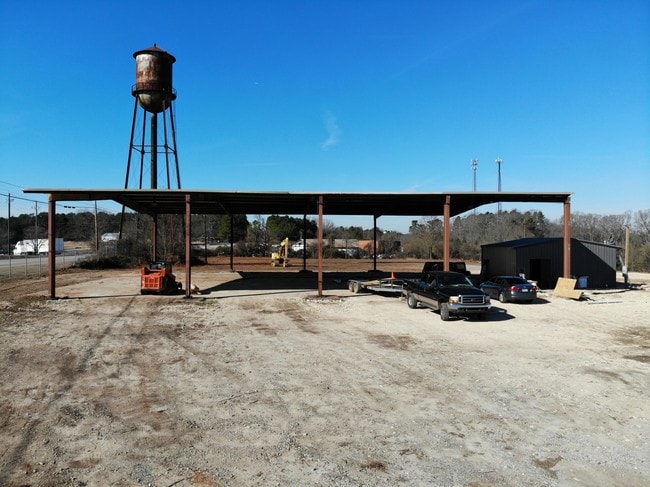
Property Record
4442 Maysville Rd, Commerce, GA 30529

NEARBY LISTINGS FOR SALE OR LEASE
Property Detail
4442 Maysville Rd
033-054
Tract 4
Commercialnec
4.70 AC TRACT 4 REV PLAT BK 24 PG 152 EXC ROW
X
Jackson
13157C0155C
Georgia
2025
4.69 AC
2024
Jackson County
010300
Atlanta
7,700 SF
Jefferson, GA
DEMOGRAPHICS near 4442 Maysville Rd
1 Mile
3 Mile
5 Mile
2024 Total Population
210
9,389
17,662
2029 Population
269
11,995
22,179
Pop Growth 2024-2029
+ 28.10%
+ 27.76%
+ 25.57%
Average Age
41
39
39
2024 Total Households
79
3,471
6,456
HH Growth 2024-2029
+ 26.58%
+ 26.36%
+ 24.36%
Median Household Inc
$61,000
$62,565
$60,135
Avg Household Size
2.50
2.60
2.70
2024 Avg HH Vehicles
2.00
2.00
2.00
Median Home Value
$257,499
$216,338
$232,160
Median Year Built
1987
1989
1988
Nearby Places
Map Layers
Map Styles
 Street
 Aerial
- Restaurants
- Banks
- Shops
- Fitness
- Groceries
SALE & LEASE HISTORY
LISTING DATE
SALE/LEASE

Jan 25, 2019
For Lease
Feb 22, 2019
For Lease
Nearby Properties
Address
Land Use
TOTAL SIZE
Lot Size
Zoning
Address
Land Use
TOTAL SIZE
Lot Size
Zoning
283.14 AC
MI
Address
Land Use
TOTAL SIZE
Lot Size
Zoning
47,853 SF
15.93 AC
R2
Address
Land Use
TOTAL SIZE
Lot Size
Zoning
1,208 SF
106.45 AC
M1
Address
Land Use
TOTAL SIZE
Lot Size
Zoning
962,280 SF
74.52 AC
MI
Address
Land Use
TOTAL SIZE
Lot Size
Zoning
52,325 SF
36.96 AC
HRC
Address
Land Use
TOTAL SIZE
Lot Size
Zoning
160,500 SF
235.35 AC
A6
Address
Land Use
TOTAL SIZE
Lot Size
Zoning
206,500 SF
14.13 AC
001
Address
Land Use
TOTAL SIZE
Lot Size
Zoning
170,100 SF
11.51 AC
001
Address
Land Use
TOTAL SIZE
Lot Size
Zoning
17,197 SF
318.04 AC
C2
Address
Land Use
TOTAL SIZE
Lot Size
Zoning
110,920 SF
49.30 AC
001
Address
Land Use
TOTAL SIZE
Lot Size
Zoning
101,750 SF
17.02 AC
C2
Address
Land Use
TOTAL SIZE
Lot Size
Zoning
86,931 SF
54.41 AC
001
Address
Land Use
TOTAL SIZE
Lot Size
Zoning
151,192 SF
27.32 AC
C2
Address
Land Use
TOTAL SIZE
Lot Size
Zoning
150,400 SF
13.91 AC
004
Address
Land Use
TOTAL SIZE
Lot Size
Zoning
126,216 SF
14.49 AC
E1
Address
Land Use
TOTAL SIZE
Lot Size
Zoning
12,065 SF
2.09 AC
C2
Address
Land Use
TOTAL SIZE
Lot Size
Zoning
89,000 SF
12.50 AC
M1
Address
Land Use
TOTAL SIZE
Lot Size
Zoning
7,980 SF
15 AC
002
Address
Land Use
TOTAL SIZE
Lot Size
Zoning
104,932 SF
23.60 AC
C2
Address
Land Use
TOTAL SIZE
Lot Size
Zoning
51,478 SF
1.52 AC
C2
Address
Land Use
TOTAL SIZE
Lot Size
Zoning
12,238 SF
1.73 AC
C2
Address
Land Use
TOTAL SIZE
Lot Size
Zoning
93.38 AC
GI
Address
Land Use
TOTAL SIZE
Lot Size
Zoning
13,398 SF
15 AC
B2
Address
Land Use
TOTAL SIZE
Lot Size
Zoning
80,000 SF
21.47 AC
C2
Address
Land Use
TOTAL SIZE
Lot Size
Zoning
114,246 SF
15.02 AC
C2
Address
Land Use
TOTAL SIZE
Lot Size
Zoning
40,000 SF
0.94 AC
002
Address
Land Use
TOTAL SIZE
Lot Size
Zoning
167.53 AC
M2
Address
Land Use
TOTAL SIZE
Lot Size
Zoning
10,496 SF
23.04 AC
C2
Address
Land Use
TOTAL SIZE
Lot Size
Zoning
12,872 SF
1.61 AC
C2
Address
Land Use
TOTAL SIZE
Lot Size
Zoning
4,072 SF
5.12 AC
C2
The World's #1 Commercial Real Estate Marketplace
Connect with us
© 2026 CoStar Group
The information above has been obtained from sources believed reliable. While we do not doubt its accuracy we have not verified it and make no guarantee, warranty or representation about it. It is your responsibility to independently confirm its accuracy and completeness. Any projections, opinions, assumptions, or estimates used are for example only and do not represent the current or future performance of the property. The value of this transaction to you depends on tax and other factors which should be evaluated by your tax, financial, and legal advisors. You and your advisors should conduct a careful, independent investigation of the property to determine to your satisfaction the suitability of the property for your needs.