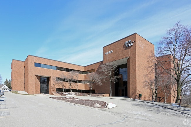
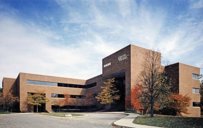
Property Record
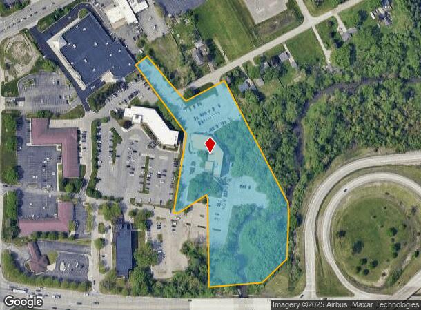
4444 W Bristol Rd, Flint, MI 48507
NEARBY LISTINGS FOR SALE OR LEASE
Property Detail
4444 W Bristol Rd
Flint, MI
Supervisors Plat #4
07-28-551-048
LOT 48 MILLER ROAD ACRES & PART OF LOTS 36 37 40 & 41 SUP PL NO 4 & PART OF SW 1/4 OF SEC 28 T7N R6E DEGCR AS-A POL BEG S 0
Commercialnec
Genesee
AE
Michigan
26049C0282D
48
2024
6.48 AC
2025
Flint
010912
Detroit
36,921 SF
DEMOGRAPHICS near 4444 W Bristol Rd
1 mile
3 mile
5 mile
2024 Total Population
1,423
24,249
90,577
2029 Population
1,383
23,664
89,621
Pop Growth 2024-2029
(2.81%)
(2.41%)
(1.06%)
Average Age
42
42
40
2024 Total Households
618
10,488
37,794
HH Growth 2024-2029
(3.07%)
(2.56%)
(1.13%)
Median Household Inc
$65,065
$48,066
$45,983
Avg Household Size
2.20
2.20
2.30
2024 Avg HH Vehicles
2.00
2.00
2.00
Median Home Value
$149,462
$130,429
$118,343
Median Year Built
1968
1967
1964
Nearby Places
Map Layers
Map Styles
 Street
 Aerial
Transit
 Traffic
 Biking
Places
Listings with unknown addresses are not visible on the map
- Restaurants
- Banks
- Shops
- Fitness
- Groceries
PUBLIC TRANSPORTATION
COMMUTER RAIL
Drive
Walk
Distance
12 min
7.7 mi
AIRPORT
Bishop International
Drive
Walk
Distance
Bishop International
14 min
3.2 mi
SALE & LEASE HISTORY
LISTING DATE
SALE/LEASE

Sep 24, 2016
For Lease
Jun 22, 2020
For Lease
Jan 22, 2025
For Lease
Aug 29, 2022
For Lease
Nearby Properties
Address
Land Use
TOTAL SIZE
Lot Size
Zoning
Address
Land Use
TOTAL SIZE
Lot Size
Zoning
381,509 SF
371.45 AC
PC
Address
Land Use
TOTAL SIZE
Lot Size
Zoning
911,140 SF
Address
Land Use
TOTAL SIZE
Lot Size
Zoning
260,000 SF
15.55 AC
PC
Address
Land Use
TOTAL SIZE
Lot Size
Zoning
101,590 SF
5.54 AC
Address
Land Use
TOTAL SIZE
Lot Size
Zoning
51.34 AC
I-2
Address
Land Use
TOTAL SIZE
Lot Size
Zoning
585,182 SF
78.28 AC
Address
Land Use
TOTAL SIZE
Lot Size
Zoning
401,680 SF
20.41 AC
PC
Address
Land Use
TOTAL SIZE
Lot Size
Zoning
112,232 SF
196 AC
Address
Land Use
TOTAL SIZE
Lot Size
Zoning
65,746 SF
3.97 AC
C-4
Address
Land Use
TOTAL SIZE
Lot Size
Zoning
Address
Land Use
TOTAL SIZE
Lot Size
Zoning
406,416 SF
21.10 AC
PC
Address
Land Use
TOTAL SIZE
Lot Size
Zoning
99,992 SF
8.39 AC
Address
Land Use
TOTAL SIZE
Lot Size
Zoning
100,750 SF
Address
Land Use
TOTAL SIZE
Lot Size
Zoning
460,000 SF
51.12 AC
PC
Address
Land Use
TOTAL SIZE
Lot Size
Zoning
85,936 SF
12.71 AC
Address
Land Use
TOTAL SIZE
Lot Size
Zoning
61,892 SF
10.61 AC
Address
Land Use
TOTAL SIZE
Lot Size
Zoning
153,343 SF
14.83 AC
Address
Land Use
TOTAL SIZE
Lot Size
Zoning
74.13 AC
I-2
Address
Land Use
TOTAL SIZE
Lot Size
Zoning
48,557 SF
2.99 AC
Address
Land Use
TOTAL SIZE
Lot Size
Zoning
27,100 SF
4.73 AC
Address
Land Use
TOTAL SIZE
Lot Size
Zoning
76,823 SF
114 AC
Address
Land Use
TOTAL SIZE
Lot Size
Zoning
23,500 SF
4.96 AC
Address
Land Use
TOTAL SIZE
Lot Size
Zoning
207,043 SF
24.20 AC
Address
Land Use
TOTAL SIZE
Lot Size
Zoning
3,355 SF
59.06 AC
M-3
Address
Land Use
TOTAL SIZE
Lot Size
Zoning
214,422 SF
208 AC
Address
Land Use
TOTAL SIZE
Lot Size
Zoning
94,280 SF
48.79 AC
Address
Land Use
TOTAL SIZE
Lot Size
Zoning
235,611 SF
24 AC
Address
Land Use
TOTAL SIZE
Lot Size
Zoning
254,935 SF
3.33 AC
Address
Land Use
TOTAL SIZE
Lot Size
Zoning
6,051 SF
3.82 AC
Address
Land Use
TOTAL SIZE
Lot Size
Zoning
209,058 SF
9.02 AC
The World's #1 Commercial Real Estate Marketplace
Connect with us
© 2026 CoStar Group
The information above has been obtained from sources believed reliable. While we do not doubt its accuracy we have not verified it and make no guarantee, warranty or representation about it. It is your responsibility to independently confirm its accuracy and completeness. Any projections, opinions, assumptions, or estimates used are for example only and do not represent the current or future performance of the property. The value of this transaction to you depends on tax and other factors which should be evaluated by your tax, financial, and legal advisors. You and your advisors should conduct a careful, independent investigation of the property to determine to your satisfaction the suitability of the property for your needs.