Property Record
4447 Highway 12, San Andreas, CA 95249


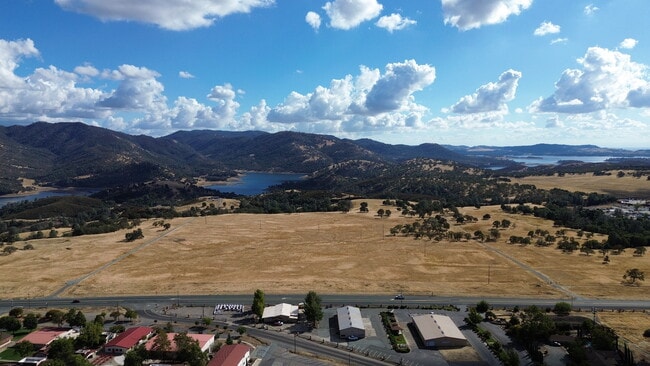
This Property Is For Sale
Property Detail
4447 Highway 12
040-004-061-000
REM PM 7 167 POR NW4 OF SW4 OF SEC 10 T4N R11E
Industrialacreage
CALAVERAS
B and X Area of moderate flood hazard, usually the area between the limits of the 100-year and 500-year floods.
California
2025
18.70 AC
2025
Merced/Central
000221
Other Market Areas
NEARBY LISTINGS FOR SALE OR LEASE
-
-
View all San Andreas listings for sale on LoopNet.com
DEMOGRAPHICS near 4447 Highway 12
1 mile
3 mile
5 mile
2025 Total Population
11
268
5,367
2030 Population
11
271
5,369
Pop Growth 2025-2030
0.00%
+ 1.12%
+ 0.04%
Average Age
40
43
44
2025 Total Households
4
105
2,140
HH Growth 2025-2030
0.00%
+ 0.95%
0.00%
Median Household Inc
$87,500
$70,999
$74,234
Avg Household Size
2.00
2.50
2.40
2025 Avg HH Vehicles
2.00
2.00
2.00
Median Home Value
$450,000
$402,000
$406,504
Median Year Built
1989
1992
1988
Nearby Places
Map Layers
Map Styles
 Street
 Aerial
Layers
 Traffic
 Biking
Places
Listings with unknown addresses are not visible on the map
- Restaurants
- Banks
- Shops
- Fitness
- Groceries
PUBLIC TRANSPORTATION
AIRPORT
Stockton Metro
Drive
Walk
Distance
Stockton Metro
70 min
46.4 mi
Freight Ports
Port of Stockton
Drive
Walk
Distance
Port of Stockton
68 min
45.3 mi
Nearby Properties
Address
Land Use
TOTAL SIZE
Lot Size
Zoning
Address
Land Use
TOTAL SIZE
Lot Size
Zoning
7.29 AC
M4
Address
Land Use
TOTAL SIZE
Lot Size
Zoning
184.21 AC
M2
Address
Land Use
TOTAL SIZE
Lot Size
Zoning
5.06 AC
M4
Address
Land Use
TOTAL SIZE
Lot Size
Zoning
4,235 SF
8.44 AC
RECMHPD
Address
Land Use
TOTAL SIZE
Lot Size
Zoning
3,476 SF
5 AC
RECMHPD
Address
Land Use
TOTAL SIZE
Lot Size
Zoning
5.01 AC
M1
Address
Land Use
TOTAL SIZE
Lot Size
Zoning
Address
Land Use
TOTAL SIZE
Lot Size
Zoning
125.70 AC
AP
Address
Land Use
TOTAL SIZE
Lot Size
Zoning
2,265 SF
118.62 AC
A1
Address
Land Use
TOTAL SIZE
Lot Size
Zoning
3,282 SF
7.31 AC
RR5
Address
Land Use
TOTAL SIZE
Lot Size
Zoning
3,093 SF
5 AC
RR5
Address
Land Use
TOTAL SIZE
Lot Size
Zoning
9.21 AC
M2
Address
Land Use
TOTAL SIZE
Lot Size
Zoning
Address
Land Use
TOTAL SIZE
Lot Size
Zoning
3,448 SF
12 AC
RR5
Address
Land Use
TOTAL SIZE
Lot Size
Zoning
3,416 SF
129.98 AC
AP
Address
Land Use
TOTAL SIZE
Lot Size
Zoning
179.90 AC
AP
Address
Land Use
TOTAL SIZE
Lot Size
Zoning
3,300 SF
5.04 AC
Address
Land Use
TOTAL SIZE
Lot Size
Zoning
3,044 SF
5.54 AC
U
Address
Land Use
TOTAL SIZE
Lot Size
Zoning
3.47 AC
M2
Address
Land Use
TOTAL SIZE
Lot Size
Zoning
2,373 SF
10.49 AC
RA5
Address
Land Use
TOTAL SIZE
Lot Size
Zoning
2,236 SF
5.04 AC
RR5
Address
Land Use
TOTAL SIZE
Lot Size
Zoning
Address
Land Use
TOTAL SIZE
Lot Size
Zoning
1,858 SF
6 AC
RR5
Address
Land Use
TOTAL SIZE
Lot Size
Zoning
1,760 SF
5.01 AC
RR5
Address
Land Use
TOTAL SIZE
Lot Size
Zoning
1,680 SF
5.01 AC
RR5
Address
Land Use
TOTAL SIZE
Lot Size
Zoning
2,679 SF
5.38 AC
RR5
Address
Land Use
TOTAL SIZE
Lot Size
Zoning
112.58 AC
Address
Land Use
TOTAL SIZE
Lot Size
Zoning
2,824 SF
5.70 AC
RR5
Address
Land Use
TOTAL SIZE
Lot Size
Zoning
7.56 AC
M1PD
Address
Land Use
TOTAL SIZE
Lot Size
Zoning
40.61 AC
The World's #1 Commercial Real Estate Marketplace
Connect with us
© 2026 CoStar Group
The information above has been obtained from sources believed reliable. While we do not doubt its accuracy we have not verified it and make no guarantee, warranty or representation about it. It is your responsibility to independently confirm its accuracy and completeness. Any projections, opinions, assumptions, or estimates used are for example only and do not represent the current or future performance of the property. The value of this transaction to you depends on tax and other factors which should be evaluated by your tax, financial, and legal advisors. You and your advisors should conduct a careful, independent investigation of the property to determine to your satisfaction the suitability of the property for your needs.