Property Record
4448 Chandler Rd, Apopka, FL 32712

Property Detail
4448 Chandler Rd
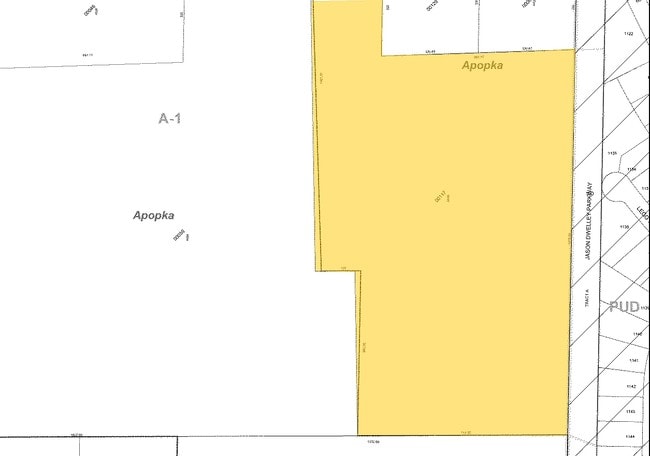
18-2028-0000-00-117
BEG 661.25 FT W OF E1/4 COR RUN S 675 FT E 661.77 FT S 1315.02 FT W 717.32 FT N 562.95 FT W 135 FT N 1401.61 FT E 261.22 FT TO POB IN SEC 18-20-28
Vacantlandnec
ORANGE
RSF-1B
Florida
B and X Area of moderate flood hazard, usually the area between the limits of the 100-year and 500-year floods.
117
2023
27.81 AC
2026
NW Orange Outlying
017813
Orlando
1,344 SF
Orlando-Kissimmee-Sanford, FL
NEARBY LISTINGS FOR SALE OR LEASE
DEMOGRAPHICS near 4448 Chandler Rd
1 mile
3 mile
5 mile
2025 Total Population
4,250
29,686
70,167
2030 Population
4,674
32,964
77,754
Pop Growth 2025-2030
+ 9.98%
+ 11.04%
+ 10.81%
Average Age
41
42
41
2025 Total Households
1,395
10,297
24,288
HH Growth 2025-2030
+ 10.39%
+ 11.35%
+ 11.17%
Median Household Inc
$156,117
$112,660
$101,472
Avg Household Size
3.00
2.80
2.80
2025 Avg HH Vehicles
2.00
2.00
2.00
Median Home Value
$620,113
$450,576
$417,140
Median Year Built
2004
2002
2000
Nearby Places
Map Layers
Map Styles
 Street
 Aerial
Layers
 Traffic
 Biking
Places
Listings with unknown addresses are not visible on the map
- Restaurants
- Banks
- Shops
- Fitness
- Groceries
PUBLIC TRANSPORTATION
AIRPORT
Orlando Sanford International
Drive
Walk
Distance
Orlando Sanford International
44 min
28.8 mi
Orlando International
Drive
Walk
Distance
Orlando International
51 min
38.7 mi
Freight Ports
Port Canaveral
Drive
Walk
Distance
Port Canaveral
99 min
81.3 mi
Nearby Properties
Address
Land Use
TOTAL SIZE
Lot Size
Zoning
Address
Land Use
TOTAL SIZE
Lot Size
Zoning
3,322 SF
152.85 AC
MU-KPI
Address
Land Use
TOTAL SIZE
Lot Size
Zoning
200,177 SF
8 AC
D-APK-RMF
Address
Land Use
TOTAL SIZE
Lot Size
Zoning
161,490 SF
15.18 AC
O
Address
Land Use
TOTAL SIZE
Lot Size
Zoning
313,324 SF
32.44 AC
PR
Address
Land Use
TOTAL SIZE
Lot Size
Zoning
82 AC
D-APK-MU-K
Address
Land Use
TOTAL SIZE
Lot Size
Zoning
131,814 SF
5 AC
D-APK-AG
Address
Land Use
TOTAL SIZE
Lot Size
Zoning
75.90 AC
MU-KPI
Address
Land Use
TOTAL SIZE
Lot Size
Zoning
3,688 SF
71.90 AC
MU-KPI
Address
Land Use
TOTAL SIZE
Lot Size
Zoning
185,772 SF
16.70 AC
O
Address
Land Use
TOTAL SIZE
Lot Size
Zoning
49 AC
D-APK-MU-V
Address
Land Use
TOTAL SIZE
Lot Size
Zoning
42 AC
D-APK-MU-V
Address
Land Use
TOTAL SIZE
Lot Size
Zoning
29 AC
D-APK-MU-K
Address
Land Use
TOTAL SIZE
Lot Size
Zoning
69,150 SF
9.41 AC
MU-VC
Address
Land Use
TOTAL SIZE
Lot Size
Zoning
7,688 SF
36.97 AC
MU-KPI
Address
Land Use
TOTAL SIZE
Lot Size
Zoning
2,442 SF
45.29 AC
T
Address
Land Use
TOTAL SIZE
Lot Size
Zoning
23 AC
D-APK-MU-K
Address
Land Use
TOTAL SIZE
Lot Size
Zoning
14.64 AC
AG
Address
Land Use
TOTAL SIZE
Lot Size
Zoning
18,594 SF
272.21 AC
O
Address
Land Use
TOTAL SIZE
Lot Size
Zoning
98,625 SF
4.71 AC
C-C
Address
Land Use
TOTAL SIZE
Lot Size
Zoning
D-APK-MU-V
Address
Land Use
TOTAL SIZE
Lot Size
Zoning
17 AC
D-APK-MU-K
Address
Land Use
TOTAL SIZE
Lot Size
Zoning
60.93 AC
P-D
Address
Land Use
TOTAL SIZE
Lot Size
Zoning
16 AC
D-APK-MU-K
Address
Land Use
TOTAL SIZE
Lot Size
Zoning
237.55 AC
T
Address
Land Use
TOTAL SIZE
Lot Size
Zoning
3,276 SF
192.10 AC
T
Address
Land Use
TOTAL SIZE
Lot Size
Zoning
65,440 SF
20.61 AC
O
Address
Land Use
TOTAL SIZE
Lot Size
Zoning
16 AC
D-APK-MU-V
Address
Land Use
TOTAL SIZE
Lot Size
Zoning
141.63 AC
AG
Address
Land Use
TOTAL SIZE
Lot Size
Zoning
15 AC
D-APK-MU-V
Address
Land Use
TOTAL SIZE
Lot Size
Zoning
6,789 SF
103.68 AC
A-1
The World's #1 Commercial Real Estate Marketplace
Connect with us
© 2026 CoStar Group
The information above has been obtained from sources believed reliable. While we do not doubt its accuracy we have not verified it and make no guarantee, warranty or representation about it. It is your responsibility to independently confirm its accuracy and completeness. Any projections, opinions, assumptions, or estimates used are for example only and do not represent the current or future performance of the property. The value of this transaction to you depends on tax and other factors which should be evaluated by your tax, financial, and legal advisors. You and your advisors should conduct a careful, independent investigation of the property to determine to your satisfaction the suitability of the property for your needs.