Property Record
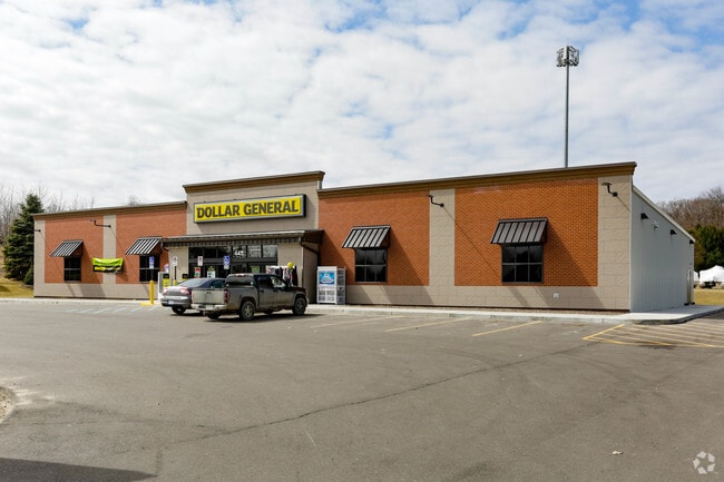
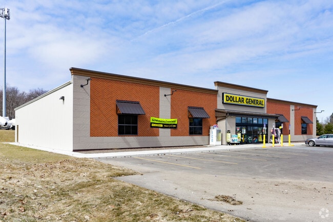
445 N Lake Pleasant Rd, Attica, MI 48412
NEARBY LISTINGS FOR SALE OR LEASE
-
-
View all Attica listings for sale on LoopNet.com
Property Detail
445 N Lake Pleasant Rd
003-009-001-66
SEC 9 T7N - R11E COMMENCING AT THE NORTHEAST CORNER OF SECTION 9, T7N-R11 E, ATTICA TOWNSHIP, LAPEER COUNTY, MICHIGAN; THENCE
Wholesaleoutletdiscountstore
Lapeer
X
Michigan
26087C0300E
1.85 AC
2024
St Clair & Lapeer Counties
2025
Detroit
338500
Detroit-Warren-Dearborn, MI
9,100 SF
DEMOGRAPHICS near 445 N Lake Pleasant Rd
1 Mile
3 Mile
5 Mile
2024 Total Population
652
3,516
12,659
2029 Population
659
3,539
12,679
Pop Growth 2024-2029
+ 1.07%
+ 0.65%
+ 0.16%
Average Age
44
44
43
2024 Total Households
261
1,370
4,939
HH Growth 2024-2029
+ 0.77%
+ 0.66%
+ 0.10%
Median Household Inc
$73,823
$73,360
$69,051
Avg Household Size
2.50
2.50
2.50
2024 Avg HH Vehicles
3.00
3.00
2.00
Median Home Value
$195,603
$217,607
$206,147
Median Year Built
1965
1975
1978
Nearby Places
Map Layers
Map Styles
 Street
 Aerial
- Restaurants
- Banks
- Shops
- Fitness
- Groceries
PUBLIC TRANSPORTATION
COMMUTER RAIL
Lapeer Amtrak Station (Blue Water - Amtrak)
DRIVE
WALK
Distance
Lapeer Amtrak Station (Blue Water - Amtrak)
14 min
7.4 mi
AIRPORT
Bishop International
DRIVE
WALK
Distance
Bishop International
53 min
37.8 mi
Freight Ports
Port of Toledo
DRIVE
WALK
Distance
Port of Toledo
156 min
121.1 mi
SALE & LEASE HISTORY
LISTING DATE
SALE/LEASE

Jun 27, 2018
For Sale
Nearby Properties
Address
Land Use
TOTAL SIZE
Lot Size
Zoning
Address
Land Use
TOTAL SIZE
Lot Size
Zoning
76 AC
AR
Address
Land Use
TOTAL SIZE
Lot Size
Zoning
46,592 SF
14.94 AC
I-1
Address
Land Use
TOTAL SIZE
Lot Size
Zoning
159.18 AC
AG
Address
Land Use
TOTAL SIZE
Lot Size
Zoning
155 AC
AG
Address
Land Use
TOTAL SIZE
Lot Size
Zoning
23,056 SF
7.42 AC
I-1
Address
Land Use
TOTAL SIZE
Lot Size
Zoning
1,412 SF
90.74 AC
AR
Address
Land Use
TOTAL SIZE
Lot Size
Zoning
1,560 SF
80 AC
AR
Address
Land Use
TOTAL SIZE
Lot Size
Zoning
2,798 SF
66.91 AC
AR
Address
Land Use
TOTAL SIZE
Lot Size
Zoning
1,832 SF
76.48 AC
AR
Address
Land Use
TOTAL SIZE
Lot Size
Zoning
1,344 SF
120 AC
AR
Address
Land Use
TOTAL SIZE
Lot Size
Zoning
15,408 SF
10 AC
I-1
Address
Land Use
TOTAL SIZE
Lot Size
Zoning
1,584 SF
80 AC
AR
Address
Land Use
TOTAL SIZE
Lot Size
Zoning
1,372 SF
55.22 AC
AR
Address
Land Use
TOTAL SIZE
Lot Size
Zoning
110 AC
AG
Address
Land Use
TOTAL SIZE
Lot Size
Zoning
3,086 SF
38.43 AC
AR
Address
Land Use
TOTAL SIZE
Lot Size
Zoning
1,380 SF
80 AC
AR
Address
Land Use
TOTAL SIZE
Lot Size
Zoning
14,337 SF
8.41 AC
I-1
Address
Land Use
TOTAL SIZE
Lot Size
Zoning
1,158 SF
63.80 AC
AR
Address
Land Use
TOTAL SIZE
Lot Size
Zoning
97.70 AC
AR
Address
Land Use
TOTAL SIZE
Lot Size
Zoning
80 AC
DUMMY
Address
Land Use
TOTAL SIZE
Lot Size
Zoning
1,909 SF
40 AC
AR
Address
Land Use
TOTAL SIZE
Lot Size
Zoning
16,000 SF
3.96 AC
B-1
Address
Land Use
TOTAL SIZE
Lot Size
Zoning
86.96 AC
DUMMY
Address
Land Use
TOTAL SIZE
Lot Size
Zoning
80 AC
DUMMY
Address
Land Use
TOTAL SIZE
Lot Size
Zoning
1,560 SF
80 AC
I-1
Address
Land Use
TOTAL SIZE
Lot Size
Zoning
1,872 SF
40 AC
AR
Address
Land Use
TOTAL SIZE
Lot Size
Zoning
3,056 SF
20.12 AC
AR
Address
Land Use
TOTAL SIZE
Lot Size
Zoning
2,533 SF
7.70 AC
B-1
Address
Land Use
TOTAL SIZE
Lot Size
Zoning
1,242 SF
79.26 AC
AR
The World's #1 Commercial Real Estate Marketplace
Connect with us
© 2026 CoStar Group
The information above has been obtained from sources believed reliable. While we do not doubt its accuracy we have not verified it and make no guarantee, warranty or representation about it. It is your responsibility to independently confirm its accuracy and completeness. Any projections, opinions, assumptions, or estimates used are for example only and do not represent the current or future performance of the property. The value of this transaction to you depends on tax and other factors which should be evaluated by your tax, financial, and legal advisors. You and your advisors should conduct a careful, independent investigation of the property to determine to your satisfaction the suitability of the property for your needs.