Property Record
445 State Road 13 N, Saint Johns, FL 32259


NEARBY LISTINGS FOR SALE OR LEASE
Property Detail
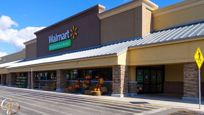
445 State Road 13 N
Jacksonville, FL
Julington Creek Unit 1
249000-1006
16/35-51 JULINGTON CREEK UT 1 TRACT F (EX OR716/690) OR3618/543 &3618/537(AMD TO DEC)
Regionalshoppingcenterormallwithanchorstore
St. Johns
X
Florida
12109C0151J
g
2023
8.98 AC
2025
St Johns County
020802
Jacksonville (Florida)
81,119 SF
DEMOGRAPHICS near 445 State Road 13 N
1 Mile
3 Mile
5 Mile
2024 Total Population
5,439
43,620
109,913
2029 Population
7,065
52,524
127,500
Pop Growth 2024-2029
+ 29.90%
+ 20.41%
+ 16.00%
Average Age
47
42
41
2024 Total Households
1,820
15,335
39,984
HH Growth 2024-2029
+ 29.40%
+ 19.17%
+ 14.42%
Median Household Inc
$121,559
$116,210
$102,968
Avg Household Size
2.60
2.80
2.70
2024 Avg HH Vehicles
2.00
2.00
2.00
Median Home Value
$375,393
$371,701
$343,285
Median Year Built
1992
1995
1994
Nearby Places
Map Layers
Map Styles
 Street
 Aerial
- Restaurants
- Banks
- Shops
- Fitness
- Groceries
PUBLIC TRANSPORTATION
AIRPORT
Jacksonville International
DRIVE
WALK
Distance
Jacksonville International
52 min
37.4 mi
Freight Ports
Jacksonville Port
DRIVE
WALK
Distance
Jacksonville Port
37 min
20.4 mi
SALE & LEASE HISTORY
LISTING DATE
SALE/LEASE

Sep 25, 2016
For Lease
Jun 30, 2021
For Lease
Feb 16, 2018
For Lease
Apr 04, 2018
For Lease
Nearby Properties
Address
Land Use
TOTAL SIZE
Lot Size
Zoning
Address
Land Use
TOTAL SIZE
Lot Size
Zoning
193,858 SF
8.67 AC
PUD
Address
Land Use
TOTAL SIZE
Lot Size
Zoning
96,065 SF
4.11 AC
PUD
Address
Land Use
TOTAL SIZE
Lot Size
Zoning
321,392 SF
42.84 AC
PUD
Address
Land Use
TOTAL SIZE
Lot Size
Zoning
80,974 SF
4.94 AC
CCG-1
Address
Land Use
TOTAL SIZE
Lot Size
Zoning
65,155 SF
58.66 AC
OR
Address
Land Use
TOTAL SIZE
Lot Size
Zoning
66,280 SF
9.45 AC
PUD
Address
Land Use
TOTAL SIZE
Lot Size
Zoning
94,789 SF
30 AC
OR
Address
Land Use
TOTAL SIZE
Lot Size
Zoning
123,398 SF
25.30 AC
PUD
Address
Land Use
TOTAL SIZE
Lot Size
Zoning
50,800 SF
2.39 AC
PUD
Address
Land Use
TOTAL SIZE
Lot Size
Zoning
82,518 SF
10.27 AC
PSD
Address
Land Use
TOTAL SIZE
Lot Size
Zoning
97,776 SF
12.34 AC
PUD
Address
Land Use
TOTAL SIZE
Lot Size
Zoning
95,870 SF
9.71 AC
OR
Address
Land Use
TOTAL SIZE
Lot Size
Zoning
45,676 SF
5.86 AC
PUD
Address
Land Use
TOTAL SIZE
Lot Size
Zoning
78,656 SF
2.73 AC
CCG-1
Address
Land Use
TOTAL SIZE
Lot Size
Zoning
101,150 SF
11.51 AC
PUD
Address
Land Use
TOTAL SIZE
Lot Size
Zoning
25,837 SF
5.05 AC
OR
Address
Land Use
TOTAL SIZE
Lot Size
Zoning
91,522 SF
9.84 AC
PUD
Address
Land Use
TOTAL SIZE
Lot Size
Zoning
109,558 SF
28.25 AC
PBF-1
Address
Land Use
TOTAL SIZE
Lot Size
Zoning
93,536 SF
3.85 AC
CCG-1
Address
Land Use
TOTAL SIZE
Lot Size
Zoning
84,122 SF
4.97 AC
PUD
Address
Land Use
TOTAL SIZE
Lot Size
Zoning
30,328 SF
2.97 AC
CG
Address
Land Use
TOTAL SIZE
Lot Size
Zoning
32,417 SF
3.48 AC
PUD
Address
Land Use
TOTAL SIZE
Lot Size
Zoning
18,774 SF
4.25 AC
PUD
Address
Land Use
TOTAL SIZE
Lot Size
Zoning
79,127 SF
12.34 AC
PUD
Address
Land Use
TOTAL SIZE
Lot Size
Zoning
66,784 SF
3.40 AC
CCG-1
Address
Land Use
TOTAL SIZE
Lot Size
Zoning
41,885 SF
2.38 AC
PUD
Address
Land Use
TOTAL SIZE
Lot Size
Zoning
25,792 SF
2.64 AC
PBF-1
Address
Land Use
TOTAL SIZE
Lot Size
Zoning
19,664 SF
0.40 AC
CCG-1
Address
Land Use
TOTAL SIZE
Lot Size
Zoning
4,720 SF
36.92 AC
PBF-1
The World's #1 Commercial Real Estate Marketplace
Connect with us
© 2025 CoStar Group
The information above has been obtained from sources believed reliable. While we do not doubt its accuracy we have not verified it and make no guarantee, warranty or representation about it. It is your responsibility to independently confirm its accuracy and completeness. Any projections, opinions, assumptions, or estimates used are for example only and do not represent the current or future performance of the property. The value of this transaction to you depends on tax and other factors which should be evaluated by your tax, financial, and legal advisors. You and your advisors should conduct a careful, independent investigation of the property to determine to your satisfaction the suitability of the property for your needs.