Property Record
4455 Derrick Rd, Atlanta, GA 30349
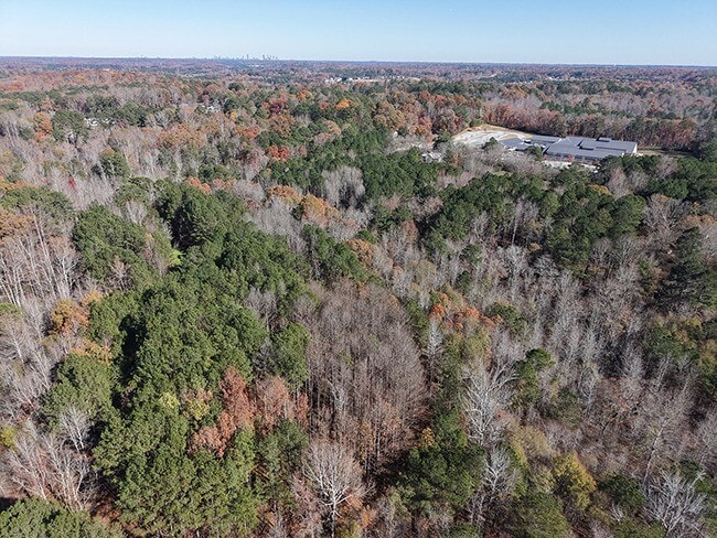
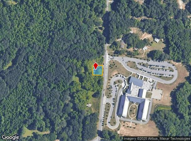
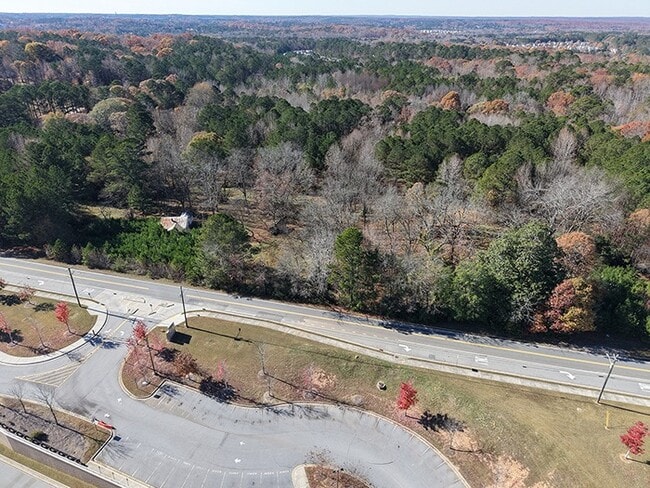
This Property Is For Sale
NEARBY LISTINGS FOR SALE OR LEASE
Property Detail
4455 Derrick Rd
Atlanta-Sandy Springs-Roswell, GA
Fulton
09F-4103-0163-054-3
Georgia
Sfr
0.23 AC
X
North Clayton/Airport
13121C0339F
Atlanta
1,523 SF
DEMOGRAPHICS near 4455 Derrick Rd
1 Mile
3 Mile
5 Mile
2024 Total Population
2,979
32,427
85,812
2029 Population
3,028
33,504
88,862
Pop Growth 2024-2029
+ 1.64%
+ 3.32%
+ 3.55%
Average Age
37
38
38
2024 Total Households
1,004
11,244
30,706
HH Growth 2024-2029
+ 1.79%
+ 3.42%
+ 3.60%
Median Household Inc
$90,675
$90,753
$83,567
Avg Household Size
2.90
2.80
2.70
2024 Avg HH Vehicles
2.00
2.00
2.00
Median Home Value
$268,448
$279,107
$256,738
Median Year Built
2002
2004
2003
Nearby Places
- Restaurants
- Banks
- Shops
- Fitness
- Groceries
PUBLIC TRANSPORTATION
AIRPORT
Hartsfield - Jackson Atlanta International
DRIVE
WALK
Distance
Hartsfield - Jackson Atlanta International
22 min
13.4 mi
Freight Ports
Georgia Ports - Savannah
DRIVE
WALK
Distance
Georgia Ports - Savannah
283 min
250.7 mi
Nearby Properties
Address
Land Use
TOTAL SIZE
Lot Size
Zoning
Address
Land Use
TOTAL SIZE
Lot Size
Zoning
14.13 AC
TCMU
Address
Land Use
TOTAL SIZE
Lot Size
Zoning
11.10 AC
SUBC
Address
Land Use
TOTAL SIZE
Lot Size
Zoning
74.44 AC
Address
Land Use
TOTAL SIZE
Lot Size
Zoning
595,060 SF
62.71 AC
Address
Land Use
TOTAL SIZE
Lot Size
Zoning
1,325,500 SF
101.81 AC
AG1
Address
Land Use
TOTAL SIZE
Lot Size
Zoning
1,226,360 SF
18.72 AC
AG1
Address
Land Use
TOTAL SIZE
Lot Size
Zoning
78.33 AC
Address
Land Use
TOTAL SIZE
Lot Size
Zoning
1,052,500 SF
184.50 AC
AG1
Address
Land Use
TOTAL SIZE
Lot Size
Zoning
39.08 AC
SUBC
Address
Land Use
TOTAL SIZE
Lot Size
Zoning
14.83 AC
AG1
Address
Land Use
TOTAL SIZE
Lot Size
Zoning
156,882 SF
25 AC
AG1
Address
Land Use
TOTAL SIZE
Lot Size
Zoning
42.90 AC
R4
Address
Land Use
TOTAL SIZE
Lot Size
Zoning
572,000 SF
46.35 AC
AG1
Address
Land Use
TOTAL SIZE
Lot Size
Zoning
669,152 SF
39.13 AC
M1C
Address
Land Use
TOTAL SIZE
Lot Size
Zoning
546,520 SF
31.54 AC
M1C
Address
Land Use
TOTAL SIZE
Lot Size
Zoning
499,950 SF
63.40 AC
AG1
Address
Land Use
TOTAL SIZE
Lot Size
Zoning
31.58 AC
Address
Land Use
TOTAL SIZE
Lot Size
Zoning
1,320,344 SF
0.35 AC
MIX
Address
Land Use
TOTAL SIZE
Lot Size
Zoning
24.53 AC
Address
Land Use
TOTAL SIZE
Lot Size
Zoning
426,244 SF
46.62 AC
AG1
Address
Land Use
TOTAL SIZE
Lot Size
Zoning
1,566 SF
41.68 AC
AG1
Address
Land Use
TOTAL SIZE
Lot Size
Zoning
102,976 SF
38.97 AC
AG1
Address
Land Use
TOTAL SIZE
Lot Size
Zoning
25.40 AC
AG1
Address
Land Use
TOTAL SIZE
Lot Size
Zoning
327,822 SF
0.16 AC
MIX
Address
Land Use
TOTAL SIZE
Lot Size
Zoning
169,212 SF
0.20 AC
MIX
Address
Land Use
TOTAL SIZE
Lot Size
Zoning
31.25 AC
Address
Land Use
TOTAL SIZE
Lot Size
Zoning
242,700 SF
17.51 AC
M1
Address
Land Use
TOTAL SIZE
Lot Size
Zoning
83,102 SF
10.75 AC
MIX
Address
Land Use
TOTAL SIZE
Lot Size
Zoning
45.90 AC
AG1
Address
Land Use
TOTAL SIZE
Lot Size
Zoning
88.01 AC
The World's #1 Commercial Real Estate Marketplace
Connect with us
© 2025 CoStar Group
The information above has been obtained from sources believed reliable. While we do not doubt its accuracy we have not verified it and make no guarantee, warranty or representation about it. It is your responsibility to independently confirm its accuracy and completeness. Any projections, opinions, assumptions, or estimates used are for example only and do not represent the current or future performance of the property. The value of this transaction to you depends on tax and other factors which should be evaluated by your tax, financial, and legal advisors. You and your advisors should conduct a careful, independent investigation of the property to determine to your satisfaction the suitability of the property for your needs.