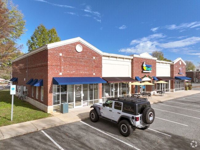
Property Record
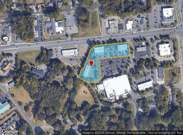
4501 School House Cmns, Harrisburg, NC 28075
Current Lease Availabilities
NEARBY LISTINGS FOR SALE OR LEASE
Property Detail
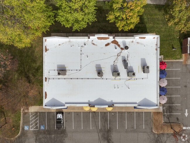
4501 School House Cmns
Charlotte-Concord-Gastonia, NC-SC
Harrisburg
5507-75-4939-0000
LT 3B SCHOOL HOUSE COMMONS
Stripcommercialcenter
Cabarrus
X
North Carolina
3710550700K
3b
2025
2.43 AC
2025
Cabarrus County
041505
Charlotte
8,436 SF
DEMOGRAPHICS near 4501 School House Cmns
1 Mile
3 Mile
5 Mile
2024 Total Population
5,580
39,040
112,877
2029 Population
6,240
42,945
123,303
Pop Growth 2024-2029
+ 11.83%
+ 10.00%
+ 9.24%
Average Age
40
38
36
2024 Total Households
1,995
13,463
41,117
HH Growth 2024-2029
+ 10.43%
+ 8.91%
+ 8.41%
Median Household Inc
$109,079
$101,087
$81,340
Avg Household Size
2.80
2.90
2.70
2024 Avg HH Vehicles
2.00
2.00
2.00
Median Home Value
$284,666
$313,514
$294,150
Median Year Built
2002
2002
2001
Nearby Places
Map Layers
Map Styles
 Street
 Aerial
- Restaurants
- Banks
- Shops
- Fitness
- Groceries
PUBLIC TRANSPORTATION
AIRPORT
Concord-Padgett Regional
DRIVE
WALK
Distance
Concord-Padgett Regional
16 min
7.8 mi
Charlotte/Douglas International
DRIVE
WALK
Distance
Charlotte/Douglas International
36 min
22.4 mi
Freight Ports
North Charleston Terminal
DRIVE
WALK
Distance
North Charleston Terminal
249 min
214.6 mi
Nearby Properties
Address
Land Use
TOTAL SIZE
Lot Size
Zoning
Address
Land Use
TOTAL SIZE
Lot Size
Zoning
154,304 SF
857.72 AC
PID
Address
Land Use
TOTAL SIZE
Lot Size
Zoning
333,498 SF
17.66 AC
R3
Address
Land Use
TOTAL SIZE
Lot Size
Zoning
196,893 SF
43.82 AC
MDR
Address
Land Use
TOTAL SIZE
Lot Size
Zoning
226,355 SF
99.26 AC
O-I
Address
Land Use
TOTAL SIZE
Lot Size
Zoning
245,838 SF
6.13 AC
Address
Land Use
TOTAL SIZE
Lot Size
Zoning
350,339 SF
77.60 AC
RM-1
Address
Land Use
TOTAL SIZE
Lot Size
Zoning
252,810 SF
6.87 AC
UR-C(CD)
Address
Land Use
TOTAL SIZE
Lot Size
Zoning
184,955 SF
5.78 AC
Address
Land Use
TOTAL SIZE
Lot Size
Zoning
169,115 SF
4.86 AC
Address
Land Use
TOTAL SIZE
Lot Size
Zoning
175,978 SF
63.81 AC
O-I
Address
Land Use
TOTAL SIZE
Lot Size
Zoning
142,368 SF
13.32 AC
MX2
Address
Land Use
TOTAL SIZE
Lot Size
Zoning
21,714 SF
15.02 AC
RC
Address
Land Use
TOTAL SIZE
Lot Size
Zoning
127,078 SF
10.66 AC
O-I
Address
Land Use
TOTAL SIZE
Lot Size
Zoning
360,400 SF
20.32 AC
EC
Address
Land Use
TOTAL SIZE
Lot Size
Zoning
125,245 SF
21.47 AC
O-I
Address
Land Use
TOTAL SIZE
Lot Size
Zoning
304,000 SF
17.30 AC
EC
Address
Land Use
TOTAL SIZE
Lot Size
Zoning
96,932 SF
20.28 AC
R-3
Address
Land Use
TOTAL SIZE
Lot Size
Zoning
160,357 SF
26.85 AC
O-I
Address
Land Use
TOTAL SIZE
Lot Size
Zoning
4,588 SF
550.66 AC
I-2
Address
Land Use
TOTAL SIZE
Lot Size
Zoning
209,420 SF
32.12 AC
EC
Address
Land Use
TOTAL SIZE
Lot Size
Zoning
101,408 SF
14.20 AC
R12MFCD
Address
Land Use
TOTAL SIZE
Lot Size
Zoning
123,800 SF
43.87 AC
CUI-1
Address
Land Use
TOTAL SIZE
Lot Size
Zoning
184,784 SF
16.30 AC
I-1
Address
Land Use
TOTAL SIZE
Lot Size
Zoning
48,888 SF
15.29 AC
GC
Address
Land Use
TOTAL SIZE
Lot Size
Zoning
32,237 SF
29.32 AC
GC
Address
Land Use
TOTAL SIZE
Lot Size
Zoning
174,732 SF
29.05 AC
LI
Address
Land Use
TOTAL SIZE
Lot Size
Zoning
80,528 SF
10.01 AC
PUD
Address
Land Use
TOTAL SIZE
Lot Size
Zoning
105,130 SF
5.03 AC
Address
Land Use
TOTAL SIZE
Lot Size
Zoning
24,943 SF
84.40 AC
R3
Address
Land Use
TOTAL SIZE
Lot Size
Zoning
105,138 SF
4.09 AC
R-8MF
The World's #1 Commercial Real Estate Marketplace
Connect with us
© 2026 CoStar Group
The information above has been obtained from sources believed reliable. While we do not doubt its accuracy we have not verified it and make no guarantee, warranty or representation about it. It is your responsibility to independently confirm its accuracy and completeness. Any projections, opinions, assumptions, or estimates used are for example only and do not represent the current or future performance of the property. The value of this transaction to you depends on tax and other factors which should be evaluated by your tax, financial, and legal advisors. You and your advisors should conduct a careful, independent investigation of the property to determine to your satisfaction the suitability of the property for your needs.