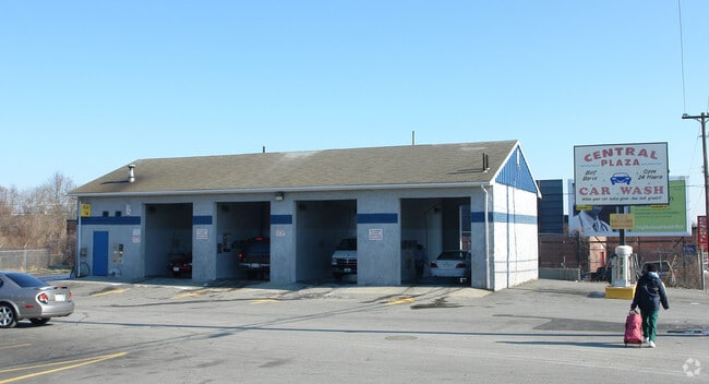
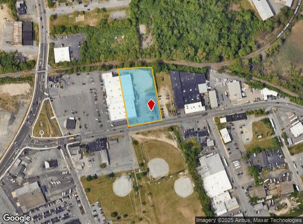
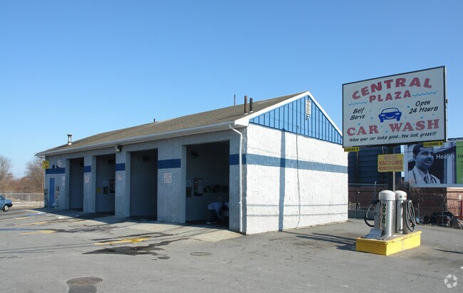
Property Record
91 Nauset St, New Bedford, MA 02746
NEARBY LISTINGS FOR SALE OR LEASE
Property Detail
91 Nauset St
NEWB-000102-000000-000120
Bristol
Carwash
Massachusetts
X
120
25005C0387G
1.49 AC
2025
Attleboro/New Bedford
2025
Boston
650800
Providence-Warwick, RI-MA
2,100 SF
DEMOGRAPHICS near 91 Nauset St
1 Mile
3 Mile
5 Mile
2024 Total Population
24,328
90,834
139,079
2029 Population
23,617
88,842
136,582
Pop Growth 2024-2029
(2.92%)
(2.19%)
(1.80%)
Average Age
36
40
41
2024 Total Households
9,701
37,823
56,995
HH Growth 2024-2029
(3.06%)
(2.26%)
(1.85%)
Median Household Inc
$40,596
$51,420
$57,905
Avg Household Size
2.40
2.30
2.30
2024 Avg HH Vehicles
1.00
1.00
2.00
Median Home Value
$278,516
$313,770
$342,771
Median Year Built
1946
1948
1950
Nearby Places
Map Layers
Map Styles
 Street
 Aerial
- Restaurants
- Banks
- Shops
- Fitness
- Groceries
PUBLIC TRANSPORTATION
AIRPORT
Rhode Island Tf Green International
DRIVE
WALK
Distance
Rhode Island Tf Green International
53 min
36.4 mi
Freight Ports
Port of New Bedford Harbor
DRIVE
WALK
Distance
Port of New Bedford Harbor
5 min
2.5 mi
Nearby Properties
Address
Land Use
TOTAL SIZE
Lot Size
Zoning
Address
Land Use
TOTAL SIZE
Lot Size
Zoning
10.29 AC
RA
Address
Land Use
TOTAL SIZE
Lot Size
Zoning
23.22 AC
RB
Address
Land Use
TOTAL SIZE
Lot Size
Zoning
23.71 AC
RA
Address
Land Use
TOTAL SIZE
Lot Size
Zoning
252,482 SF
11.56 AC
RA
Address
Land Use
TOTAL SIZE
Lot Size
Zoning
243,052 SF
9.66 AC
RB
Address
Land Use
TOTAL SIZE
Lot Size
Zoning
104.64 AC
LI
Address
Land Use
TOTAL SIZE
Lot Size
Zoning
269,020 SF
2.26 AC
MUB
Address
Land Use
TOTAL SIZE
Lot Size
Zoning
102,826 SF
15.15 AC
OI
Address
Land Use
TOTAL SIZE
Lot Size
Zoning
74.70 AC
SRA
Address
Land Use
TOTAL SIZE
Lot Size
Zoning
40.65 AC
GB
Address
Land Use
TOTAL SIZE
Lot Size
Zoning
194,474 SF
11.57 AC
RA
Address
Land Use
TOTAL SIZE
Lot Size
Zoning
231,634 SF
2.45 AC
IB
Address
Land Use
TOTAL SIZE
Lot Size
Zoning
284,742 SF
17.14 AC
RB
Address
Land Use
TOTAL SIZE
Lot Size
Zoning
120,533 SF
13.83 AC
OI
Address
Land Use
TOTAL SIZE
Lot Size
Zoning
160,391 SF
2.86 AC
MUB
Address
Land Use
TOTAL SIZE
Lot Size
Zoning
27.48 AC
B
Address
Land Use
TOTAL SIZE
Lot Size
Zoning
214,698 SF
4.66 AC
IB
Address
Land Use
TOTAL SIZE
Lot Size
Zoning
24.95 AC
PB
Address
Land Use
TOTAL SIZE
Lot Size
Zoning
127,514 SF
4.23 AC
MUB
Address
Land Use
TOTAL SIZE
Lot Size
Zoning
11.67 AC
RC
Address
Land Use
TOTAL SIZE
Lot Size
Zoning
188,739 SF
2.57 AC
IB
Address
Land Use
TOTAL SIZE
Lot Size
Zoning
116,441 SF
11.74 AC
OFD
Address
Land Use
TOTAL SIZE
Lot Size
Zoning
15.97 AC
GB
Address
Land Use
TOTAL SIZE
Lot Size
Zoning
134,355 SF
2.21 AC
IB
Address
Land Use
TOTAL SIZE
Lot Size
Zoning
5.59 AC
RC
Address
Land Use
TOTAL SIZE
Lot Size
Zoning
183,450 SF
2.51 AC
RA
Address
Land Use
TOTAL SIZE
Lot Size
Zoning
183,196 SF
8.14 AC
MUB
Address
Land Use
TOTAL SIZE
Lot Size
Zoning
146,081 SF
2.15 AC
MUB
Address
Land Use
TOTAL SIZE
Lot Size
Zoning
492.70 AC
IC
Address
Land Use
TOTAL SIZE
Lot Size
Zoning
111,337 SF
11.30 AC
RB
The World's #1 Commercial Real Estate Marketplace
Connect with us
© 2025 CoStar Group
The information above has been obtained from sources believed reliable. While we do not doubt its accuracy we have not verified it and make no guarantee, warranty or representation about it. It is your responsibility to independently confirm its accuracy and completeness. Any projections, opinions, assumptions, or estimates used are for example only and do not represent the current or future performance of the property. The value of this transaction to you depends on tax and other factors which should be evaluated by your tax, financial, and legal advisors. You and your advisors should conduct a careful, independent investigation of the property to determine to your satisfaction the suitability of the property for your needs.